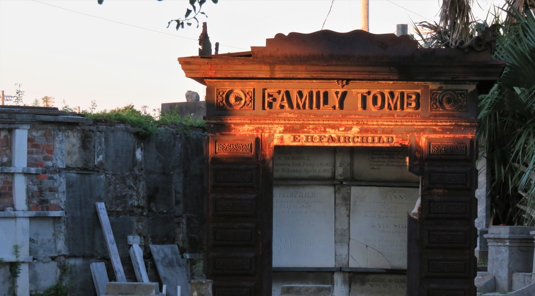
 The Fairchild cast iron tomb catches late afternoon sun in Odd Fellows Rest. Photo by Emily Ford. This is Part Two in a multi-part blog series examining the landscape history of what is now the intersection of Canal Street and City Park Avenue. From July to November 2017, construction will take place at this intersection to connect the Canal Streetcar to Canal Boulevard. Find Part One here. 1841: St. Patrick’s Cemetery At the same time that Americans from the northeast were moving en masse to New Orleans, a separate wave of immigration from Ireland made a great impact on the city. Immigrants fleeing famine and political unrest in Ireland came to New Orleans and settled mostly in what is now the Faubourg St. Mary neighborhood of New Orleans, abutting the Central Business District and what is now the Crescent City Connection bridge. These immigrants formed what is now Irish Channel, although the boundaries of this neighborhood have changed over time.[1] The neighborhood formed from settlement patterns dependent on the construction of the New Basin Canal. In 1833, the Parish of St. Patrick was founded to accommodate Irish Catholics in the neighborhood. By 1840, St. Patrick’s Church was constructed on Camp Street.
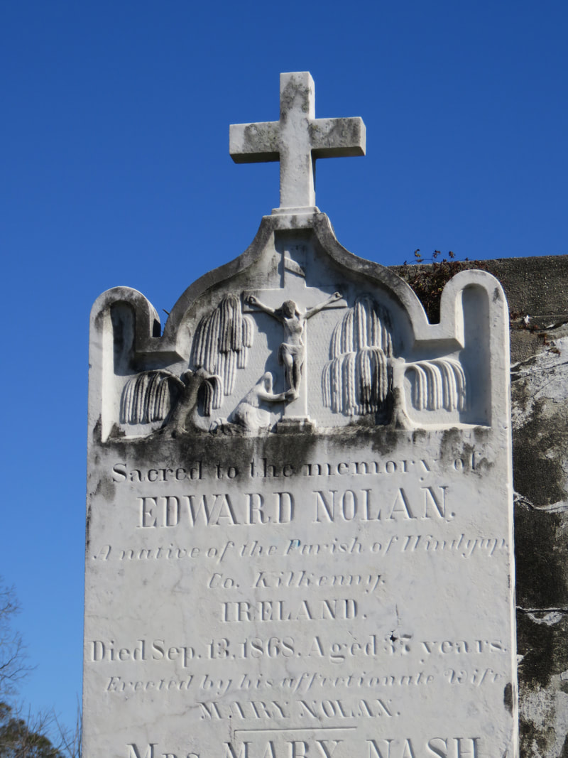
The St. Patrick Cemeteries, so fresh and clean in their snow-white garb and pebbly walks, always attract attention. Here lie the sturdy Irish pioneers who came to New Orleans in the early part of the last century and helped to make her history the proud tale it is… they breathe throughout the spirit of the Catholic faith. Special attention is directed to the beautiful Calvary shrine at the further end of St. Patrick’s No. 1 and the Mater Dolorosa that marks the entrance to St. Patrick’s No. 2.[3] The Calvary statue was designed by then-prominent monument man Charles A. Orleans, consisting of “a wooden cross twenty feet high with life-sized statues of the crucified Christ, Mary Mother of Jesus, His beloved disciple John, and Mary Magdelene. The statues were cast in Paris.”[4] In 1973, in the midst of trends toward community mausoleums, the Calvary was removed to make way for the Calvary Mausoleum. 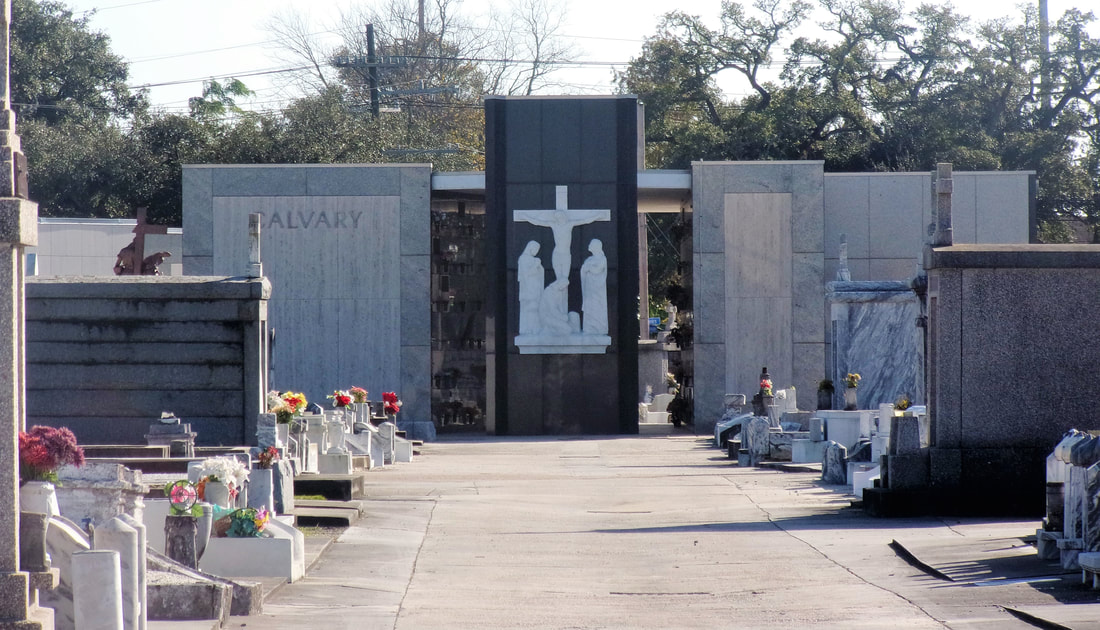 Calvary Mausoleum at St. Patrick Cemetery No. 1. Photo by Emily Ford.
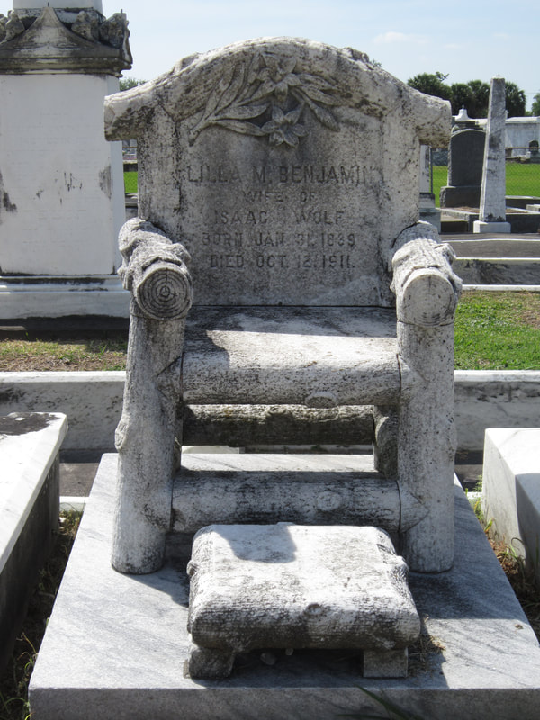
1846: Dispersed of Judah Cemetery Along with Americans and Irish immigrants to New Orleans, another group of established immigrants and newcomers found their burial place at the end of Canal Street. Jewish people had long lived in New Orleans in small communities, first of primarily Sephardic Jews (of the Spanish-Portuguese tradition) from the Caribbean and England, then later Ashkenazi Jews from Germany and Alsace-Lorraine. These communities first organized in 1828 to found Gates of Mercy congregation, which had a synagogue on Rampart Street near St. Louis Cemetery No. 1.  Dispersed of Judah Synagogue, constructed in the late 1840s, once sat at Canal Street and Bourbon Street. Image from 1904, Picayune Guide to New Orleans (Google Books) Gates of Mercy was an Ashkenazi congregation, and Sephardic Jews in New Orleans sought their own place of worship. This hope was fulfilled in 1846 when organizer Gershom Kursheedt helped aging benefactor Judah Touro found congregation Nefuzoth Yehudah (Dispersed of Judah) in 1846. Dispersed of Judah, a Sephardic congregation, was one of many religious organizations to benefit from Judah Touro’s generous will, which also founded Touro Infirmary, later to become Touro Hospital. In 1881, Dispersed of Judah and Gates of Mercy congregations would merge. The new congregation was eventually renamed Touro Synagogue. In the same year Dispersed of Judah congregation was founded, property adjoining St. Patrick Cemetery No. 2 along Canal Street was purchased for a cemetery. Dispersed of Judah was the second Jewish cemetery in New Orleans. Gates of Mercy had established a cemetery on Jackson Avenue near Saratoga Street in 1828, but this cemetery was demolished in 1957, part of a trend that will be discussed in a later part of this series.  View in Dispersed of Judah Cemetery. Photo by Emily Ford. Thus, Dispersed of Judah Cemetery is the oldest surviving Jewish Cemetery in New Orleans. Members of Dispersed of Judah congregation were often tied to English colonial or business interests, arriving in New Orleans from the English-colonized Caribbean or New York. This Anglo-cultural tie, as well as a religious need to bury belowground, allowed Dispersed of Judah to grow into a small version of a northern cemetery. The landscape today retains some elements of this – box tombs and obelisks, trees, and raised monuments. The cemetery is probably best known for the marble monument of Lilla Benjamin Wolf (died 1911), carved into the shape of an empty chair with foot stool. A local story tells the sale of Mrs. Wolf sitting in her chair in life, outside her family’s shop, calling potential customers inside. This may have been a deeply personal choice of monument for the Wolf family, although “the empty chair” was also a common funerary symbol at the turn of the century.
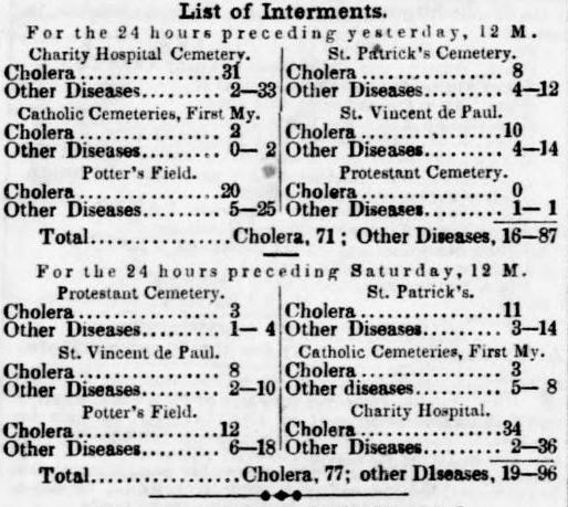
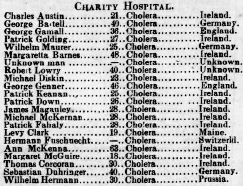
1848: Charity Hospital Cemetery By 1848, Charity Hospital was an institution nearly as old as New Orleans itself. Founded in 1732, the hospital provided care to all patients without regard to race, nationality, religion, or sex. Throughout the nineteenth century, Charity Hospital cared for thousands of newly-arrived immigrants who fell ill after the trans-Atlantic journey, or who were especially susceptible to New Orleans epidemics of yellow fever and cholera.[5] 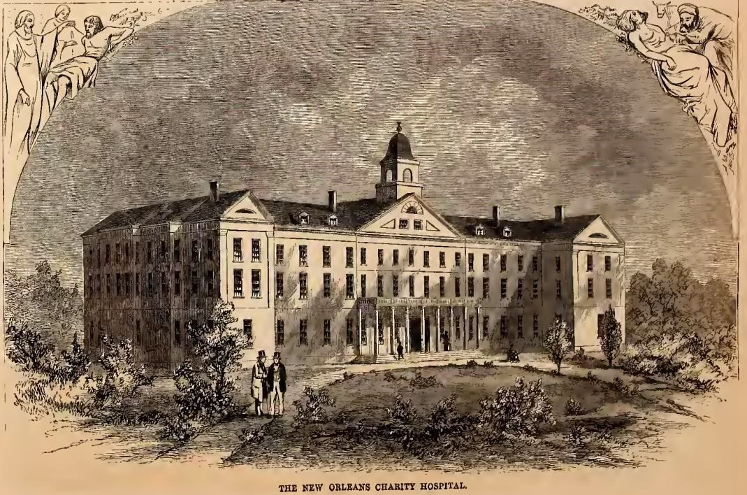 Charity Hospital's fifth building, in use from 1832 to 1939. Located on Common Street between St. Mary and Girod Streets, it was replaced in the 1930s by "Big Charity," a building designed by Weiss, Dreyfus, and Seiferth, who also designed the Louisiana State Capitol at Baton Rouge. Image from Harper's Weekly, September 3, 1859, via archive.org.
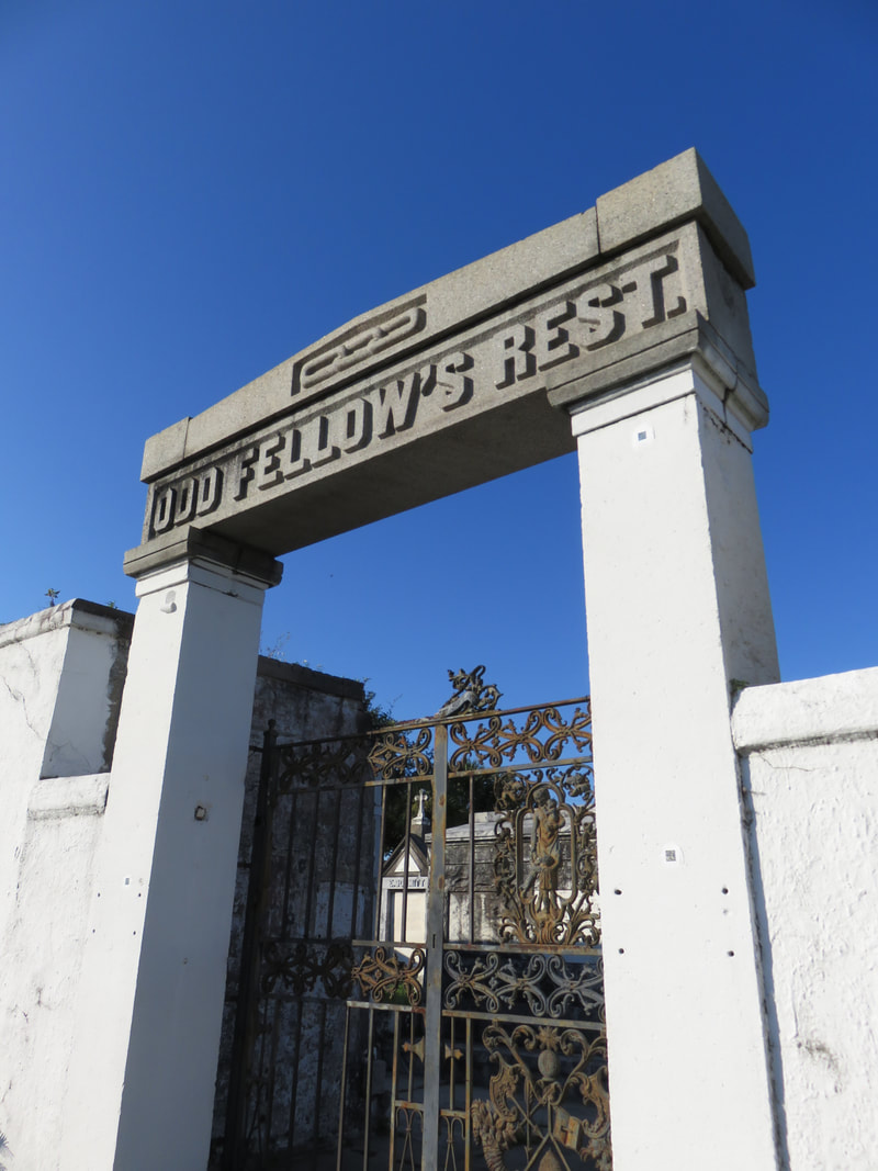
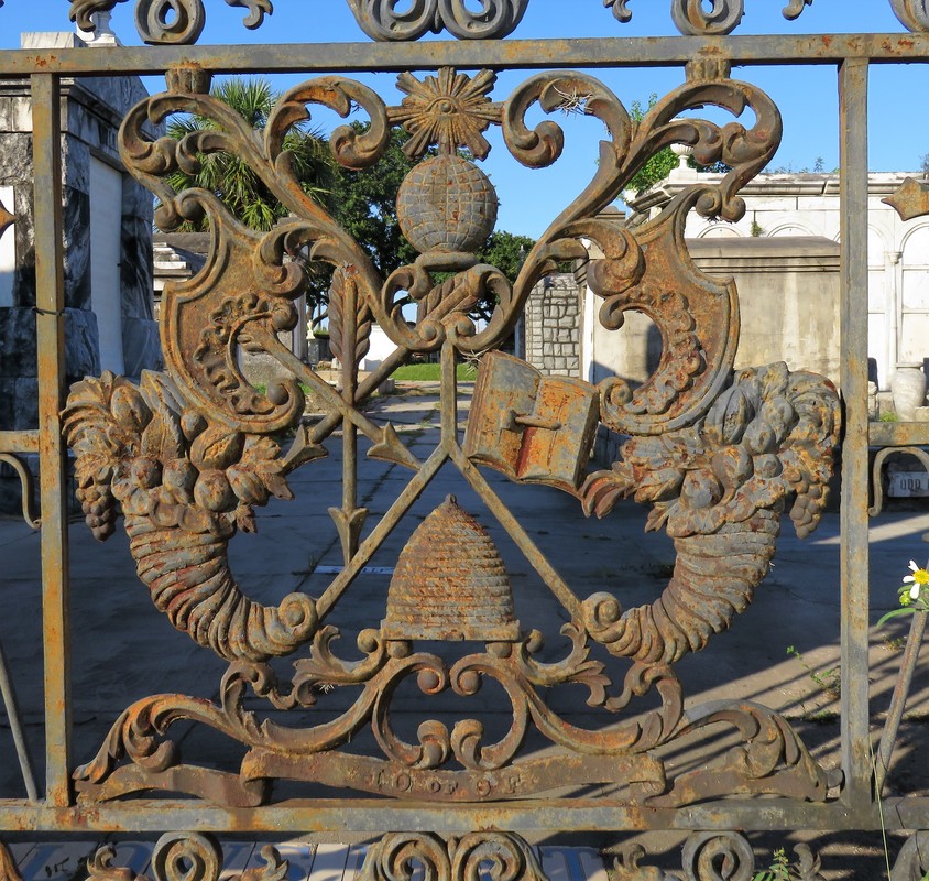
The firemen used axes to demolish the fence to save the [adjoining] St. Patrick’s Cemetery property, but nothing could be done to prevent destruction, and, after the flames had consumed the grass, covered the graves under smoldering ashes, with no crosses or headboards to identify the original plots, nothing was left for the friends or relatives of the dead to distinguish one grave from the other.[7] 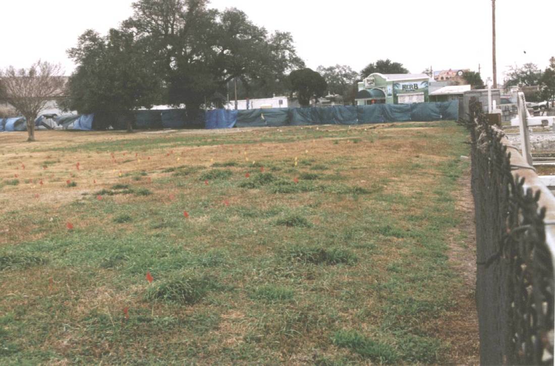 Charity Hospital Cemetery in 2003, looking over the fence from St. Patrick Cemetery No. 2 and toward Canal Street. The flags present on the site suggest that it may have recently been mapped using ground-penetrating radar (GPR) to identify gravesites. Photo by Dale Boudreaux, via usgenwebarchive.com Charity Hospital Cemetery would receive scores of burials each day during successive yellow fever and cholera epidemics. Later, the cemetery would also receive the bodies of those who had donated their remains in death as medical school cadavers. After Hurricane Katrina, the cemetery would be revised into a new kind of memorial. 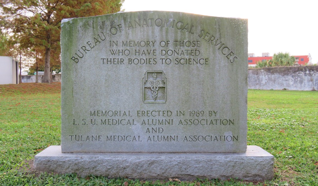 Memorial marker to those who have donated their bodies to science, erected in 1989 at Charity Hospital Cemetery, where medical cadavers were interred. Photo by Emily Ford. 1849: Odd Fellows Rest Charity Hospital was the third cemetery to be established at the end of Canal Street. By that time, the land was still overwhelmingly rural, with few structures save the Halfway House and Toll House along the Shell Road, and the towering Egyptian pillars of Cypress Grove. But around the same time Charity Hospital Cemetery was established, another great landmark was in the works. The Independent Order of Odd Fellows (IOOF), a fraternal organization established in England in the 1700s, had founded a local lodge in New Orleans in 1833. The origins of IOOF’s name seem debated; one explanation has been that the “Odd” designation came from the society’s openness to all members despite trade or occupation. The official IOOF website tells a different story: “…it was odd to find people organized for the purpose of giving aid to those in need.” Indeed, the IOOF’s stated purpose is “Visit the sick, relieve the distressed, bury the dead and educate the orphan.” The Odd Fellows were also known as the “Three Link Fraternity,” a reference to their motto “Friendship, Love, and Truth,” often symbolized by the three-link chain. By 1858, the Grand Lodge of Louisiana had more than twenty subordinate local lodges, including the Crescent, Teutonia, Howard, Magnolia, Covenant, and Polar Star Lodges, all beneath the IOOF Grand Lodge umbrella. In addition to establishing widows’ and orphans’ assistance, and constructing one, and then another imposing Odd Fellows Hall building, the local Odd Fellows sought to establish their own cemetery by the late 1840s. Odd Fellows cemeteries were a national phenomenon in the nineteenth century, and can still be found in places as disparate as New Jersey, Texas, Nebraska, California, and Oregon. New Orleans Odd Fellows sought to do the same.  Odd Fellows Hall, located on Camp Street at Lafayette Square, 1901. This structure would be demolished in 1914 and was replaced with the Fifth District Court Building. Image via Wikimedia Commons. Previous to this time, the land acquired by respective cemetery owners like St. Patrick’s Church, Charity Hospital, and the Firemen had been allotted using lines of property demarcation corresponded to Lake Pontchartrain and not the Mississippi River, leading to the long lots exemplified best by St. Patrick Cemetery No. 1, 2, and 3. These property lines ran across Bayou Metairie at angles, leaving a small triangle of land wedged between St. Patrick Cemetery No. 2, Bayou Metairie, and Canal Street. In 1848, the Grand Lodge of Louisiana IOOF purchased this small triangle of land for use as their cemetery – the first, but not the last fraternal cemetery at the end of Canal Street.[8] 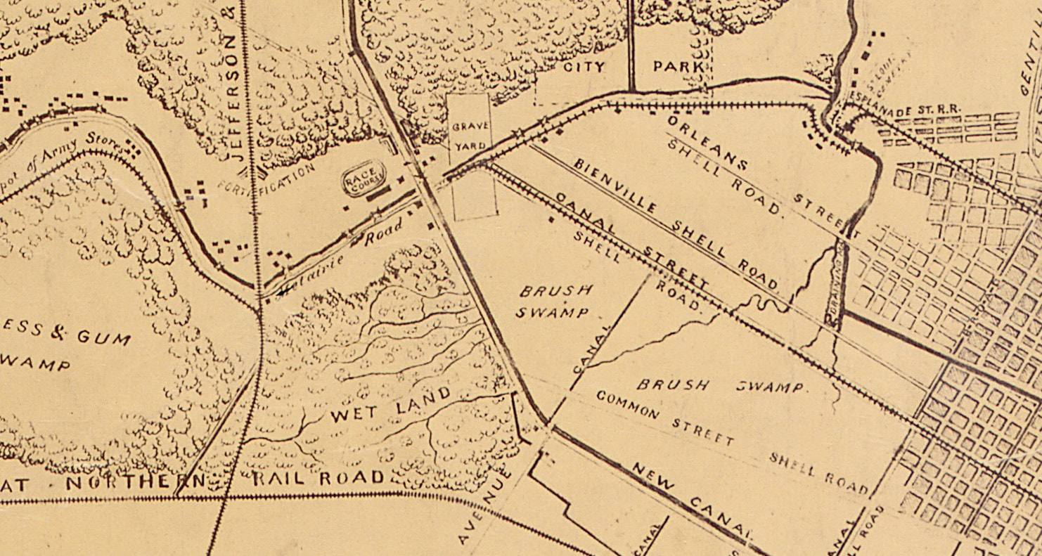 Detail of an 1863 map prepared for Major General N.P. Banks, detailing approaches to New Orleans. The area around the Canal Street Cemeteries, lumped together with the label "Grave Yard" remains remove from the city blocks of New Orleans. Image via Wikimedia Commons. On February 26, 1849, the various Odd Fellows Lodges converged on the Place d’Armes (Jackson Square) to form an “exceedingly beautiful” procession to celebrate the consecration of Odd Fellows Rest.[1] The parade of hundreds was decked in black crape, banners, and emblems of the many symbols recognized by the Odd Fellows. They marched through the French Quarter in a serpentine route, up one street and down another, across Canal Street and through the American Sector (now the Central Business District) where they converged at the New Basin Canal and boarded carriages to proceed up the New Shell Road to the Halfway House.[2] At the Halfway House, the Odd Fellows re-formed their procession, following a carriage drawn by six gray horses and carrying a sarcophagus containing the remains of sixteen Odd Fellows, exhumed from other cemeteries to be re-interred at Odd Fellows Rest. 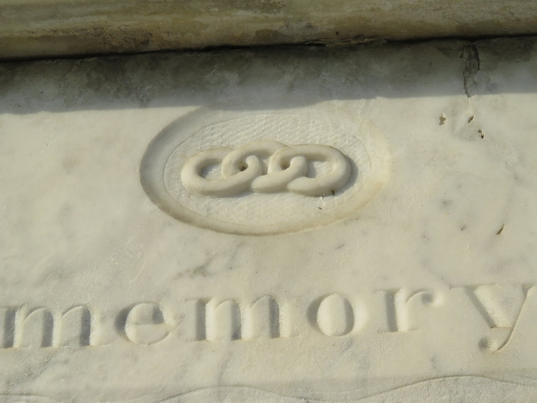 Detail of an 1850s tablet in Odd Fellows Rest, showing the three-link chain symbol. Photo by Emily Ford. The procession entered through the cemetery’s gate, a granite Egyptian Revival post-and-lintel that mirrored in style if not size the grand entrance of Cypress Grove immediately across Canal Street. Once inside, the parade ended at the center of the cemetery, where a tomb had been prepared. Poems were read and oratories recited, and the remains reburied. The entrance to Odd Fellows Rest would remain at the center of its Canal Street boundary for more than fifty years. The granite entryway was enclosed by two cast-iron gates produced in Spain for the Odd Fellows that portrayed dozens of the Order’s symbols: cornucopia, beehives, globes, books, shepherd’s staffs, stars, axes, and a mother protecting four children. The gates were surmounted by finals depicting the sun and moon, and atop all of this was the perennial Odd Fellows Symbol, the heart-in-hand. In the mid-twentieth century, New Orleans photographer Clarence John Laughlin would capture the gates in their historic context, complete with detail and careful multichromatic paints. By the 1970s, much of the original ironwork had been stolen or lost. 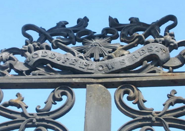 Detail of Odd Fellows gate, October 2004. The left half of this element is now missing. Photo by Flickr user Kristin Lanum.
Within the walls of Odd Fellows Rest, the cemetery would be populated by hundreds of enclosed wall vaults, belowground burials, high-style tombs, and even a tumulus. In the 1850s, local sculptor and stonecutter Anthony Barret (1803 – 1873) constructed a 48-vault society tomb for the Teutonia Lodge of the Grand Order IOOF. The society tomb, later transferred to Southwestern Lodge No. 42, was designed reminiscent of an Italian loggia, with each arched group of vaults framed by inverted torches carved in marble. The Teutonia Lodge tomb was surmounted by marble urns on each corner of its roof. At the primary façade of the tomb was the piece-de-resistance of the structure: a remarkably ornate marble panel carved with dozens of symbols of the Order, each framed with fine scrollwork carved in relief. At the center of the panel, the protecting mother sits nursing a baby and wrapping her cloak around another child. Anthony Barret was well known for his remarkable stonework, carving some of the finest relief sculptures found in the Lafayette Cemeteries and elsewhere. Even still, the Teutonia Lodge tomb is the greatest artistic accomplishment of Barret’s to survive into the present day. 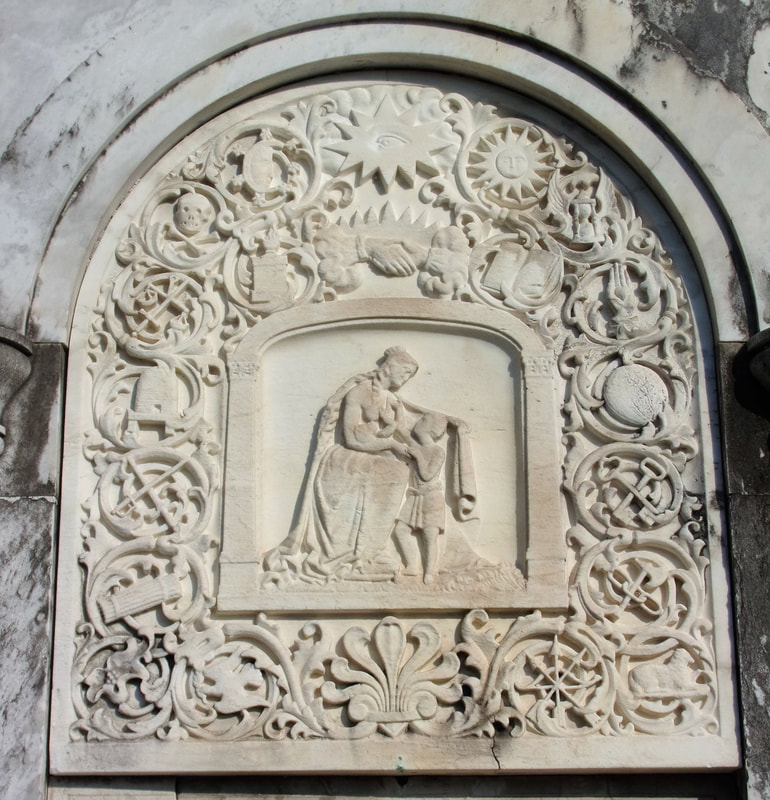 The remarkably detailed marble panel of the Teutonia Lodge society tomb, carved in the 1850s by Anthony Barret. Sixteen symbols relevant to the IOOF surround a mother and child and are surmounted by the clasped hands and all-seeing eye. Photo by Emily Ford. [1] Campanella, Bienville’s Dilemma, 172.
[2] Dell Upton, “The Urban Cemetery and the Urban Community: The Origin of the New Orleans Cemetery,” in Exploring Everyday Landscapes: Perspectives in Vernacular Architecture, ed. Annmarie Adams and Sally McMurry (Knoxville: The University of Tennessee Press, 1997), 132-133, 139-140. [3] The New Orleans Picayune, The Picayune’s Guide to New Orleans (New Orleans: The Picayune, 1904), 152. [4] Leonard Victor Huber, Peggy McDowell, Mary Louise Christovich, New Orleans Architecture, Vol. III: The Cemeteries (Gretna: Pelican Publishing, 2004), 33. [5] John E. Salvaggio, New Orleans’ Charity Hospital: A Story of Physicians, Politics, and Poverty (Baton Rouge: LSU Press, 1992), 35-45. [6] “Second Municipality Council,” Daily Picayune, May 19, 1847, 2. [7] “A Cemetery Blaze: Flames Sweep the Spot where Charity Hospital Dead are Interred,” Times-Picayune, February 27, 1905, 11. [8] An 1833 map of New Orleans from the Mississippi River to Lake Pontchartrain shows the intersection of Bayou Metairie and the New Basin Canal divided into properties belonging to the New Orleans Banking and Canal Company, and illustrates how the property lines correspond with Lake-oriented parcels. A high-resolution of that map is available here. [9] “Consecration of Odd Fellows Rest,” Daily Crescent, February 27, 1849, 1. [10] Ibid.
1 Comment
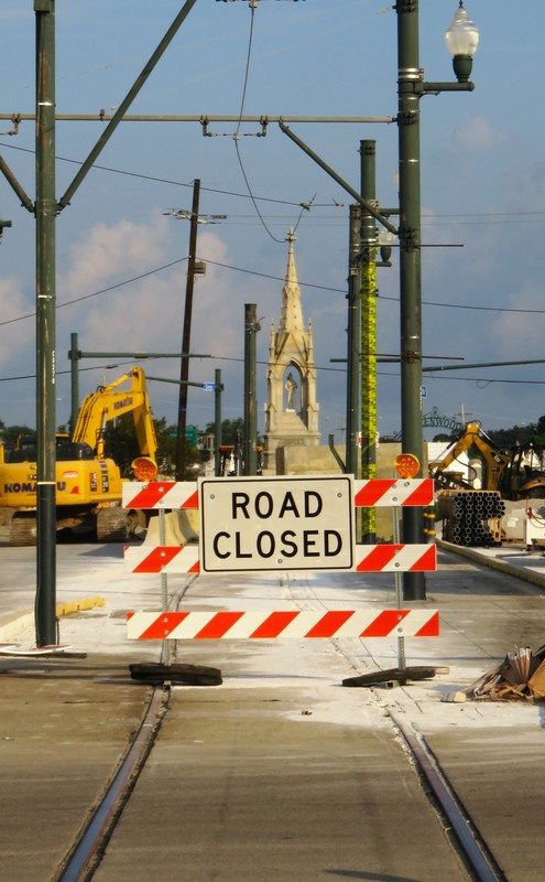
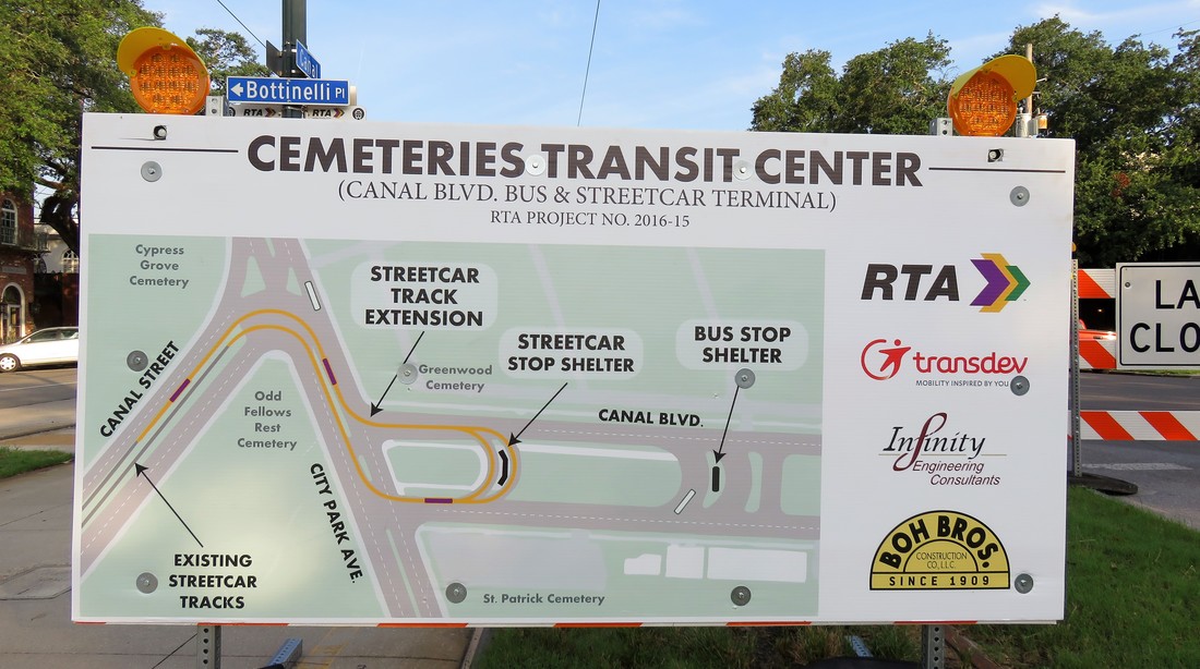 Informational panel posted at Canal Street and Botinelli Place, outlining current construction project. Photo by Emily Ford, Sept. 9, 2017. Beginning July 2017, New Orleans Regional Transit Authority (RTA) and the Federal Highway Administration (FHA) will be executing a significant construction project at the intersections of Canal Street, City Park Avenue, and Canal Boulevard – an area known simply as “the Cemeteries” by streetcar riders and New Orleaneans in general for more than a century. The construction project will extend the Canal Streetcar across City Park Avenue and onto Canal Boulevard in a turnaround that will streamline public transportation (see the diagram above). This is first successful attempt at creating a streetcar turnaround at this intersection, which is notoriously confusing and historically jammed with traffic, owing to an odd dog-leg where Canal Boulevard and Canal Street meet City Park Avenue. Fifty years ago, RTA made a similar attempt to connect Canal Boulevard and Canal Street – although that earlier design necessitated the demolition of Odd Fellows Rest Cemetery. Fortunately for New Orleans cemetery heritage, this plan was scrapped and the cemetery was saved.[1] This tangled intersection of New Orleans thoroughfares, joined with the Pontchartrain Expressway (Interstate 10), is the site of a dozen different New Orleans cemeteries ranging in founding dates from 1840 to 1973, and ranging in background from elite city of the dead to humble potter’s field. The intersection of Canal Street and City Park Avenue is an essential crux of New Orleans history in almost every way. It is a heart of metropolitan development and architectural expression without compare. Over the next month, Oak and Laurel is taking a look at the history of the Canal Street cemeteries and their environs, beginning with the history of the land itself.
Until this time, commercial navigation between the Mississippi River and Lake Pontchartrain utilized Bayou St. John and the Carondelet Canal. The Carondelet Canal was dug in 1794 and extended Bayou St. John to what is now Basin Street – named so for the turning basin located there. The Carondelet or “Old Basin” Canal had disadvantages. Specifically, its age made it less practical, and its location meant its primary beneficiaries were Creoles and other established residents of the former colonial city.[2] Competition between the old French-speaking order and the American interests that populated the city after the Louisiana Purchase motivated investment in a new canal. In 1831, the New Orleans Canal and Banking Company was founded by the Maunsell White and Beverly Chew with the backing of the state of Louisiana. The company was formed with the specific goal of establishing a “canal from some part of the city or suburbs of New Orleans, above Poydras street to the Lake Pontchartrain.”[3] Construction on the New Basin Canal began in 1832, although a terrible cholera epidemic held up its progress that year. 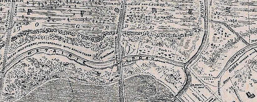 Detail of 1849 Sauve's Crevasse map showing the intersections of Bayou Metairie/Metairie Road, the New Basin Canal, and Bayou St. John. The New Basin Canal intersects Bayou Metairie just to the left of the word "ROAD" above. (Wikimedia Commons) The construction of the New Basin Canal was overwhelmingly fueled by the labor of Irish immigrants. Beginning in the 1830s and intensifying in the next decade, migration from Ireland to New Orleans helped make the Crescent City the second-largest port for immigrants in the country. Newly-arrived Irishmen typically came from agricultural backgrounds and sought manual labor in their new city. Tragically, the enormous labor demand and barbaric conditions of hand-digging the New Basin Canal caused thousands of deaths. Sources refer to daily deaths in the trenches from illness and exhaustion, the fallen laborer buried in the soil along the canal as work progressed. The construction of the New Basin Canal defined the Irish experience in New Orleans.[4] The New Basin Canal began at a turning basin along Triton Walk, approximately the present location of the Union Passenger Terminal in the Central Business District. It extended northwest near what is now Carrollton Avenue and turned more northerly from there, meeting Lake Pontchartrain at what is now West End Boulevard. If this route sounds vaguely like the route of Interstate 10 from the Crescent City Connection to the I-10/610 merge, that’s because the Pontchartrain Expressway very closely replaced the New Basin Canal route in the mid-twentieth century.
While newcomers to the city found in the Shell Road and New Basin Canal a rural retreat possibly reminiscent of home, these same people from the Northeast, from Ireland, from Germany, and elsewhere, found no cemetery in New Orleans that could be so reminiscent. For the next sixty years, these people would shape this area into such cemeteries.[5] 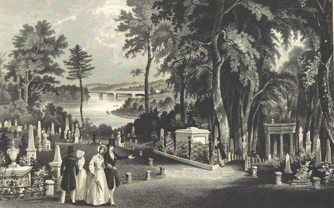 Illustration from "A Guide to Laurel Hill Cemetery, near Philadelphia," published 1844. Rural cemeteries like Laurel Hill (founded 1836) influenced northern transplants in New Orleans. (Wikimedia Commons) 1840: Cypress Grove Cemetery From the time of the Louisiana Purchase through the 1840s, immigrants from all over poured into New Orleans. As they brought their bodies and livelihoods, they brought their culture and traditions. From Creoles of color from San Domingue, New Orleans gained the shotgun house. As for the thousands of immigrants from the Anglo-Protestant North who came to New Orleans, New Orleans gained from them wire-cut Pennsylvania brick, Anglo-American concepts of landscape design, and the idea of the rural garden cemetery. The rural cemetery movement arose in the northeast in part from the contemporary expansion of cities. Advances in industrialization within the urban landscape created in city-dwellers a longing for the countryside. Furthermore, this same industrialization advanced the American middle class in such a way that recreation was newly defined. Inspired by English landscape design, the rural cemetery was the predecessor to the public park – in fact, Central Park landscape architect Frederick Law Olmstead designed one such cemetery in California. This shift in the appearance and purpose of cemeteries coincided with many American cultural movements like Romanticism, the definition of the middle class, and the “beautification of death period.” Northern Americans who moved to New Orleans were inspired by what they saw at Mount Auburn Cemetery in Massachusetts, Laurel Hill Cemetery in Philadelphia, Green-Wood Cemetery in Brooklyn, and many more. These were cemeteries that were designed instead of planned, with undulating pathways that strolled past weeping willows and reflecting pools. This was the rural cemetery movement, a great leap in the history of cemeteries that would change the American perception of death forever. 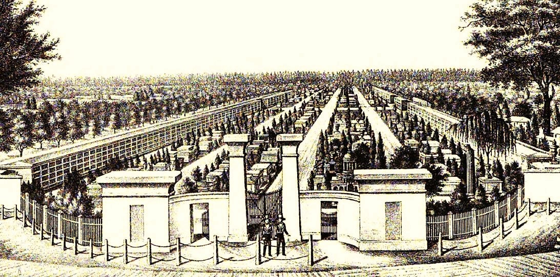 Aerial rendering of Cypress Grove Cemetery, from "History of the Fire Department of New Orleans," edited by Thomas O'Connor, 1895. This contrasted deeply with the Francophile and Creole cemeteries that had developed in New Orleans to this time – densely packed “cities of the dead” with few if any landscape features. St. Louis Cemetery No. 1 was not planned out by lots or aisles and instead haphazardly developed into the necropolis it became. After St. Louis No. 1, Girod Street Cemetery, St. Louis No. 2, and Lafayette Cemetery No. 1 (1822, 1823, and 1833, respectively) were planned into square and aisles, but remained cemeteries set in urban landscapes. The cemeteries at the end of Canal Street would be a departure from this context. On April 25, 1840, the first cemetery at the intersection of Canal Street and Metairie Road was officially opened. Cypress Grove was owned and operated by the Firemen’s Charitable Benevolent Association (FCBA) and, although the cemetery would be open to all burials, it would be dedicated to the memory of New Orleans’ volunteer firemen. The dedication ceremony of Cypress Grove included a march of nearly one thousand firemen, clergy, and prominent citizens marching through downtown New Orleans, each wearing mourning bands and a few carrying urns of the ashes of their martyred comrades. The procession boarded the Nashville railroad at the foot of Canal Street and rode to the end, where the Egyptian Revival columns of Cypress Grove’s entrance would have stood almost completely alone within the undeveloped landscape. Among the martyrs honored that day was Irad Ferry, the “first martyr,” who perished in the line of duty on New Year’s Day 1837. Originally buried in Girod Street Cemetery, Ferry’s remains were relocated to Cypress Grove as the cemetery’s first burial, beneath a marble sarcophagus topped with a broken column which was designed by J.N.B. de Pouilly and constructed by stonecutter Newton Richards. In a nearby tomb constructed for this purpose, the remains of eleven additional firemen were buried.[6]
It would seem almost superfluous to set for the advantages of this rural cemetery. The rapid growth of our city has already encroached upon the tombs of its fathers, and the sacred relics of the dead have been compelled to give way to the cold and selfish policy of speculators, and the intrusion of business; and the solemnity of the grave yard is disturbed by discordant shouts of merriment, and the baleful proximity of the dissolute.[8] (To learn more about Cypress Grove’s history, check out our blog post “Lost Landscapes of Cypress Grove,” Part 1 and Part 2) 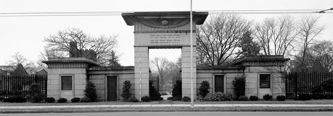 Main gate, Mount Auburn Cemetery, Cambridge, Massachusetts (Wikimedia Commons) 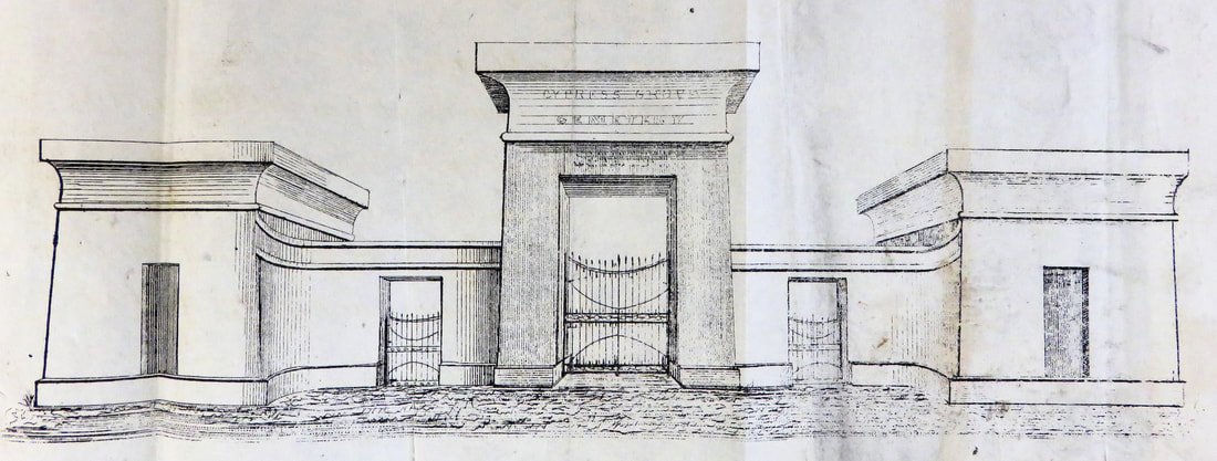 1840 sketch of Cypress Grove Cemetery entrance (Tulane University Louisiana Research Collection) 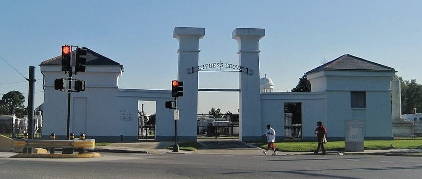 Entrance to Cypress Grove Cemetery, present day. (Wikimedia Commons) Cypress Grove Cemetery No. 2 or Charity Hospital Cemetery No. 2 Cypress Grove Cemetery may have extended across Bayou Metairie and through what is now Canal Boulevard. It is true that a cemetery was once present in this space. However, the cemetery is referred to in records as both “Cypress Grove Cemetery No. 2” and “Charity Hospital Cemetery No. 2.” This potter’s field, which records suggest was dominated only by below-ground burials of the indigent, is referred to in at least one record as belonging to the Firemen’s Benevolent Association, but leased by Charity Hospital for the burial of deceased patients.[9] Over the next century, Cypress Grove No. 2 would accept thousands of indigent burials and become an on-again, off-again bone of contention in this funerary landscape.[10] Next week, we will explore the 1840s as new cemeteries are founded, namely St. Patrick’s, Dispersed of Judah, Charity Hospital Cemetery, and Odd Fellows Rest. 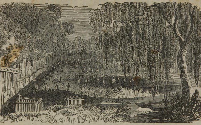 1853 sketch of Cypress Grove Cemetery No. 2, from C.W. Kenworthy, "History of Yellow Fever in New Orleans" (Tulane University Louisiana Research Collection) [1] “End to Canal ‘Dog Leg’ Urged,” Times-Picayune, August 11, 1963, 1; “Planners Revive Canal St. Cut-off,” Times-Picayune, August 12, 1963, 17; “Council Irate at Land Deal: City Officials Criticized for Failure to Buy,” Times-Picayune, July 3, 1964; “City Abandons Cemetery Suit,” Times-Picayune, December 12, 1972, 9.
[2] Richard Campanella, Bienville’s Dilemma: A Historical Geography of New Orleans (Lafayette, LA: Center for Louisiana Studies, 2008), 30, 135. [3] T.P. Thompson, “Early Financing in New Orleans: Being the Story of the Canal Bank, 1831-1915,” Publications of the Louisiana Historical Society, Vol. VII (1913-1914), 24. [4] Laura D. Kelley, The Irish in New Orleans (Lafayette: University of Louisiana at Lafayette Press, 2014), 32-36. [5] Dell Upton, “The Urban Cemetery and the Urban Community: The Origin of the New Orleans Cemetery,” in Exploring Everyday Landscapes: Perspectives in Vernacular Architecture, ed. Annmarie Adams and Sally McMurry (Knoxville: The University of Tennessee Press, 1997), 132-133, 139-140; David Charles Sloane, The Last Great Necessity: Cemeteries in American History (Baltimore and London: Johns Hopkins University Press, 1991), 44-46. [6] Thomas O’Connor, ed. History of the Fire Department of New Orleans (New Orleans: FMBA, 1890), 70-71. [7] “Firemen’s Celebration in New Orleans,” Galveston Daily News, March 6, 1869, 1. [8] Firemen’s Charitable Association, Report of the Committee of the Firemen’s Charitable Association, on the Cypress Grove Cemetery (New Orleans: McKean, 1840), 4. [9] Henry Rightor, Standard History of New Orleans, Louisiana (New Orleans: Lewis Publishing Company, 1900), 265. Rightor’s 1900 history refers to this cemetery as Charity Hospital No. 2. [10] Peter Dedek, The Cemeteries of New Orleans: A Cultural History (Baton Rouge: Louisiana State University Press, 2017), 61, 77. |

About the Author:Emily Ford owns and operates Oak and Laurel Cemetery Preservation, LLC. Archives
November 2019
Categories
All
|
|
Oak and Laurel Cemetery Preservation, LLC is a preservation contractor in New Orleans, Louisiana, specializing in historic cemeteries, stone conservation, educational workshops and lectures. Oak and Laurel serves the region of the Southeastern US.
|
QUICK LINKS |
CONNECT |