|
How were some of New Orleans' most beautiful tombs designed, and why? 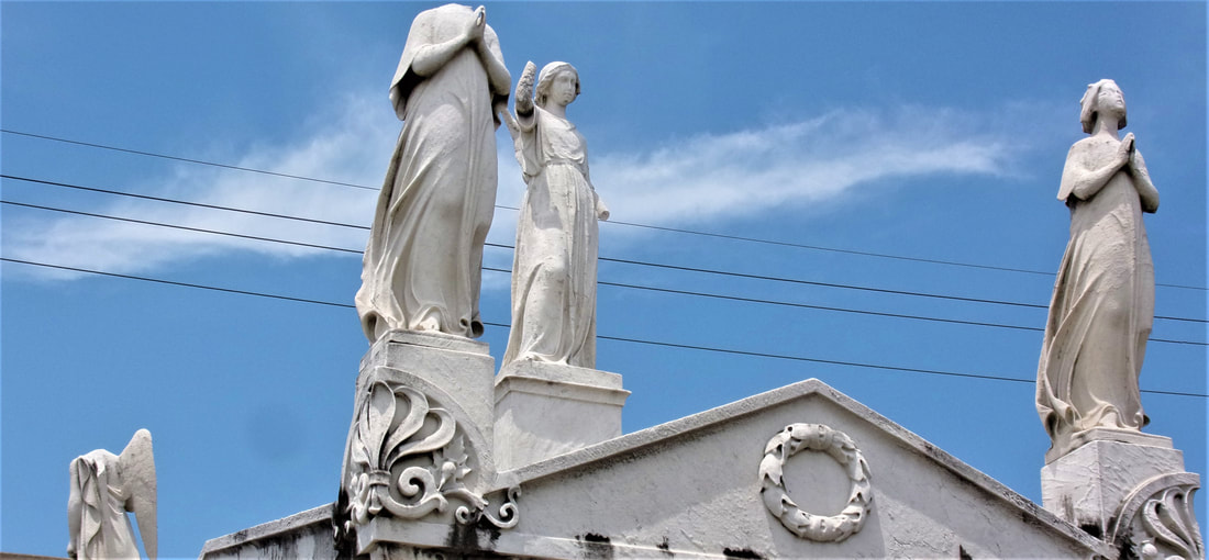 Detail of the Barelli tomb, St. Louis Cemetery No. 2 (Photo by Emily Ford) The architecture of New Orleans cemeteries is as diverse and varied as the neighborhoods in which the cemeteries are set. On one end of town, St. Vincent de Paul Cemetery grew from a peaceful field in the 1830s into a florid, tightly-packed garden cemetery full of Spanish and Italian inscriptions by the 1860s. Far uptown, the Americans built Lafayette Cemetery No. 1 from a below-ground graveyard into a little city of stone tombs in the same period. Between the two of them, the French-Creole cemeteries St. Louis No. 1 housed several generations of architecture within its walls decades before either Lafayette No. 1 nor St. Vincent de Paul were even conceived of.[1]
Each tomb’s design in each cemetery is an adaptation of myriad influences, determined through the eye and imagination of mostly vernacular builders. Yet as is the case in all cemeteries, the appearance of the present is determined by what came before. In this blog post, we examine how a single influence gained a dual life in the form of the New Orleans sarcophagus tomb.
2 Comments
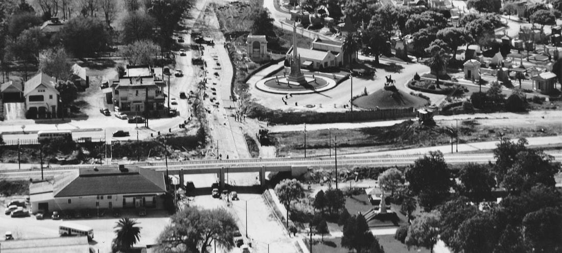 Metairie Cemetery (upper right) and the Halfway House (lower left) in the late 1950s or 1960s as the New Basin Canal (horizontal across center) is filled in for the Pontchartrain Expressway (I-10). Image via New Orleans Public Library Photographs Collection, used with permission. This is the fifth and final part in a five-part series on the historic landscape of City Park Avenue and Canal Street, and its associated cemeteries. From July to November 2017, construction will take place at this intersection to connect the Canal Streetcar to Canal Boulevard. To start at the beginning of this series, find Part One here, Part Two here, Part Three here, and Part Four here. By the 1930s, the intersection of Canal Street and City Park Avenue had undergone a century of extraordinary change. Where once Bayou Metairie meandered westward past acacia trees and a pastoral ridge, now City Park Avenue coasted across the New Basin Canal to become Metairie Road, past the grand monuments of Metairie Cemetery, and into Old Metairie. Where once the Egyptian Revival columns of Cypress Grove stood tall over an undeveloped landscape, now cars rumbled past the monuments and walls of Greenwood Cemetery and Odd Fellows Rest. Jazz blared from the Halfway House beside the New Basin Canal through the 1920s, until the House was converted into an ice cream parlor in 1930.[1] Bayou Metairie had slowly been filled in to accommodate City Park Avenue. To the east, Delgado Central Trades School (now Delgado Community College) was opened in 1921. Beside Delgado, Holt Cemetery remained the municipal potter’s field for New Orleans, but in 1940 the cemetery gained a new neighbor – the Higgins Boat Plant.  Workers at the Higgins Boat Plant, June 1943. Photo by John Vachon, via Library of Congress. PTs, Higgins, and the Cemetery Andrew Higgins (1886-1952) is known today in New Orleans as the man who brought the shallow-bottom PT and “landing craft, vehicles, personnel” or “LCVP” boats to the Allied effort in World War II. LCVP boats were used extensively in the D-Day invasion of Normandy in 1945, leading then-President Dwight D. Eisenhower to say in 1964 that Higgins had “won the war for us.” Before World War II, Higgins had gotten his start designing shallow-bottom boats that performed well in the Louisiana bayous and other waterways beset by submerged obstacles. But by the late 1930s, Higgins produced new designs that not only could achieve amphibious landings in shallow waters, but were also equipped with ramps to allow swift disembarkation upon landing. These qualities made Higgins Boats imperative to the war effort. 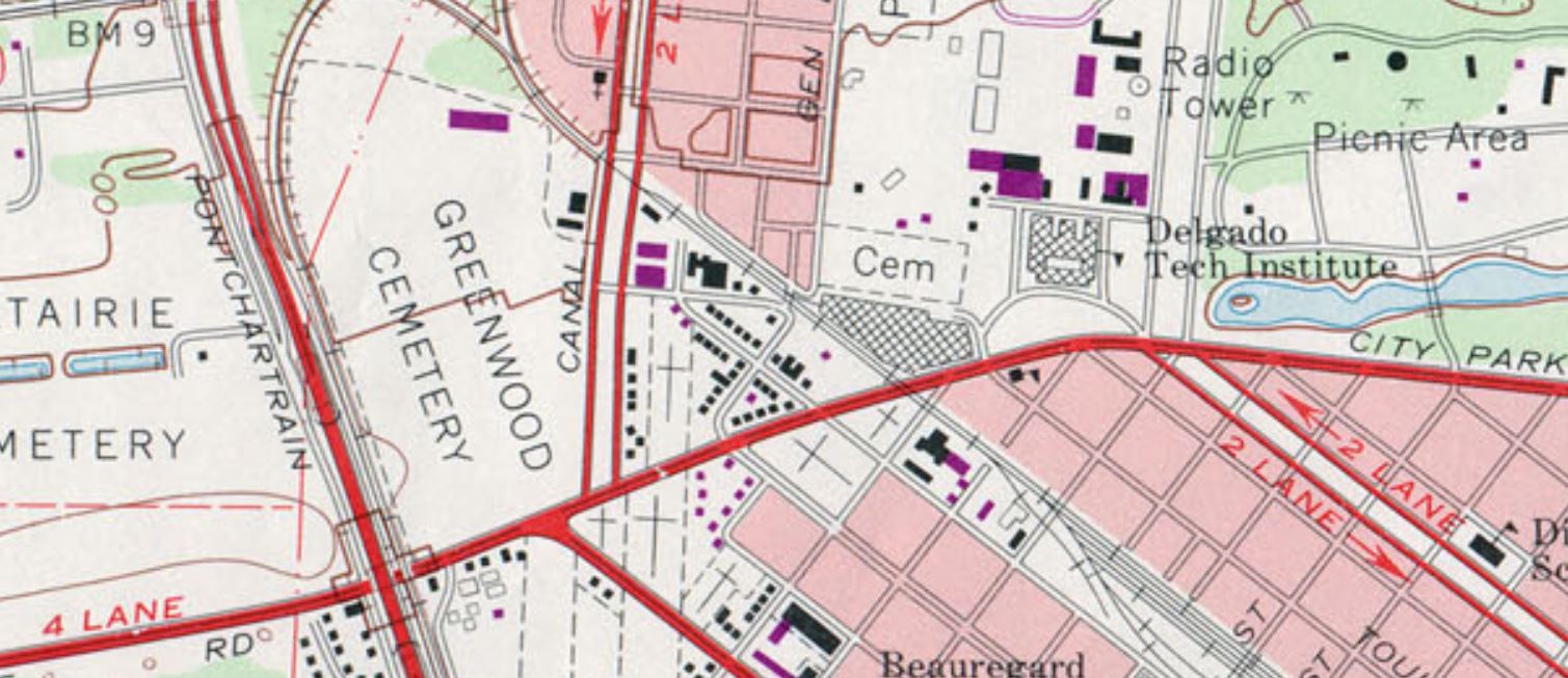 Detail of 1979 US Geological Survey Map of New Orleans, showing the former footprint of the Higgins Plant - to the left of Delgado Tech. Institute and below Holt Cemetery (marked "Cem"). In 1940, Higgins Industries constructed a $1.5 million boat-building facility in the least expected of places: far from water, along City Park Avenue, and beside Holt Cemetery. Ever known for his enterprising spirit, Higgins’ City Park plant became the “world’s largest boat manufacturing plant housed under one roof.”[1] The plant took advantage of the Southern Railway line that cut northwesterly across City Park Avenue, beside Masonic Cemetery No. 2. Boats would be manufactured at the City Park plant, which employed thousands of people, and shipped to Lake Pontchartrain for testing. The booming wartime production of the plant left the operation bursting at the seams. Said historian Jerry Strahan of Higgins’ need to expand: “The back of the shipyard was adjacent to Holt Cemetery. Higgins decided to enlarge the plant ‘knowingly and willingly’ by preempting an unused portion of the cemetery grounds. The plant was increased until 40 percent of the new facility was constructed on property to which Higgins held no title, a problem that was unresolved as late as 1947.”[2] Photos of the plant and adjoining Holt Cemetery can be found here under photographs numbered 14 and 21. As early as November 1945, the loss of massive wartime governmental contracts hit the Higgins plant hard. The property was put up for sale.[3] The building at 501 City Park Avenue would have myriad uses over the next thirty-five years – it was a Piggly Wiggly grocery store in 1948, offices for Georgia Pacific Corporation in 1959, and part of the building was used as an art warehouse in 1964.[4] From the 1960s through the 1970s, a van and storage company conducted business in the old plant. In 1972, the building was demolished - its walls, beams, floors, and other items sold for salvage.[5] Finally, in 1982, Delgado Community College opened the Arthur J. O’Keefe Administration Building at 501 City Park Avenue.[6] The architecturally intriguing building remains in the same capacity to this day. In 1964, Holt Cemetery would cease to serve as New Orleans’ potter’s field. The city of New Orleans, under coroner Frank Minyard instead leased a lot from Resthaven Cemetery in New Orleans East for this purpose. This section of Resthaven continues to serve as New Orleans’ indigent burial ground. 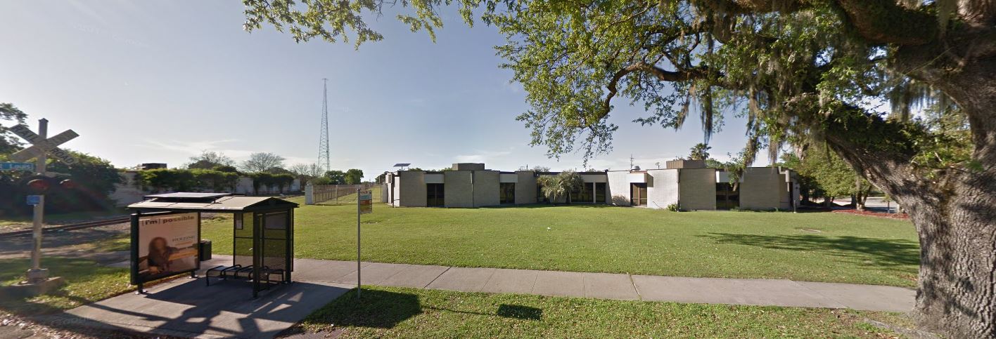 Google Street View of 501 City Park Avenue, Delgado Community College administration building. The American Way of Death After the close of World War II, industries which had boomed forward industrially and technologically looked inward for domestic uses of their innovations. Higgins Industries attempted to this very thing: selling Higgins-designed watercraft for private uses. While to contemporary readers it may seem strange, the same phenomenon took place in the funeral and cemetery industries. Moreover, the clientele of these industries had changed: they were more prosperous, more mobile, and had different values. For 1950s Americans, death was to be confronted with more discretion, privacy, and modernity than had been the case for previous generations. The cultural boom of the 1950s held an inherent disdain for the old-fashioned. This trend is often best exemplified in the scorn held for Victorian architecture during this period. Modern Americans sought urban renewal to wipe away old landscapes. In New Orleans, such sentiments manifested in the rapid construction of community mausoleums, establishment of “memorial park” style cemeteries like Garden of Memories, and the destruction of Girod Street Cemetery. Girod Street Cemetery was established in 1822 at the foot of Girod Street near Liberty Street. By the mid-1950s, the cemetery was bounded by the New Orleans Union Passenger Terminal, part of a neighborhood seen as old, blighted, and an obstruction to progress. After repeated attempts by the cemetery’s owner, Christ Church Cathedral, to resurrect the cemetery both architecturally and functionally, it was expropriated by eminent domain to the federal government and the City of New Orleans. The cemetery was demolished in 1957.  1885 postcard image of vaults in Girod Street Cemetery (Wikimedia Commons) Girod Street Cemetery was located far from the Canal Street cemeteries, but it held certain cultural and architectural ties to other Protestant-dominated cemeteries like Cypress Grove and St. John’s Lutheran Cemetery. As the process of demolition began, the Huber family which had assumed ownership of St. John’s Cemetery in the 1920s, jockeyed for the contract to relocate the Girod Street remains. This competition involved multiple cemetery craftsmen-turned-cemetery owners and would not be the last time a cemetery operator competed for business with his peers. At the same time Girod Street Cemetery was being demolished, cemeteries at Canal Street and City Park Avenue were modernizing. The first inklings of cemetery stoneworkers turning to cemetery operation began in the 1910s and 1920s. For example, in 1910, stonecutter Albert Stewart assumed ownership of St. Vincent de Paul Cemetery on Louisa Street, acquiring it from the Suarez brothers. The Huber family had gained ownership of St. John’s Lutheran Cemetery in the 1920s – and by the 1930s, began construction on Hope Mausoleum, the first community mausoleum in New Orleans. 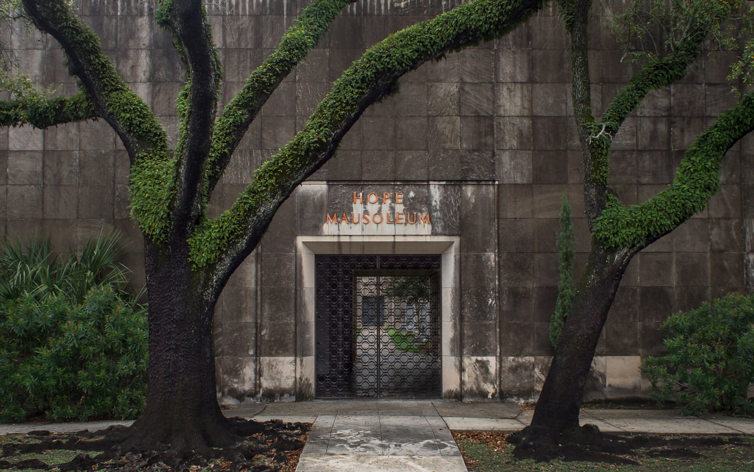 Entrance to Hope Mausoleum, 2016. Photo by Kevin O'Mara via Flickr. Community mausoleums had gained some traction in the United States beginning in the 1890s and increasingly so in by the time of the Great Depression. In this era, the idea of a large, single-structure facility for burial appealed to cultural ideals of mutual benevolence (indeed, many belonged to fraternal societies like the Masons and Odd Fellows) and frugality. In New Orleans, these cultural desires were often met instead with society tombs – large, multi-vault structures within larger cemeteries. Society tombs were New Orleans’ version of community mausoleums, which reflected a more northern aesthetic. It is, then, not surprising that the Huber family gained ownership of German Lutheran St. John’s Cemetery and erected Hope Mausoleum around the historic burial ground. The development almost appears as an extension of St. John’s, Girod, and Cypress Grove Cemetery’s tendency to reflect non-Francophile aesthetics. In the early 1930s, Hope Mausoleum opened, a modestly Art Deco edifice encased in polished marble and touting itself as, “The Modern Way of Burial.”[8] The postwar boom of the 1950s saw a second heyday for community mausoleums, but these mausoleums suited newer cultural norms. The era valued opulence and modernity, sleek, state-of-the-art materials and a dearth of filigree and detail. The funeral and cemetery industries, rising into a new period of lobbying professional organizations, consolidated costs, and property accumulation, responded in kind. Indeed, author Jessica Mitford in her 1963 indictment of the industry, The American Way of Death, compared the contemporary funeral industry to the car industry of the same age: overloaded with space-age fins and baubles.[9] Thus, the new community mausoleum was meant to be an expression of modernity and opulence, and a doing-away with the stodgy funereal rituals and trappings of the past. Into this new market rose the children of Albert Stewart – Frank Sr. and Charles Stewart. Under their business, Acme Marble and Granite Company, the Stewarts purchased land adjoining the north boundary of Metairie Cemetery and set forth to construct a community mausoleum for the age. 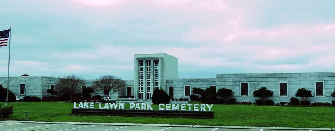 Lake Lawn Park Mausoleum, 2017. Photo by Emily Ford. Completed in 1958, Lake Lawn Mausoleum would be the “the ultimate in modern burial,” with “paneling of rich mahoganies, carpeted floors, custom-built furniture, and rare plants and flowers.”[1] Lake Lawn would be the anti-Girod Street Cemetery. Historic photos suggest that Lake Lawn advertised within the walls of Girod Street, declaring that burials removed from the old Protestant cemetery could be moved to a thoroughly modern location. In fact, the engineer of Girod Street Cemetery’s demolition, Mayor deLesseps Story “Chep” Morrison, did just that. The contents of the Story family mausoleum, relatives of Mayor Morrison, were moved to Lake Lawn Park Mausoleum in May of 1956. In the end, though, Hope Mausoleum would gain the contract to re-inter the white burials from Girod Street Cemetery. In accordance with contemporary segregation laws (even in death) Providence Memorial Park in Metairie would receive the African American burials from Girod Street.  Discarded advertisement for Lake Lawn Park and Mausoleum, photographed in Girod Street Cemetery, 1957. Photo by Robert Kelley via LIFE Magazine Photo Collection, Google Cultural Commons. The torchbearer of urban renewal, Mayor Chep Morrison, would himself in death become part of the struggle between rising cemetery entrepreneurs, and the clash of new and old New Orleans cemetery culture. Shortly before his death in 1957, entrepreneurial monument man Albert Weiblen, who by this time had expanded his business to owning entire quarries in Georgia, purchased the entirety of Metairie Cemetery. His widow Norma maintained this enterprise after Albert’s passing, and when Mayor Chep Morrison perished in a tragic airplane accident in 1964, a standoff ensued between old Metairie Cemetery and modern, neighboring, Lake Lawn Park Mausoleum. Mayor Morrison had, as mentioned previously, moved his family’s remains from Girod Street Cemetery to Lake Lawn Park Mausoleum. Yet while the new mausoleum was modern, Metairie Cemetery had been the lauded resting place of New Orleans mayors, governors, and Mardi Gras kings (nine, eleven, and more than fifty, respectively[1]). Metairie’s position in New Orleans culture was to be the hallowed resting place of power in all its forms. Presumably to preserve this reputation, Norma Weiblen called Morrison executor William H. Lindsay, Sr. on May 24, 1964, offering the Morrison family very steep discounts on a new tomb in Metairie Cemetery if they would consider moving Mayor Morrison’s burial there from Lake Lawn Park. She added that Lake Lawn Park was a “stinkpot,” and that she “knew [Metairie Cemetery] was where [Morrison] belonged.”[2] Years later, the matter would result in a lawsuit. Morrison was buried in Metairie Cemetery and, in 1969, Stewart Enteprises purchased Metairie Cemetery, renaming the joined properties “Lake Lawn-Metairie Cemetery.” 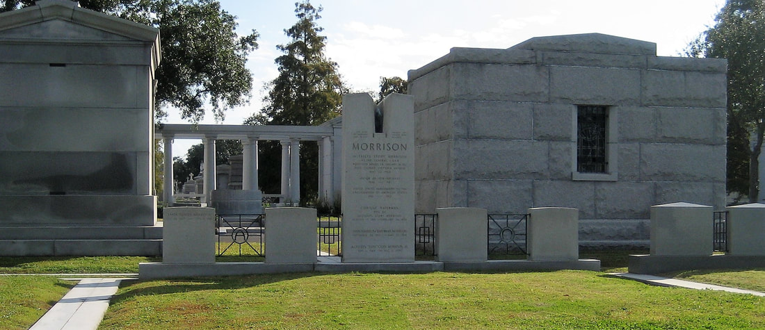 Morrison monument at Metairie Cemetery. Image by Infrogmation via Wikimedia Commons. The modernization of historic cemeteries at the end of Canal Street was fueled by the spirit of an era – and a struggle for space. By the 1950s, many of the cemeteries in the area were more than a century old. Furthermore, the city of New Orleans and the suburb of Metairie had grown tightly around them, leaving no room to expand. Community mausoleums were a practical way to capitalize on sellable space. Metairie Cemetery had made such a venture – filling in one of the cemetery’s lagoons to construct Metairie Mausoleum in 1958. In 1964, the various parish-owned Catholic cemeteries in New Orleans would be consolidated under the new New Orleans Archdiocesan Cemeteries. Ten years later, the Calvary at the rear of St. Patrick Cemetery No. 1 would be demolished to construct Calvary Mausoleum. In 1969, the Firemen’s Charitable Benevolent Association would open Greenwood Mausoleum.  Metairie Mausoleum, completed 1958. Photo by Emily Ford.  Greenwood Mausoleum, completed 1969. Photo by Emily Ford. The Jewish cemeteries at the end of Canal Street would also reorganize ownership. In the late 1950s, the Hebrew Burial Association would form to assume ownership of Dispersed of Judah Cemetery, the oldest surviving Jewish Cemetery in New Orleans. With religious restrictions against above-ground burial, the cemetery instead appears to have expanded toward Bernadotte Street in this time, where today a section of modern, 1950s granite monuments stands. In 1973, conservative congregation Chevra Thilim established Chevra Thilim Memorial Park in a small triangle of land bounded by St. Patrick Cemetery No. 2, Dispersed of Judah Cemetery, and Iberville Street. In 1999, Chevra Thilim merged with another congregation to form Shir Chadosh congregation, who retains ownership of the memorial park-style cemetery. Canals, Streetcars, and Automobiles Within cemetery walls, local stonecutters became sales agents and marble increasingly gave way to increased use of granite. No longer the city’s potter’s field, Holt Cemetery became a burial ground for the families of those already interred therein. Outside the cemeteries of Canal Street and City Park Avenue, water and soil gave way to concrete and pylons 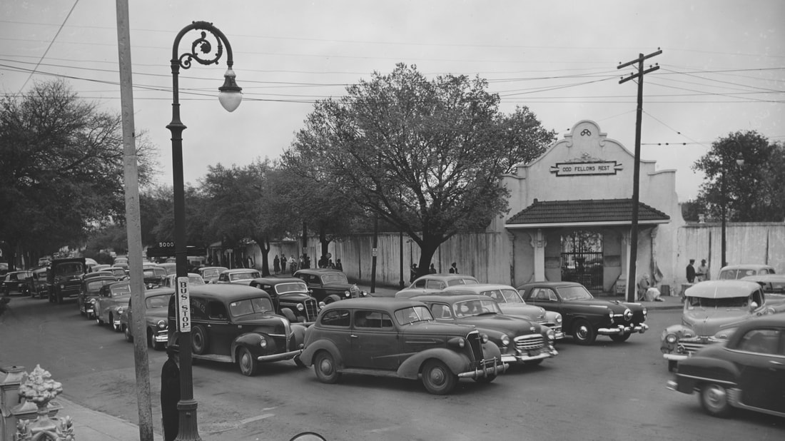 Traffic backing up at City Park Avenue at the "dog-leg" between Canal Street (at right) and Canal Boulevard (at left). Late 1950s. Image via New Orleans Public Library Photographs Collection, used with permission. The New Basin Canal, in service since 1838 and arguably the heart of the cemeteries landscape, was by the 1950s no longer fit for industrial use. As with Bayou Metairie before, the canal was filled in and repurposed for automobile use. In 1958, a new overpass was constructed for City Park Avenue traffic to traverse over the canal, but its use would be short lived. By 1962, sections of the canal nearest to Lake Pontchartrain were filled in and became West End Boulevard. At the end of the wide boulevard’s neutral ground, a civil defense bunker was constructed as a station of command for government in the event of nuclear war. The bunker has been abandoned since the late 1990s, but remains present on West End Boulevard near Robert E. Lee Boulevard. 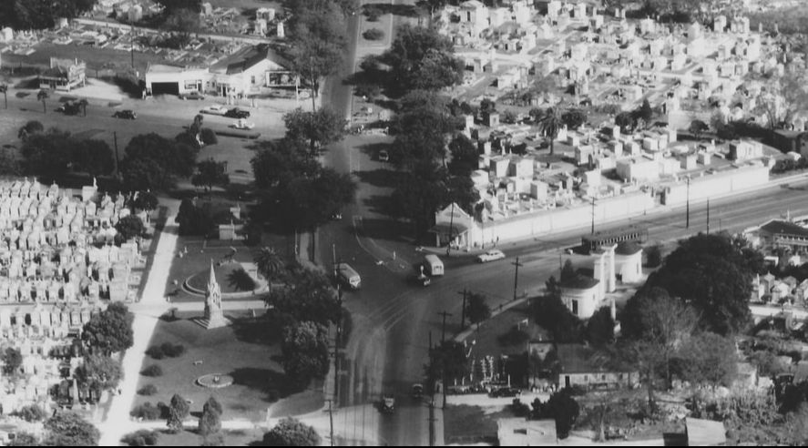 Aerial view of City Park Avenue, Canal Street, and Canal Boulevard "dog-leg." Late 1950s. Image via New Orleans Public Library Photographs Collection, used with permission. Finally, in 1968, plans that had begun in the 1950s with Mayor Morrison came to fruition and a superhighway was constructed to connect Baton Rouge and New Orleans. The Pontchartrain Expressway, part of Interstate 10, was constructed above the filled-in New Basin Canal – replacing high levies and deep water with tall pylons and dipping underpasses. 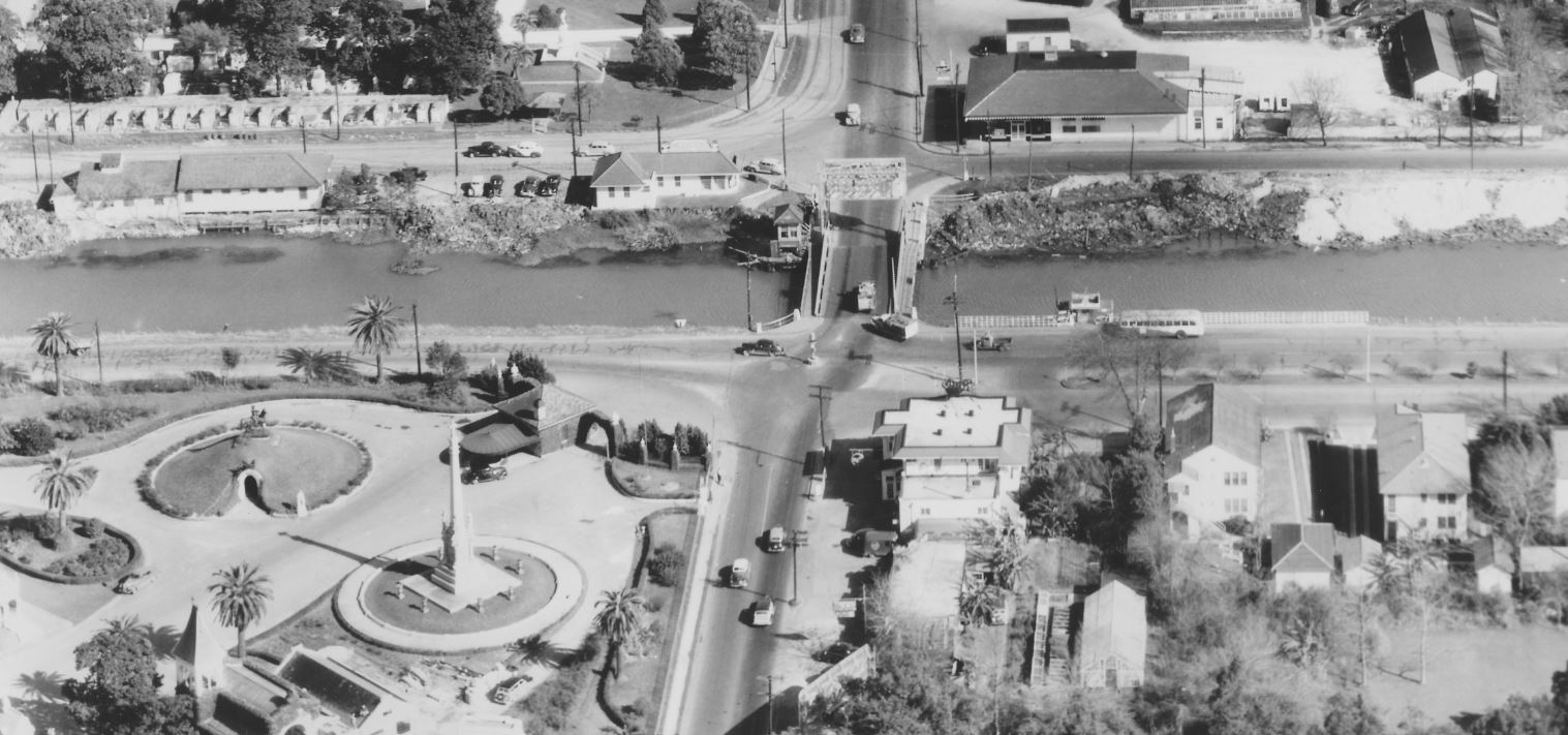 Late 1950s aerial photograph of New Basin Canal at City Park Avenue, with Metairie Cemetery in the lower right corner. The Pontchartrain Expressway replaced the route of the New Basin Canal. Image via New Orleans Public Library Photographs Collection, used with permission. Increased automobile traffic was met with increased automobile infrastructure, but one seemed to continually outpace the other. The roadways as they were in 1968 were complex and disconnected: Canal Boulevard met City Park Avenue, which met Canal Street in a dog-leg which already vexed motorists. The triangular lot of Odd Fellows Rest formed this dog-leg, and in the 1960s, civic eyes turned to eliminate the obstacle. The (sort-of) Battle for Odd Fellows Rest As early as 1948, New Orleans’ City Planning Commission recognized the “dog-leg” problem.[13] As automobile drivers increasingly used Canal Boulevard and Canal Street as a commuter route to and from the city, the multiple turns needed to achieve this route caused traffic congestion. While the commission desired nothing more than to connect the two streets, Odd Fellows Rest cemetery had sat firmly between them since 1849. By 1963, the plan to “bypass” Odd Fellows Rest was revived. The Planning Commission announced in August of that year that it sought to purchase “the entire Odd Fellows Rest on the downtown river side of the intersection of Canal st. and City Park ave. and a very small portion of the adjoining St. Patrick No. 2 cemetery.”[14] The City would purchase the cemetery, relocate the remains interred therein, and demolish the remainder in order to connect Canal Street and Canal Boulevard. 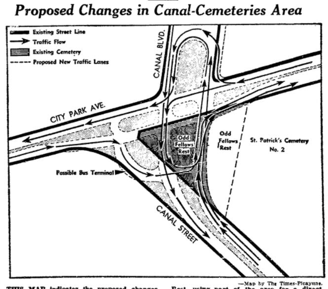 Diagram of proposed connection for Canal Blvd. and Canal Street through Odd Fellows Rest. Times-Picayune, August, 11, 1963. Like its neighboring cemeteries, Odd Fellows Rest had struggled to transition from the nineteenth century to the postwar era. In 1950, the Grand Lodge of Louisiana Independent Order of Odd Fellows (IOOF) hired stonecutter Armand Rodehorst, Sr. as the new superintendant of the cemetery.[15] Rodehorst had worked for fifteen years across the street at Greenwood Cemetery, as a laborer for Samuel Gately. In joining Odd Fellows Rest, he was striking out on his own.[16] Rodehorst developed Odd Fellows much in the same way that other cemeteries had done. He built multi-vault tombs to sell piecemeal and constructed modern, cast-concrete tombs. In 1958, however, Rodehorst died in his home at the age of 56.[17] The economic future of Odd Fellows Rest was left without a helmsman. Thus, by 1963, the Louisiana Grand Lodge was positioned to sell the cemetery property, although “not interested in partial relocation, but in total relocation of the cemetery.”[18] City Council, Mayor Victor Schiro, and the Planning Commission agreed to fund the project. Property on City Park Avenue near Delgado Community College was selected, which the City would purchase and gift to the Odd Fellows for transfer of the cemetery’s remains. City Council purchased a lot “bounded by City Park Avenue, Conti Street, Virginia Street, and St. Louis Street” for the purpose.[19] Yet in a twist of fate perhaps unique to New Orleans and its local politics, a private firm learned of the land purchase and beat the City to the punch. The purchaser, Plaza Towers, Inc., bought the property and, in turn, offered to gift it to the City in exchange for another parcel of municipal land located on Howard Avenue and South Rampart. Unlike the City Park Avenue property, which was purchased only as leverage, the Plaza Towers firm needed the Howard Avenue property in their construction project: the forty-five story Plaza Tower building designed by Leonard R. Spangenberg, Jr. & Associates. This obvious power grab left City Council “irate.”[20]
In August of 2005, flooding caused by Hurricane Katrina effected even the cemeteries of Metairie Ridge. Metairie Cemetery lost its administrative building near the cemetery entrance, and untold tombs were damaged.  Photo taken by FEMA photographer Jocelyn Augustino, August 30, 2005, showing the Pontchartrain Expressway (I-10) at vertical center and Greenwood Cemetery (left) and Metairie Cemetery (right). In 2008, state-owned Charity Hospital Cemetery was converted into a memorial to the lives lost in Hurricane Katrina. The property was excavated and analyzed by archaeologists, and large vaults were erected, clad in reflective black granite. The unidentified and unclaimed remains of 86 hurricane victims were interred at this site, which each year is visited and dedicated on the anniversary of Katrina’s landfall. To learn more about the inspiring, harrowing, and touching story of the Katrina Memorial, please read this fantastic piece by Mary LaCoste in the Louisiana Weekly: “Remembering the Katrina Memorial that Almost Wasn’t.” 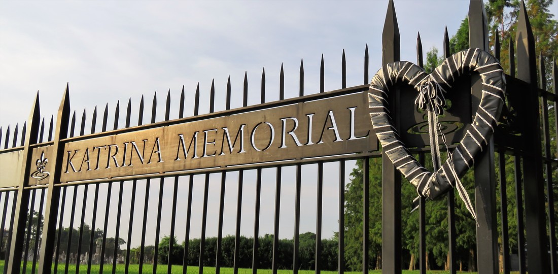 Entrance to the Katrina Memorial after 2017 commemoration. Photo by Emily Ford. The Last Days of the Halfway House The Halfway House, once positioned tranquilly along the New Basin Canal but by 2005 instead wedged beside the Interstate 10 overpass, was also damaged in the storm. Beginning in the 1840s as a place of rest and refreshment for carriages en route to Lake Pontchartrain, later a restaurant and jazz hall, then an ice cream parlor, the building was purchased in the 1950s by Orkin Pest Control Company. Abandoned by Orkin in the mid-1990s, by 2005 the property was derelict, its roof partially collapsed. The Halfway House was the property of the Firemen’s Charitable and Benevolent Association, held by a long-term lease by the city of New Orleans. After Hurricane Katrina, plans were set in motion to convert the adjoining property – once Albert Weiblen’s marble shop – into the new 911 Communications Center for the city. It looked as if the Halfway House would be demolished to make way for a parking lot. Even before 2005, an organization called the Jazz Restoration Society worked with the FCBA and City to secure ownership of the Halfway House, with the goal of restoring it to a restaurant and music hall. Years of infighting, pushing and pulling, and negotiations in the city finally ended in 2009, when the building was declared a landmark and the Society was given permission to step in. But, much like the land deal between the City and Odd Fellows Rest, another shoe had to drop. When an environmental assessment was conducted at the Halfway House, soil tests found that forty years of pesticide storage and disposal left the property unsalvageable by even the best intentions. Despite years of fighting to save the Halfway House, it was demolished in 2010. 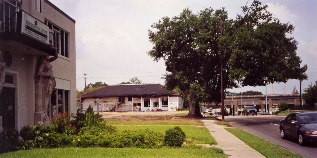 2002 image of old Weiblen shop (at left) and Halfway House after a fire. Photo by Infrogmation. Conclusion As of this writing, the current road construction project at the intersection of Canal Street and City Park Avenue is on-schedule and should be finished in one week. Streetcar lines are laid, sweeping across City Park Avenue and onto Canal Boulevard. Archaeological assessments and relocation of remains from the cemetery beneath Canal Boulevard have taken place. Soon, the intersection will assume its most recent form, in a place that has held so many forms for one hundred and eighty years. In this series, we have seen this place conform to cultural changes, urban expansion, technological innovation, war, and peace. It is a testament to how imperceptibly dynamic New Orleans cemeteries are – that we can walk through them and feel tranquility and stillness, when in reality they’re shifting, conforming, losing and gaining things that will be held precious by future generations. And there’s even so much we’ve left out! Left out was the Perseverance Lodge No. 13 society tomb in Cypress Grove, hit by lightning twice in the late twentieth century and recently reconstructed by FCBA. Left out was the flower shop on Canal Street beside Cypress Grove, once a hub for chrysanthemums and roses shuttled off to the cemeteries, by the 1990s derelict, and demolished in 2016. The merger of Stewart Enterprises, Inc. with Service Corporation International in 2014 merits its own thousand words on the industrialization of funeral and cemetery industries. Uncountable changes have taken place in this tiny colony of cities of the dead. This retrospect, more than anything, then, has been an overture to recognizing how very important those aspects of our cemeteries which have survived all of this. From Cypress Grove to Chevra Thilim Memorial Park, from Lake Lawn Park Mausoleum to Holt Cemetery, it is impossible to appreciate these relics too much. 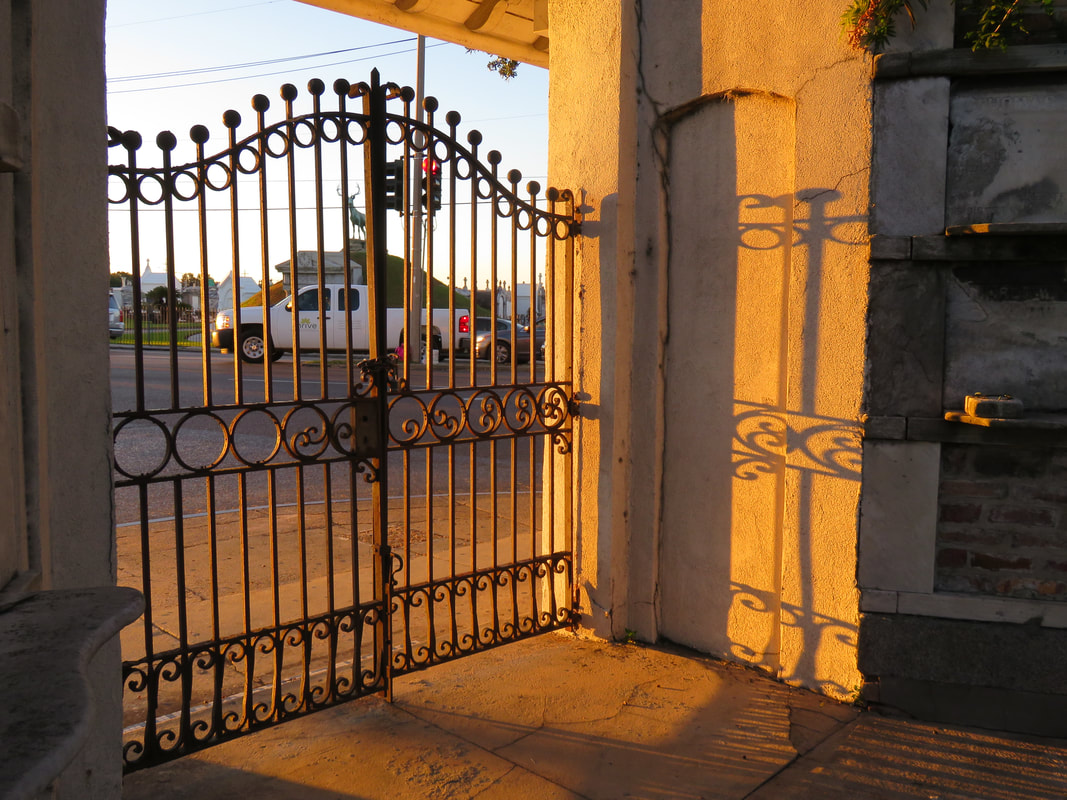 A truck stops at the intersection of City Park Avenue and Canal Street, viewed through the entrance gate to Odd Fellows Rest. Photo by Emily Ford. [1] Samuel Charters, A Trumpet Around the Corner: The Story of New Orleans Jazz (Oxford: University Press of Mississippi, 2008), 257.
[2] Jerry Strahan, Andrew Jackson Higgins and the Boats that Won World War II (Baton Rouge: LSU Press, 1994), 49-50. [3] Ibid. [4] “For Sale: Two of the Modern Higgins Industrial Plants and Clinic in New Orleans,” Times-Picayune, November 19, 1945, 17. [5] Times-Picayune, April 11, 19; Times-Picayune, October 6, 1959, 27; Times-Picayune, April 5, 1964, 71; Times-Picayune, February 10, 1964, 45. [6] “Higgins Shipyard,” Times-Picayune, August 12, 1972, 44. [7] “Congratulations Delgado,” Times-Picayune, March 4, 1982, 19. [8] “The Modern Way of Burial” was Hope Mausoleum’s official slogan from the 1930s through the 1950s. For example, “Hope Mausoleum,” Times-Picayune, May 2, 1935, 2; and “Hope Mausoleum,” Times-Picayune, January 26, 1958, 2. [9] Jessica Mitford, The American Way of Death (New York: Simon & Schuster, 1963), 20-21. [10] “Lake Lawn Park Mausoleum,” Times-Picayune, October 3, 1954, 15; “Lake Lawn Park and Mausoleum – A Report on Progress,” Times-Picayune, October 30, 1951, 10. [11] Henri A. Gandolfo, Metairie Cemetery: An Historical Memoir (New Orleans: Stewart Enterprises, Inc., 1981), 108. [12] “Details on Switch of Morrison’s Burial Site Revealed,” Times-Picayune, May 5, 1966. [13] “End to Canal ‘Dog-Leg’ Urged,” Times-Picayune, August 11, 1963, 1. I would like to recognize and thank Michael Duplantier for sharing resources and information contained in the (sort of) Battle for Odd Fellows Rest section. [14] Ibid. [15] “Odd Fellows Cemetery,” Times-Picayune, December 26, 1950, 41. [16] Soards’ New Orleans City Directory for 1935, Vol. LXI (New Orleans: Soards Directory Co., Ltd., Publishers, 1935), 1171; Polk’s New Orleans City Directory 1938 (New Orleans: R.L. Polk & Co., 1938), 933; Polk’s New Orleans City Directory 1949 (New Orleans: R.L. Polk & Co., 1949), 1209. [17] “Business, Civic Leader Expires: Rodehorst Rites will be Held Today,” Times-Picayune, September 16, 1958. [18] “Accord on Canal Street ‘Dog Leg’ Plans Possible,” Times-Picayune, November 7, 1963, Section 2, 6; “Lodge to Help on Street Link,” Times-Picayune, August 20, 1963, 7. [19] “Cemetery Head Petitions Court,” Times-Picayune, August 1, 1968, 9. [20] “Council Irate at Land Deal: City Officials Criticized for Failure to Buy,” Times-Picayune, June 3, 1964, 1. [21] “Cemetery Head Petitions Court,” Times-Picayune, August 1, 1968, 9. [22] Edward J. Branley, New Orleans: The Canal Streetcar Line (Arcadia Publishing, 2004), 95.  Sunset behind tombs in Greenwood Cemetery. Photo by Emily Ford. This is Part Three in a multi-part blog series examining the landscape history of what is now the intersection of Canal Street and City Park Avenue. From July to November 2017, construction will take place at this intersection to connect the Canal Streetcar to Canal Boulevard. Find Part One here and Part Two here. 1852: Greenwood Cemetery By 1850 the terminus of Canal Street remained mostly undeveloped. On each side of Canal approaching Bayou Metairie were the predominantly belowground Dispersed of Judah, St. Patrick’s, and Charity Hospital Cemeteries, each likely bounded by wooden fences. Improvements like the Halfway House, the Toll House, and the walls of Odd Fellows Rest modestly framed the monumental entryway to Cypress Grove Cemetery. Cypress Grove itself was more than a decade old and flourishing as a garden cemetery full of trees and landscape features – despite a fire in 1848 that destroyed many plantings.[1] The Firemen’s Charitable Association had been quite successful in developing Cypress Grove, so much so that demand for lots overran supply. In 1852, the FCA opened Greenwood Cemetery across Bayou Metairie from both Odd Fellows and Cypress Grove. Its eastern boundary would adjoin Cypress Grove Cemetery No. 2, also known as Charity Hospital No. 2. In some ways, Greenwood Cemetery would be a continuation of Cypress Grove – dedicated to the memorial of fallen firemen and stylistically influenced by Anglo-Protestant aesthetics over those of Creole New Orleaneans. In fact, it’s likely no accident that Greenwood Cemetery shared its name with a famous garden cemetery in New York, founded in 1838. 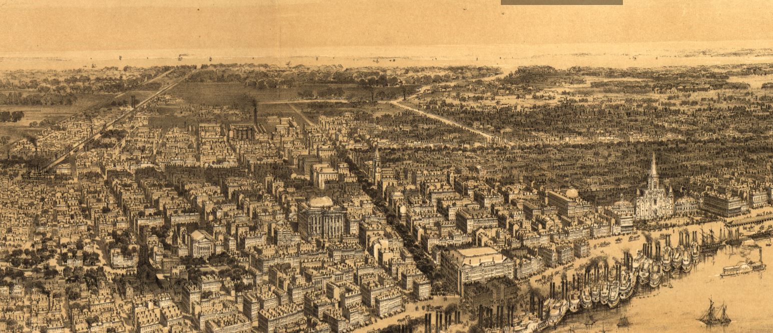 Detail of a 1851 bird's eye drawing of New Orleans by John Bachmann. The tree-lined street at the center of the image is Canal Street. As it extends toward Lake Pontchartrain, the rural character of the cemeteries area is evident. Image via Library of Congress. However, Greenwood would not accommodate the landscape features and lofty architecture so well fostered by Cypress Grove. Instead, the new Firemen’s cemetery would be organized in compact, neat rows that mirrored the kind of order seen in contemporary cemeteries like St. Louis Cemetery No. 3 on Esplanade Avenue (est. 1854). A grand dedication ceremony like those seen at Cypress Grove and Odd Fellows Rest would not be held for Greenwood Cemetery. This may have been the result of an almost immediate cholera and yellow fever epidemic following the cemetery’s opening. The 1853 yellow fever epidemic would kill as many as 12,000 people in New Orleans, quickly making Greenwood a vital burial ground. Unlike Cypress Grove or Odd Fellows Rest, Greenwood Cemetery was not enclosed with a masonry wall, but an iron fence. This left the southern boundary of the cemetery visually open to the bayou that meandered in front of it. The grassy space left room for display of more impressive monuments. Decades would pass, however, before the most iconic monuments of Greenwood would appear. The Confederate monument (1873), Firemen’s monument (1887), and Elk’s Lodge tumulus (1911) did not yet rise above the bayou. Instead, one of the first monuments to be erected in Greenwood Cemetery would be that of two martyred firefighters. On March 16, 1854, Daniel Woodruff and William McLeod responded to a fire on Magazine Street as members of Mississippi Fire Company No. 2. In the blaze, a wall fell upon Daniel Woodruff and he was killed in action. Later, William McLeod died of injuries sustained in the fire.[2]  1854 Woodruff-McLeod tomb, Greenwood Cemetery. Photo by Emily Ford. Exactly one year after the tragic fire, the FCA laid the cornerstone of the fallen men’s memorial tomb. The Firemen traveled to Greenwood Cemetery in a procession to Metairie Ridge where the cornerstone was laid. In Masonic tradition, the architect of the tomb, Sheppard Reynolds, presented the Grand Master of the FCA with a plumb, square, and level with which to test the cornerstone. After it was pronounced level and plumb, the stone was anointed using vessels of corn, wine, and oil. After an oratory, the procession retreated.[3] The Woodruff-McLeod tomb, similar in style but not size to the Teutonia Lodge tomb, was completed by stonecutter and tomb builder Newton Richards (1805 – 1874), who also constructed the Irad Ferry monument. Each arched loggia-like vault memorializes the life and service of Woodruff and McLeod. Yet only one of the two martyrs are actually buried in this tomb. When the time came to re-inter William McLeod in Greenwood his widow objected. His body remained at Girod Street Cemetery. It is unclear where McLeod may have been re-interred after the demolition of Girod Street Cemetery in 1957.[4] 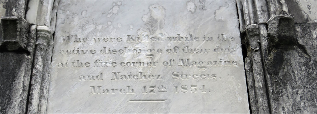 Detail of Woodruff-McLeod epitaph, Greenwood Cemetery. Photo by Emily Ford. Newton Richards had by 1859 constructed the Irad Ferry monument, the Woodruff-McLeod monument, dozens of other tombs in New Orleans cemeteries, and even the granite pedestal atop which the Andrew Jackson statue is mounted in Jackson Square.[5] A man from New Hampshire who specialized in granite monuments, Richards was especially active in the Anglo-Northern associated cemeteries. In 1859, he would once again shape the budding landscape of Greenwood Cemetery by erecting the memorial of former New Orleans mayor Abidel Daily Crossman in Greenwood Cemetery. A.D. Crossman served four consecutive terms as mayor of New Orleans, weathering the city through natural disasters like Sauve’s Crevasse and the 1853 yellow fever epidemic. He oversaw the re-joining of the city from three separate municipalities into one united city government, and local military response to the Mexican-American War. Crossman was from Massachusetts and had long been a friend of the city’s firefighters – serving as a firefighter himself under Eagle Company No. 7.[6] For Crossman, Richards erected a classical Doric column carved of granite and surmounted with an urn. The granite die and stacked bases atop which the column sits are enclosed with cast iron fencing, the corners of which are each topped with cast iron flaming lamps. 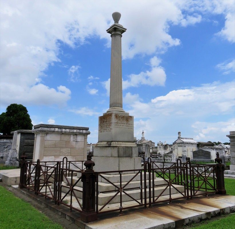 1859 A.D. Crossman monument, erected by Newton Richards. Photo by Emily Ford.
The cemeteries at the end of Canal Street were tied not only by geography but, in some cases, mutual origins and culture, specifically that of Northern-born Americans. For this reason, it is no surprise that stonecutters and tomb builders with similar backgrounds tended to concentrate their work in Cypress Grove, Greenwood, and Odd Fellows. In fact, the first sexton of Greenwood Cemetery, Daniel Merritt, also served as sexton in Odd Fellows Rest. Carved tablets signed by Merritt are found in all three cemeteries.[7] Greenwood Cemetery greeted a peculiar new tomb construction in the 1860s – tombs built of brick and mortar but clad in cast-iron panels. This style was not exclusive to Greenwood (Lafayette Cemetery No. 1 had the Karstendiek tomb by 1866, and Cypress Grove famously houses the Leeds cast-iron tomb), but Greenwood gathered the highest concentration of these unique structures. Four of these tombs (Marks, Enberger, Summers, and Hetion) were identical catalog-order tombs from the ironwork firm of Wood, Miltenberger, and Company, which had a branch in New Orleans. The Edwards tomb, also of cast iron, was a custom construction erected in 1861 across the aisle from the Woodruff and McLeod tomb.  1861 Edwards cast iron tomb in Greenwood Cemetery. Photo by Emily Ford.
1858: Tememe Derech Cemetery Jewish immigration to New Orleans continued through the first half of the nineteenth century. Some Jews emigrated from France, Germany, and the contested territory of Alsace-Lorraine between the two countries. By the 1850s, however, other Jewish people from Eastern Europe began to arrive, fleeing pogroms in their home countries. In 1858, Polish Jews formed the Orthodox congregation of Tememe Derech (“The Right Way”). This congregation was the first Eastern European Jewish congregation to construct a purpose-built synagogue, once on Carondelet Street. Tememe Derech also established its own cemetery across Canal Street from Dispersed of Judah Cemetery, on what is now Botinelli Place.[8] Tememe Derech was not the only Eastern European Jewish congregation in nineteenth century New Orleans. Over time, other congregations formed and merged, and Tememe Derech itself merged with others in 1904 to form Beth Israel Congregation. The new congregation constructed a synagogue on Carondelet Street and designed by Emile Weil. This building is now the New Home Family Worship Center at 1616 Carondelet.[9] 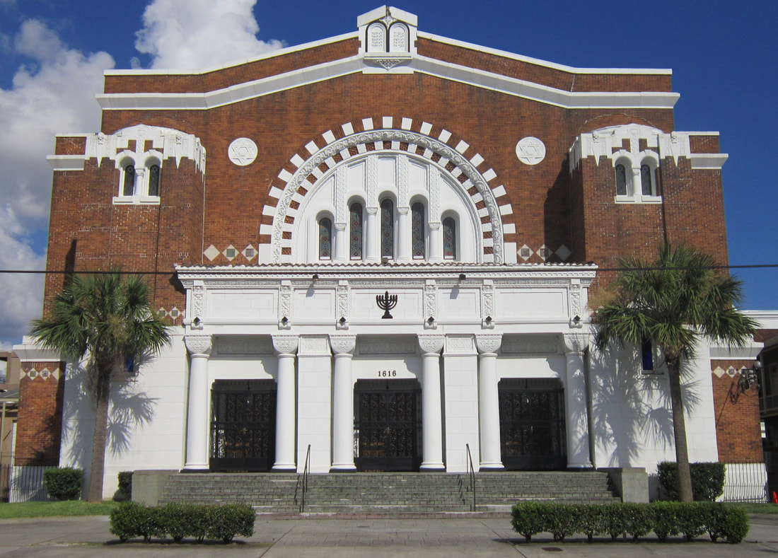 1904 Beth Israel synagogue building, Carondelet Street near Euterpe Street. The building now houses the New Home Family Worship Center. Photo by Emily Ford, 2012. As congregations formed and merged among Eastern European Jews in New Orleans, Tememe Derech’s original cemetery would become the burying ground for other congregations, namely Chevra Thilim and later Beth Israel. In 1916, Beth Israel would construct a Metaher house (a traditional chapel for the cleansing of bodies) at the entrance to the Canal Street cemetery. This structure was demolished in the 1960s.[10] 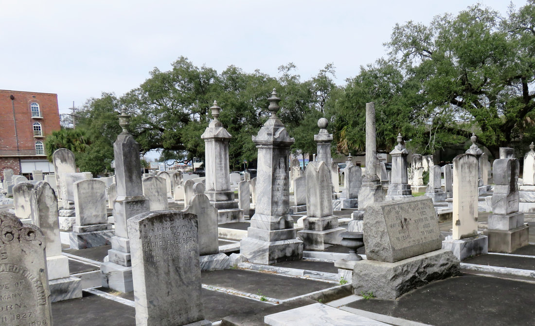 One section of the multi-congregation Jewish Cemetery off of Botinelli Place and Canal Street. Photo by Emily Ford. The 1860s: A Decade of Change With the addition of Greenwood and Tememe Derech Cemeteries in the 1850s, the confluence of Canal Street, New Basin Canal, and Bayou Metairie had six cemeteries within its bounds. In 1854, New Orleans City Park was founded. Larger than New York’s Central Park and home to the largest concentration of old-growth live oak trees in the world, City Park would add to the character of this area as a place of diversion and rural retreat. A portion of Bayou Metairie running through City Park would eventually be closed off to become a park lagoon. Today, this lagoon is the last remaining vestige of Bayou Metairie. 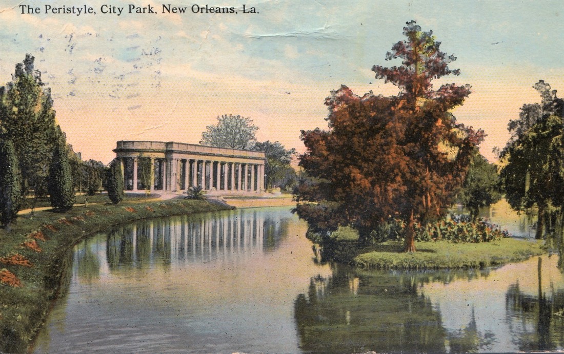 The Peristyle pavilion in New Orleans City Park was constructed in 1907 and overlooks the last vestige of Bayou Metairie. Image via New Orleans City Park. New Orleans as a city was growing in both population and urbanized area. In 1861, the New Orleans City Railroad Company constructed a rail line extending up Canal Street from its foot at the Mississippi River all the way to Bayou Metairie, expanding access and development. The next year, the second fraternal cemetery in the area would arrive when Masonic Cemetery No. 1 and 2 opened at Bienville Street and Bayou Metairie. Despite steady development in the area, it would not escape the humbling effects of natural forces. Metairie Ridge had escaped the flooding of Sauve’s Crevasse in 1849, but would not be so lucky in 1860, when both New Basin and Carondelet Canals overflowed their levies and flooded the area.[11] Another crevasse in 1871 would inundate the cemeteries even more, when the New Basin Canal levy breached at the Halfway House, causing water to flow into the cemeteries.[12] By 1862, additional railroad track was present running alongside Bayou Metairie to the Halfway House. Through the Civil War and into the 1870s, New Orleans’ street grid would encroach toward the cemeteries. Nearby City Park, home to the famous “dueling oaks,” would not be the only venue for such bouts. In 1868, a duel between a Mr. “M” and a Mr. “G” was fought near the Halfway House with swords as the chosen weapon. Although neither man died in the match, neighbors in the vicinity soon afterward requested a police station be placed at the Halfway House – a request that the city council granted.[13] 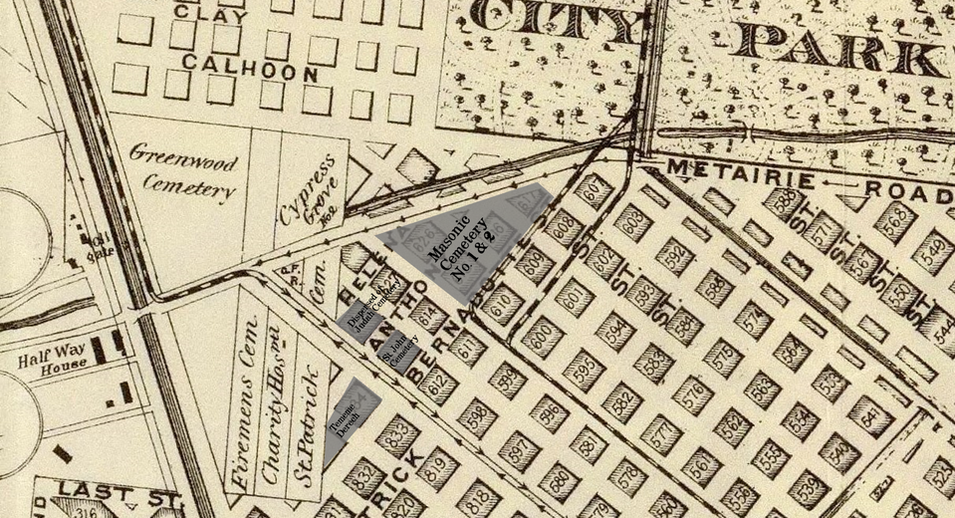 Map showing cemeteries present by 1870. Masonic Cemetery, Dispersed of Judah, St. John's, and Tememe Derech are added. The location of Cypress Grove on this map may not be correct. Image via Wikimedia Commons. 1867: St. John Cemetery Another cemetery would join the landscape of Canal Street in 1867. Founded by German St. John Evangelical Lutheran Church, St. John Cemetery was the second Protestant cemetery in New Orleans (the first was Episcopal Girod Street Cemetery, founded 1822). St. John Cemetery was owned and managed by the church through the nineteenth century and was religiously restricted. Wrote Leonard Victor Huber, who later co-owned the cemetery with his family, under the church’s ownership “secret societies were not allowed to hold ceremonies in it, and Catholic priests were forbidden by their bishops to officiate services in it.”[14] St. John Cemetery was managed by a sexton who lived on the grounds. The small cemetery at Canal and Bernadotte Streets would develop over time into a typical New Orleans cemetery until the 1920s, when circumstances would transform it into a completely different type of cemetery.[15] The Civil War New Orleans was captured by Union forces in late April 1862, early in the Civil War. The American Civil War was also a time in which the culture and practice of death changed nationwide. Soldiers, accustomed to the concept of a “good death” instead died on battlefields, often buried where they fell. In New Orleans, bodies of both Union and Confederate soldiers were received, transported from elsewhere and buried in places like Cypress Grove Cemetery No. 2 and Chalmette Cemetery in St. Bernard Parish. After the Civil War, questions of claiming and memorializing the dead dominated conversation. 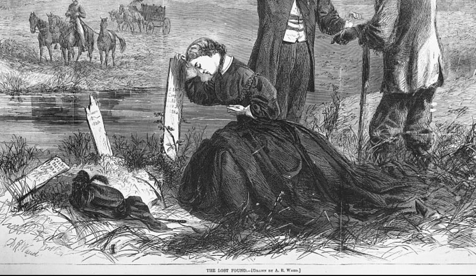 "The Lost Found," Illustration from Harper's Weekly, February 1866, depicting a widow as she discovers the battlefield grave of her husband. Image via Library of Congress. Cypress Grove Cemetery No. 2, also referred to as Charity Hospital Cemetery No. 2, received the remains of both Federal and Confederate soldiers. In the 1870s, when the remains of Confederate soldiers were relocated from Chalmette Cemetery to Greenwood Cemetery, remains from other cemeteries including Cypress Grove No. 2 were reinterred in the same place. This effort was headed by the Ladies Benevolent Association of New Orleans, who erected the Greenwood Confederate monument atop this mass grave of 600 soldiers in 1873. The “Old Soldier’s Home,” established in 1866 by the State of Louisiana for Confederate veterans, also had a society tomb in Greenwood Cemetery by 1868. Remains of Union soldiers were also removed from Cypress Grove No. 2, as well. In the 1920s, as the old potter’s field was beginning to be redeveloped as a road and dumping ground, Federal soldiers were disinterred from Cypress Grove No. 2 and relocated to Chalmette National Cemetery. 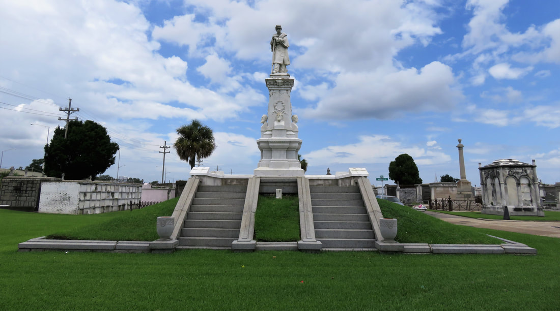 The Greenwood Confederate monument marks the point of relocation for 600 soldiers removed from other cemeteries. Erected in 1873 by the Ladies Benevolent Association. Photo by Emily Ford. On All Saints’ Day, November 1, 1868, New Orleaneans observed the yearly tradition of decorating and visiting graves. The New Orleans Republican offered a glimpse of the Canal Street cemeteries on this day, noting the “noble monuments” of Cypress Grove, and nodding to the society tombs of the Deutscher Louisiana Draymen Verein (now mostly demolished), and the New Orleans Typographical Union in Greenwood Cemetery. Odd Fellows was described as well, “with its specious avenues bordered with trees and lined with the tombs of good and charitable men, is one of the most attractive of the homes of the dead.”[16] 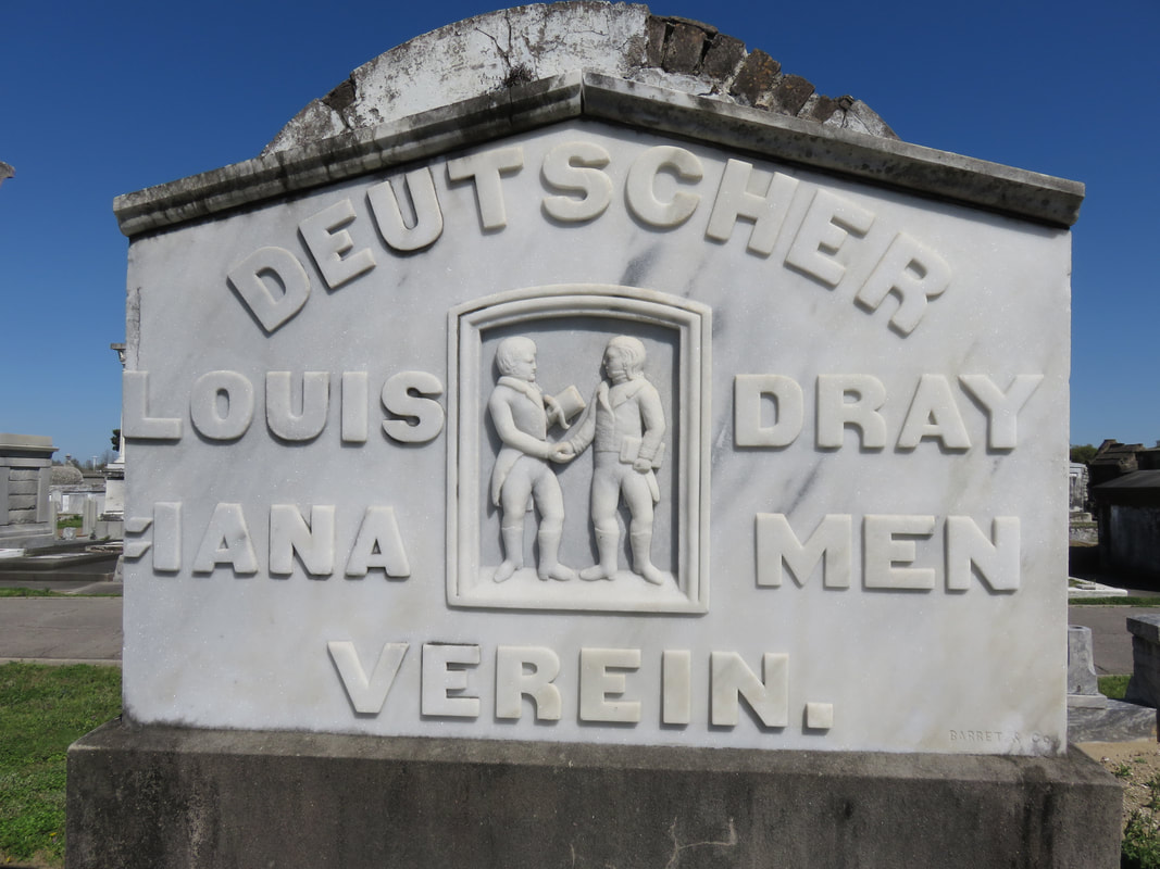 The former society tomb of the Deutscher Louisiana Draymen Verein is mostly demolished, although the tomb pediment stone, carved by Anthony Barret, remains. The rural cemeteries at Canal and City Park Avenue had matured into landscapes of marble, granite, limewash, and green landscaping. Each cemetery enclosed by masonry walls, picket fences, or painted ironwork, they framed canal and bayou as carriages and barges passed through. As much as the landscape had changed over three decades since the New Basin Canal opened, it was about to transform even further with the founding of an entirely new cemetery, the likes of which the city of New Orleans had yet to see.  Modern tombs in Greenwood Cemetery. Photo by Emily Ford. [1] Thomas O’Conner, editor, History of the Fire Department of New Orleans (New Orleans: Thomas O’Conner, 1891), 75.
[2] O’Conner, 84-85. [3] “Woodruff and McLeod Monument,” Daily Picayune, March 18, 1855. [4] Huber et. Al., New Orleans Architecture, Vol. III: The Cemeteries, 39. [5] “Inauguration of the Equestrian Statue of Andrew Jackson,” Daily Picayune, February 9, 1856, 2. [6] O’Connor, 127. [7] “Firemen’s Charitable Association, Cypress Grove and Greenwood Cemeteries,” Daily Picayune, June 17, 1855; “Odd Fellows Rest,” Daily Crescent, January 21, 1862. [8] Catherine C. Kahn and Irwin Lachoff, Images of America: The Jewish Community of New Orleans (Charleston, SC: Arcadia Publishing, 2005), 24; The Goldring/Woldenberg Institute of Southern Jewish Life, “History of Orthodox Congregations in New Orleans.” http://www.msje.org/history/archive/la/HistoryofOrthodoxCongregations.htm [Accessed September 10, 2017] [9] Barry Stiefel and Emily Ford, The Jews of New Orleans and the Mississippi Delta: A History of Life and Community Along the Bayou (Charleston, SC: History Press, 2012), 47, 77-80. [10] Huber et. Al., New Orleans Architecture, Vol. III: The Cemeteries, 22-23. [11] “Overflow of Canals,” Daily Crescent, October 4, 1860, 1. [12] “The Last Great Flood: Rear of the City Submerged,” New Orleans Republican, June 4, 1871, 1. [13] “Dueling,” New Orleans Republican, May 30, 1868, 3; “To the Common Council of the City of New Orleans,” New Orleans Republican, May 31, 1868. [14] Huber, et. Al., New Orleans Architecture, Vol III: The Cemeteries, 47-48. [15] Ibid. [16] “All Saints Day,” New Orleans Republican, November 2, 1868, 1. 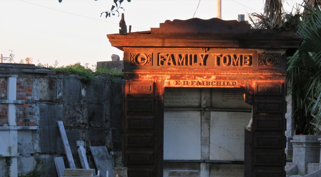 The Fairchild cast iron tomb catches late afternoon sun in Odd Fellows Rest. Photo by Emily Ford. This is Part Two in a multi-part blog series examining the landscape history of what is now the intersection of Canal Street and City Park Avenue. From July to November 2017, construction will take place at this intersection to connect the Canal Streetcar to Canal Boulevard. Find Part One here. 1841: St. Patrick’s Cemetery At the same time that Americans from the northeast were moving en masse to New Orleans, a separate wave of immigration from Ireland made a great impact on the city. Immigrants fleeing famine and political unrest in Ireland came to New Orleans and settled mostly in what is now the Faubourg St. Mary neighborhood of New Orleans, abutting the Central Business District and what is now the Crescent City Connection bridge. These immigrants formed what is now Irish Channel, although the boundaries of this neighborhood have changed over time.[1] The neighborhood formed from settlement patterns dependent on the construction of the New Basin Canal. In 1833, the Parish of St. Patrick was founded to accommodate Irish Catholics in the neighborhood. By 1840, St. Patrick’s Church was constructed on Camp Street.
The St. Patrick Cemeteries, so fresh and clean in their snow-white garb and pebbly walks, always attract attention. Here lie the sturdy Irish pioneers who came to New Orleans in the early part of the last century and helped to make her history the proud tale it is… they breathe throughout the spirit of the Catholic faith. Special attention is directed to the beautiful Calvary shrine at the further end of St. Patrick’s No. 1 and the Mater Dolorosa that marks the entrance to St. Patrick’s No. 2.[3] The Calvary statue was designed by then-prominent monument man Charles A. Orleans, consisting of “a wooden cross twenty feet high with life-sized statues of the crucified Christ, Mary Mother of Jesus, His beloved disciple John, and Mary Magdelene. The statues were cast in Paris.”[4] In 1973, in the midst of trends toward community mausoleums, the Calvary was removed to make way for the Calvary Mausoleum.  Calvary Mausoleum at St. Patrick Cemetery No. 1. Photo by Emily Ford.
1846: Dispersed of Judah Cemetery Along with Americans and Irish immigrants to New Orleans, another group of established immigrants and newcomers found their burial place at the end of Canal Street. Jewish people had long lived in New Orleans in small communities, first of primarily Sephardic Jews (of the Spanish-Portuguese tradition) from the Caribbean and England, then later Ashkenazi Jews from Germany and Alsace-Lorraine. These communities first organized in 1828 to found Gates of Mercy congregation, which had a synagogue on Rampart Street near St. Louis Cemetery No. 1. 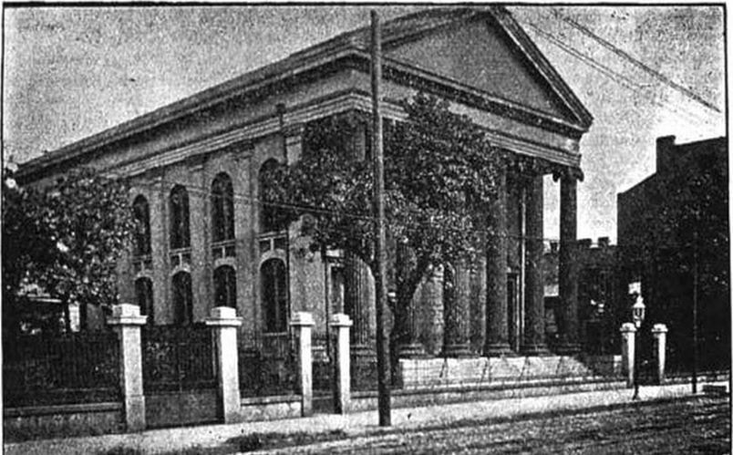 Dispersed of Judah Synagogue, constructed in the late 1840s, once sat at Canal Street and Bourbon Street. Image from 1904, Picayune Guide to New Orleans (Google Books) Gates of Mercy was an Ashkenazi congregation, and Sephardic Jews in New Orleans sought their own place of worship. This hope was fulfilled in 1846 when organizer Gershom Kursheedt helped aging benefactor Judah Touro found congregation Nefuzoth Yehudah (Dispersed of Judah) in 1846. Dispersed of Judah, a Sephardic congregation, was one of many religious organizations to benefit from Judah Touro’s generous will, which also founded Touro Infirmary, later to become Touro Hospital. In 1881, Dispersed of Judah and Gates of Mercy congregations would merge. The new congregation was eventually renamed Touro Synagogue. In the same year Dispersed of Judah congregation was founded, property adjoining St. Patrick Cemetery No. 2 along Canal Street was purchased for a cemetery. Dispersed of Judah was the second Jewish cemetery in New Orleans. Gates of Mercy had established a cemetery on Jackson Avenue near Saratoga Street in 1828, but this cemetery was demolished in 1957, part of a trend that will be discussed in a later part of this series.  View in Dispersed of Judah Cemetery. Photo by Emily Ford. Thus, Dispersed of Judah Cemetery is the oldest surviving Jewish Cemetery in New Orleans. Members of Dispersed of Judah congregation were often tied to English colonial or business interests, arriving in New Orleans from the English-colonized Caribbean or New York. This Anglo-cultural tie, as well as a religious need to bury belowground, allowed Dispersed of Judah to grow into a small version of a northern cemetery. The landscape today retains some elements of this – box tombs and obelisks, trees, and raised monuments. The cemetery is probably best known for the marble monument of Lilla Benjamin Wolf (died 1911), carved into the shape of an empty chair with foot stool. A local story tells the sale of Mrs. Wolf sitting in her chair in life, outside her family’s shop, calling potential customers inside. This may have been a deeply personal choice of monument for the Wolf family, although “the empty chair” was also a common funerary symbol at the turn of the century.
1848: Charity Hospital Cemetery By 1848, Charity Hospital was an institution nearly as old as New Orleans itself. Founded in 1732, the hospital provided care to all patients without regard to race, nationality, religion, or sex. Throughout the nineteenth century, Charity Hospital cared for thousands of newly-arrived immigrants who fell ill after the trans-Atlantic journey, or who were especially susceptible to New Orleans epidemics of yellow fever and cholera.[5] 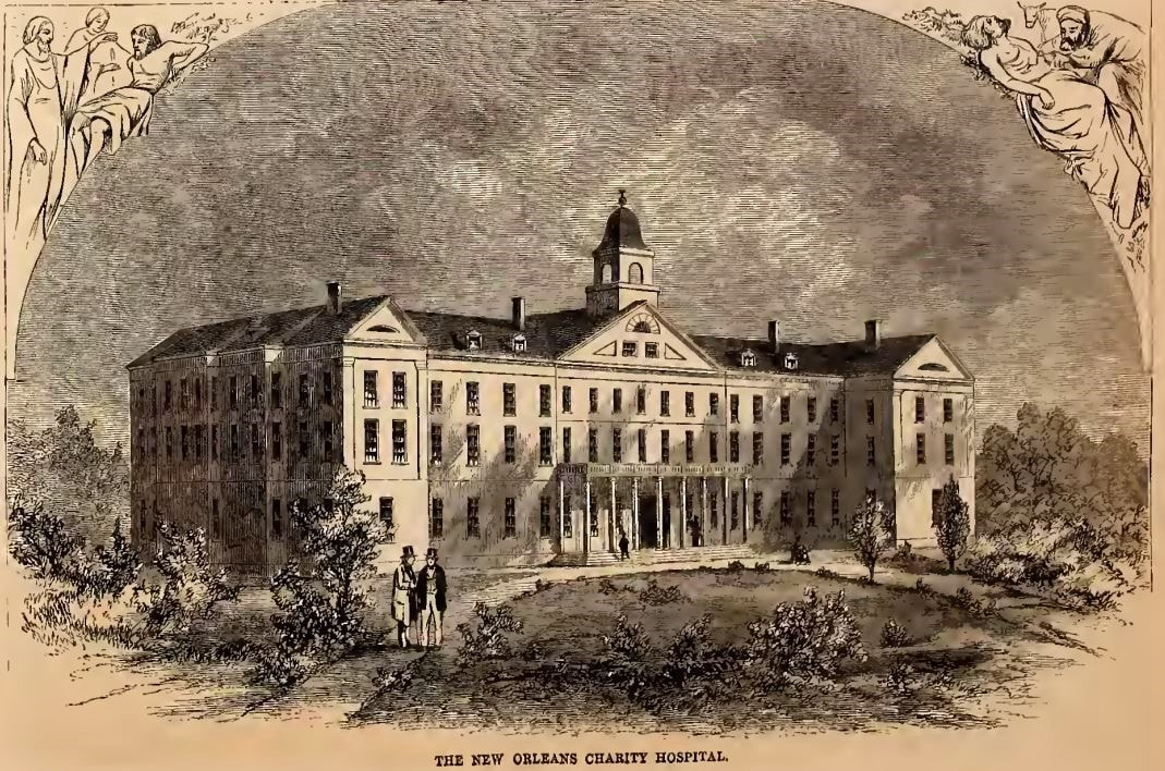 Charity Hospital's fifth building, in use from 1832 to 1939. Located on Common Street between St. Mary and Girod Streets, it was replaced in the 1930s by "Big Charity," a building designed by Weiss, Dreyfus, and Seiferth, who also designed the Louisiana State Capitol at Baton Rouge. Image from Harper's Weekly, September 3, 1859, via archive.org.
The firemen used axes to demolish the fence to save the [adjoining] St. Patrick’s Cemetery property, but nothing could be done to prevent destruction, and, after the flames had consumed the grass, covered the graves under smoldering ashes, with no crosses or headboards to identify the original plots, nothing was left for the friends or relatives of the dead to distinguish one grave from the other.[7] 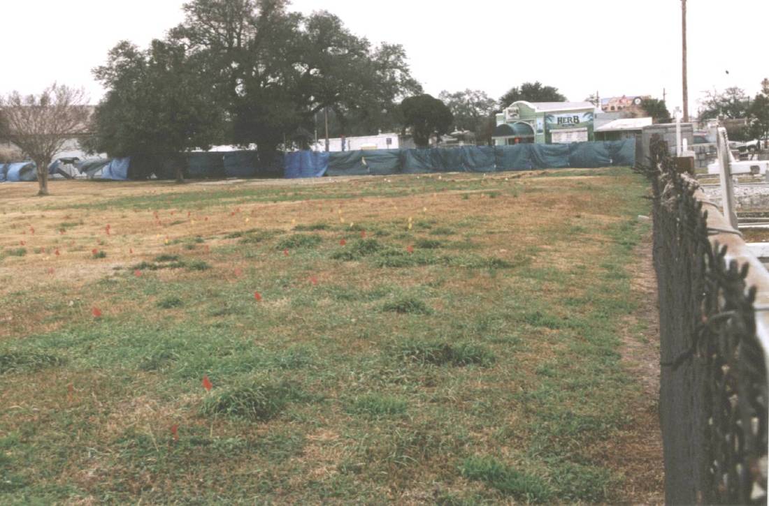 Charity Hospital Cemetery in 2003, looking over the fence from St. Patrick Cemetery No. 2 and toward Canal Street. The flags present on the site suggest that it may have recently been mapped using ground-penetrating radar (GPR) to identify gravesites. Photo by Dale Boudreaux, via usgenwebarchive.com Charity Hospital Cemetery would receive scores of burials each day during successive yellow fever and cholera epidemics. Later, the cemetery would also receive the bodies of those who had donated their remains in death as medical school cadavers. After Hurricane Katrina, the cemetery would be revised into a new kind of memorial. 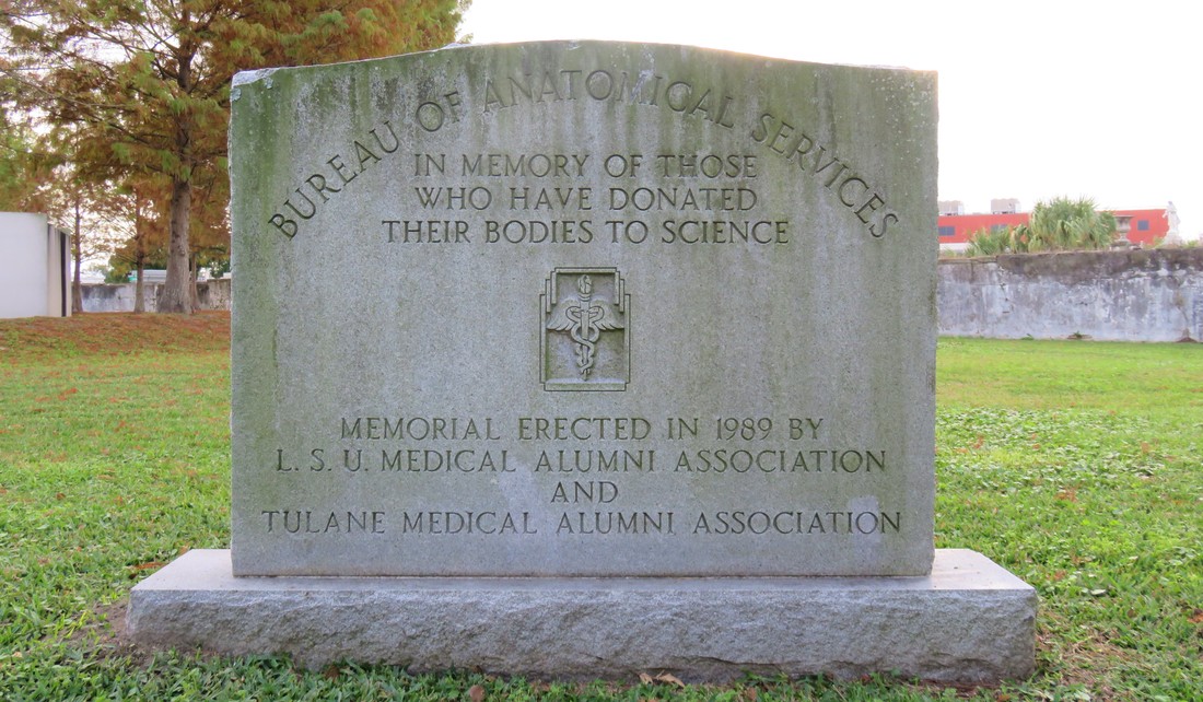 Memorial marker to those who have donated their bodies to science, erected in 1989 at Charity Hospital Cemetery, where medical cadavers were interred. Photo by Emily Ford. 1849: Odd Fellows Rest Charity Hospital was the third cemetery to be established at the end of Canal Street. By that time, the land was still overwhelmingly rural, with few structures save the Halfway House and Toll House along the Shell Road, and the towering Egyptian pillars of Cypress Grove. But around the same time Charity Hospital Cemetery was established, another great landmark was in the works. The Independent Order of Odd Fellows (IOOF), a fraternal organization established in England in the 1700s, had founded a local lodge in New Orleans in 1833. The origins of IOOF’s name seem debated; one explanation has been that the “Odd” designation came from the society’s openness to all members despite trade or occupation. The official IOOF website tells a different story: “…it was odd to find people organized for the purpose of giving aid to those in need.” Indeed, the IOOF’s stated purpose is “Visit the sick, relieve the distressed, bury the dead and educate the orphan.” The Odd Fellows were also known as the “Three Link Fraternity,” a reference to their motto “Friendship, Love, and Truth,” often symbolized by the three-link chain. By 1858, the Grand Lodge of Louisiana had more than twenty subordinate local lodges, including the Crescent, Teutonia, Howard, Magnolia, Covenant, and Polar Star Lodges, all beneath the IOOF Grand Lodge umbrella. In addition to establishing widows’ and orphans’ assistance, and constructing one, and then another imposing Odd Fellows Hall building, the local Odd Fellows sought to establish their own cemetery by the late 1840s. Odd Fellows cemeteries were a national phenomenon in the nineteenth century, and can still be found in places as disparate as New Jersey, Texas, Nebraska, California, and Oregon. New Orleans Odd Fellows sought to do the same.  Odd Fellows Hall, located on Camp Street at Lafayette Square, 1901. This structure would be demolished in 1914 and was replaced with the Fifth District Court Building. Image via Wikimedia Commons. Previous to this time, the land acquired by respective cemetery owners like St. Patrick’s Church, Charity Hospital, and the Firemen had been allotted using lines of property demarcation corresponded to Lake Pontchartrain and not the Mississippi River, leading to the long lots exemplified best by St. Patrick Cemetery No. 1, 2, and 3. These property lines ran across Bayou Metairie at angles, leaving a small triangle of land wedged between St. Patrick Cemetery No. 2, Bayou Metairie, and Canal Street. In 1848, the Grand Lodge of Louisiana IOOF purchased this small triangle of land for use as their cemetery – the first, but not the last fraternal cemetery at the end of Canal Street.[8] 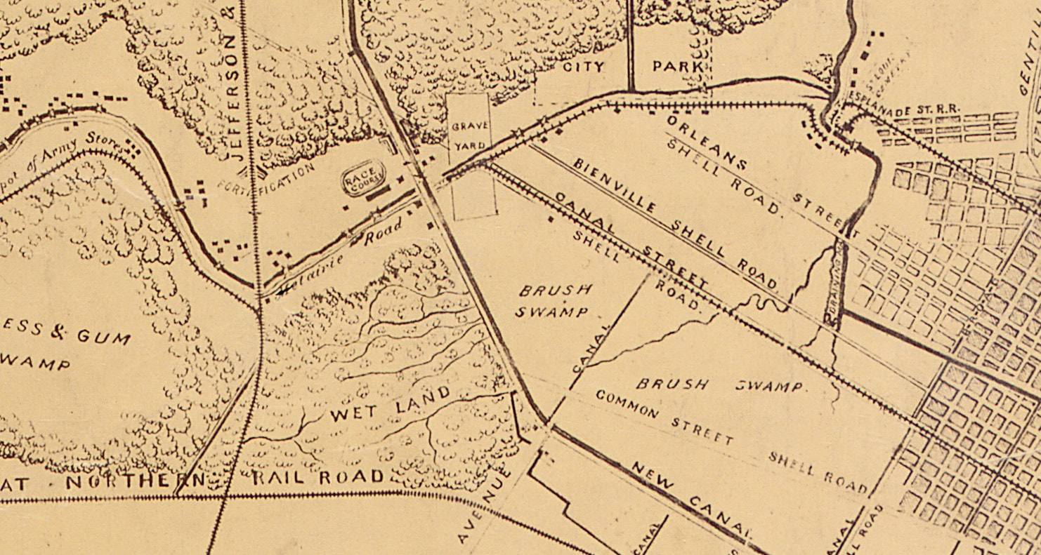 Detail of an 1863 map prepared for Major General N.P. Banks, detailing approaches to New Orleans. The area around the Canal Street Cemeteries, lumped together with the label "Grave Yard" remains remove from the city blocks of New Orleans. Image via Wikimedia Commons. On February 26, 1849, the various Odd Fellows Lodges converged on the Place d’Armes (Jackson Square) to form an “exceedingly beautiful” procession to celebrate the consecration of Odd Fellows Rest.[1] The parade of hundreds was decked in black crape, banners, and emblems of the many symbols recognized by the Odd Fellows. They marched through the French Quarter in a serpentine route, up one street and down another, across Canal Street and through the American Sector (now the Central Business District) where they converged at the New Basin Canal and boarded carriages to proceed up the New Shell Road to the Halfway House.[2] At the Halfway House, the Odd Fellows re-formed their procession, following a carriage drawn by six gray horses and carrying a sarcophagus containing the remains of sixteen Odd Fellows, exhumed from other cemeteries to be re-interred at Odd Fellows Rest. 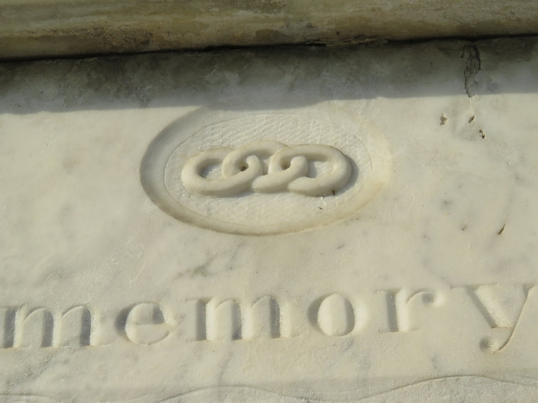 Detail of an 1850s tablet in Odd Fellows Rest, showing the three-link chain symbol. Photo by Emily Ford. The procession entered through the cemetery’s gate, a granite Egyptian Revival post-and-lintel that mirrored in style if not size the grand entrance of Cypress Grove immediately across Canal Street. Once inside, the parade ended at the center of the cemetery, where a tomb had been prepared. Poems were read and oratories recited, and the remains reburied. The entrance to Odd Fellows Rest would remain at the center of its Canal Street boundary for more than fifty years. The granite entryway was enclosed by two cast-iron gates produced in Spain for the Odd Fellows that portrayed dozens of the Order’s symbols: cornucopia, beehives, globes, books, shepherd’s staffs, stars, axes, and a mother protecting four children. The gates were surmounted by finals depicting the sun and moon, and atop all of this was the perennial Odd Fellows Symbol, the heart-in-hand. In the mid-twentieth century, New Orleans photographer Clarence John Laughlin would capture the gates in their historic context, complete with detail and careful multichromatic paints. By the 1970s, much of the original ironwork had been stolen or lost. 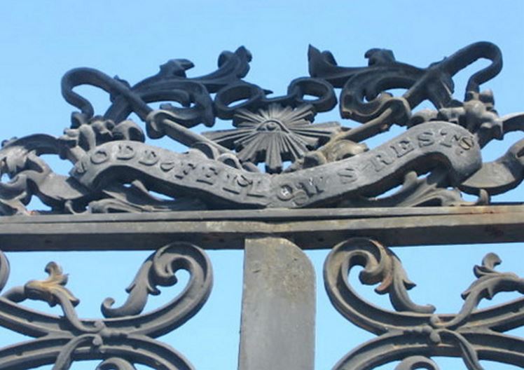 Detail of Odd Fellows gate, October 2004. The left half of this element is now missing. Photo by Flickr user Kristin Lanum.
Within the walls of Odd Fellows Rest, the cemetery would be populated by hundreds of enclosed wall vaults, belowground burials, high-style tombs, and even a tumulus. In the 1850s, local sculptor and stonecutter Anthony Barret (1803 – 1873) constructed a 48-vault society tomb for the Teutonia Lodge of the Grand Order IOOF. The society tomb, later transferred to Southwestern Lodge No. 42, was designed reminiscent of an Italian loggia, with each arched group of vaults framed by inverted torches carved in marble. The Teutonia Lodge tomb was surmounted by marble urns on each corner of its roof. At the primary façade of the tomb was the piece-de-resistance of the structure: a remarkably ornate marble panel carved with dozens of symbols of the Order, each framed with fine scrollwork carved in relief. At the center of the panel, the protecting mother sits nursing a baby and wrapping her cloak around another child. Anthony Barret was well known for his remarkable stonework, carving some of the finest relief sculptures found in the Lafayette Cemeteries and elsewhere. Even still, the Teutonia Lodge tomb is the greatest artistic accomplishment of Barret’s to survive into the present day. 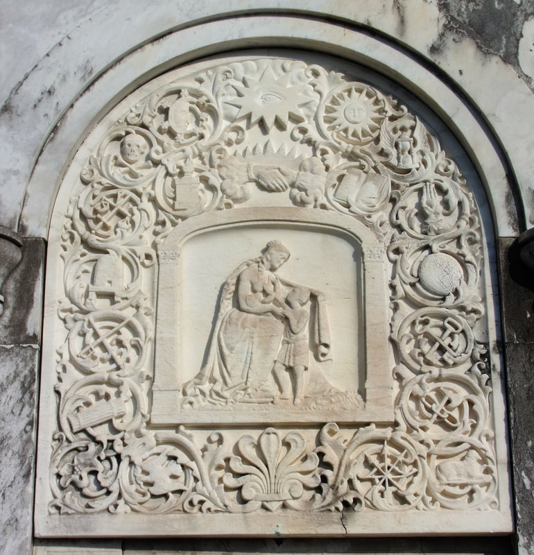 The remarkably detailed marble panel of the Teutonia Lodge society tomb, carved in the 1850s by Anthony Barret. Sixteen symbols relevant to the IOOF surround a mother and child and are surmounted by the clasped hands and all-seeing eye. Photo by Emily Ford. [1] Campanella, Bienville’s Dilemma, 172.
[2] Dell Upton, “The Urban Cemetery and the Urban Community: The Origin of the New Orleans Cemetery,” in Exploring Everyday Landscapes: Perspectives in Vernacular Architecture, ed. Annmarie Adams and Sally McMurry (Knoxville: The University of Tennessee Press, 1997), 132-133, 139-140. [3] The New Orleans Picayune, The Picayune’s Guide to New Orleans (New Orleans: The Picayune, 1904), 152. [4] Leonard Victor Huber, Peggy McDowell, Mary Louise Christovich, New Orleans Architecture, Vol. III: The Cemeteries (Gretna: Pelican Publishing, 2004), 33. [5] John E. Salvaggio, New Orleans’ Charity Hospital: A Story of Physicians, Politics, and Poverty (Baton Rouge: LSU Press, 1992), 35-45. [6] “Second Municipality Council,” Daily Picayune, May 19, 1847, 2. [7] “A Cemetery Blaze: Flames Sweep the Spot where Charity Hospital Dead are Interred,” Times-Picayune, February 27, 1905, 11. [8] An 1833 map of New Orleans from the Mississippi River to Lake Pontchartrain shows the intersection of Bayou Metairie and the New Basin Canal divided into properties belonging to the New Orleans Banking and Canal Company, and illustrates how the property lines correspond with Lake-oriented parcels. A high-resolution of that map is available here. [9] “Consecration of Odd Fellows Rest,” Daily Crescent, February 27, 1849, 1. [10] Ibid. 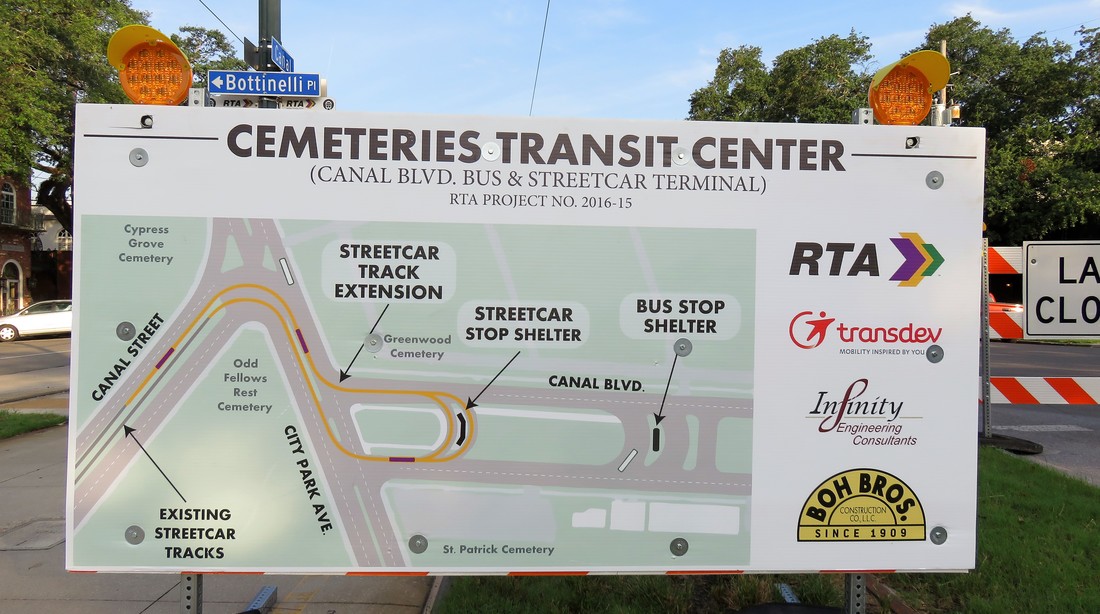 Informational panel posted at Canal Street and Botinelli Place, outlining current construction project. Photo by Emily Ford, Sept. 9, 2017. Beginning July 2017, New Orleans Regional Transit Authority (RTA) and the Federal Highway Administration (FHA) will be executing a significant construction project at the intersections of Canal Street, City Park Avenue, and Canal Boulevard – an area known simply as “the Cemeteries” by streetcar riders and New Orleaneans in general for more than a century. The construction project will extend the Canal Streetcar across City Park Avenue and onto Canal Boulevard in a turnaround that will streamline public transportation (see the diagram above). This is first successful attempt at creating a streetcar turnaround at this intersection, which is notoriously confusing and historically jammed with traffic, owing to an odd dog-leg where Canal Boulevard and Canal Street meet City Park Avenue. Fifty years ago, RTA made a similar attempt to connect Canal Boulevard and Canal Street – although that earlier design necessitated the demolition of Odd Fellows Rest Cemetery. Fortunately for New Orleans cemetery heritage, this plan was scrapped and the cemetery was saved.[1] This tangled intersection of New Orleans thoroughfares, joined with the Pontchartrain Expressway (Interstate 10), is the site of a dozen different New Orleans cemeteries ranging in founding dates from 1840 to 1973, and ranging in background from elite city of the dead to humble potter’s field. The intersection of Canal Street and City Park Avenue is an essential crux of New Orleans history in almost every way. It is a heart of metropolitan development and architectural expression without compare. Over the next month, Oak and Laurel is taking a look at the history of the Canal Street cemeteries and their environs, beginning with the history of the land itself.
Until this time, commercial navigation between the Mississippi River and Lake Pontchartrain utilized Bayou St. John and the Carondelet Canal. The Carondelet Canal was dug in 1794 and extended Bayou St. John to what is now Basin Street – named so for the turning basin located there. The Carondelet or “Old Basin” Canal had disadvantages. Specifically, its age made it less practical, and its location meant its primary beneficiaries were Creoles and other established residents of the former colonial city.[2] Competition between the old French-speaking order and the American interests that populated the city after the Louisiana Purchase motivated investment in a new canal. In 1831, the New Orleans Canal and Banking Company was founded by the Maunsell White and Beverly Chew with the backing of the state of Louisiana. The company was formed with the specific goal of establishing a “canal from some part of the city or suburbs of New Orleans, above Poydras street to the Lake Pontchartrain.”[3] Construction on the New Basin Canal began in 1832, although a terrible cholera epidemic held up its progress that year. 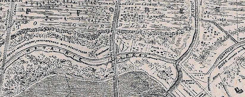 Detail of 1849 Sauve's Crevasse map showing the intersections of Bayou Metairie/Metairie Road, the New Basin Canal, and Bayou St. John. The New Basin Canal intersects Bayou Metairie just to the left of the word "ROAD" above. (Wikimedia Commons) The construction of the New Basin Canal was overwhelmingly fueled by the labor of Irish immigrants. Beginning in the 1830s and intensifying in the next decade, migration from Ireland to New Orleans helped make the Crescent City the second-largest port for immigrants in the country. Newly-arrived Irishmen typically came from agricultural backgrounds and sought manual labor in their new city. Tragically, the enormous labor demand and barbaric conditions of hand-digging the New Basin Canal caused thousands of deaths. Sources refer to daily deaths in the trenches from illness and exhaustion, the fallen laborer buried in the soil along the canal as work progressed. The construction of the New Basin Canal defined the Irish experience in New Orleans.[4] The New Basin Canal began at a turning basin along Triton Walk, approximately the present location of the Union Passenger Terminal in the Central Business District. It extended northwest near what is now Carrollton Avenue and turned more northerly from there, meeting Lake Pontchartrain at what is now West End Boulevard. If this route sounds vaguely like the route of Interstate 10 from the Crescent City Connection to the I-10/610 merge, that’s because the Pontchartrain Expressway very closely replaced the New Basin Canal route in the mid-twentieth century.
While newcomers to the city found in the Shell Road and New Basin Canal a rural retreat possibly reminiscent of home, these same people from the Northeast, from Ireland, from Germany, and elsewhere, found no cemetery in New Orleans that could be so reminiscent. For the next sixty years, these people would shape this area into such cemeteries.[5] 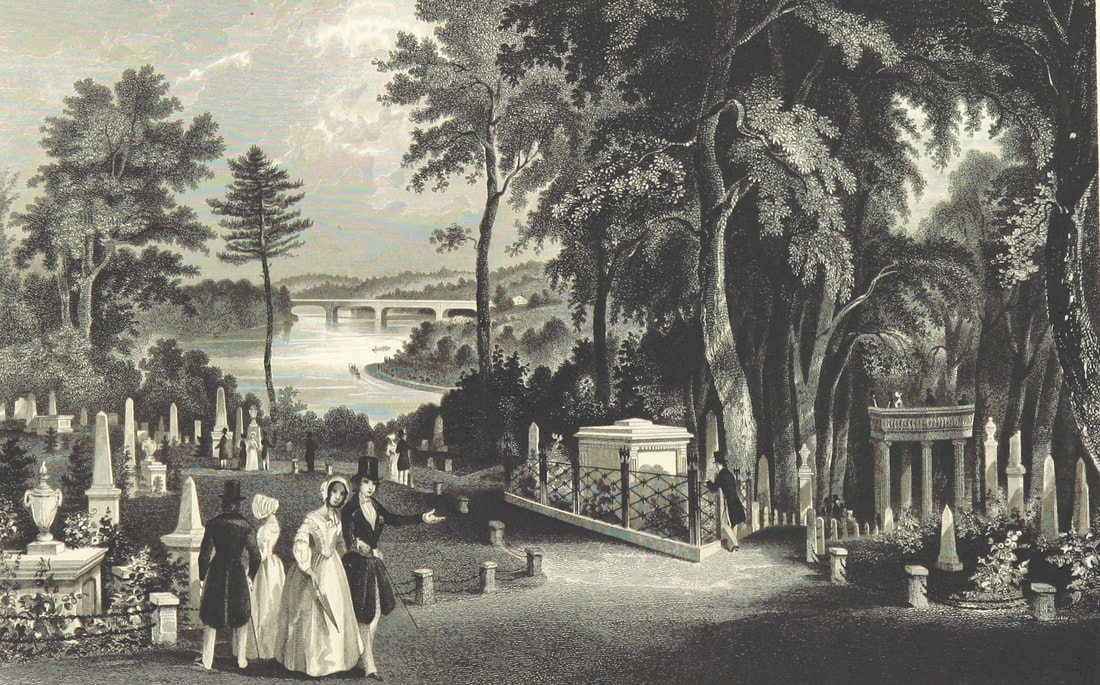 Illustration from "A Guide to Laurel Hill Cemetery, near Philadelphia," published 1844. Rural cemeteries like Laurel Hill (founded 1836) influenced northern transplants in New Orleans. (Wikimedia Commons) 1840: Cypress Grove Cemetery From the time of the Louisiana Purchase through the 1840s, immigrants from all over poured into New Orleans. As they brought their bodies and livelihoods, they brought their culture and traditions. From Creoles of color from San Domingue, New Orleans gained the shotgun house. As for the thousands of immigrants from the Anglo-Protestant North who came to New Orleans, New Orleans gained from them wire-cut Pennsylvania brick, Anglo-American concepts of landscape design, and the idea of the rural garden cemetery. The rural cemetery movement arose in the northeast in part from the contemporary expansion of cities. Advances in industrialization within the urban landscape created in city-dwellers a longing for the countryside. Furthermore, this same industrialization advanced the American middle class in such a way that recreation was newly defined. Inspired by English landscape design, the rural cemetery was the predecessor to the public park – in fact, Central Park landscape architect Frederick Law Olmstead designed one such cemetery in California. This shift in the appearance and purpose of cemeteries coincided with many American cultural movements like Romanticism, the definition of the middle class, and the “beautification of death period.” Northern Americans who moved to New Orleans were inspired by what they saw at Mount Auburn Cemetery in Massachusetts, Laurel Hill Cemetery in Philadelphia, Green-Wood Cemetery in Brooklyn, and many more. These were cemeteries that were designed instead of planned, with undulating pathways that strolled past weeping willows and reflecting pools. This was the rural cemetery movement, a great leap in the history of cemeteries that would change the American perception of death forever. 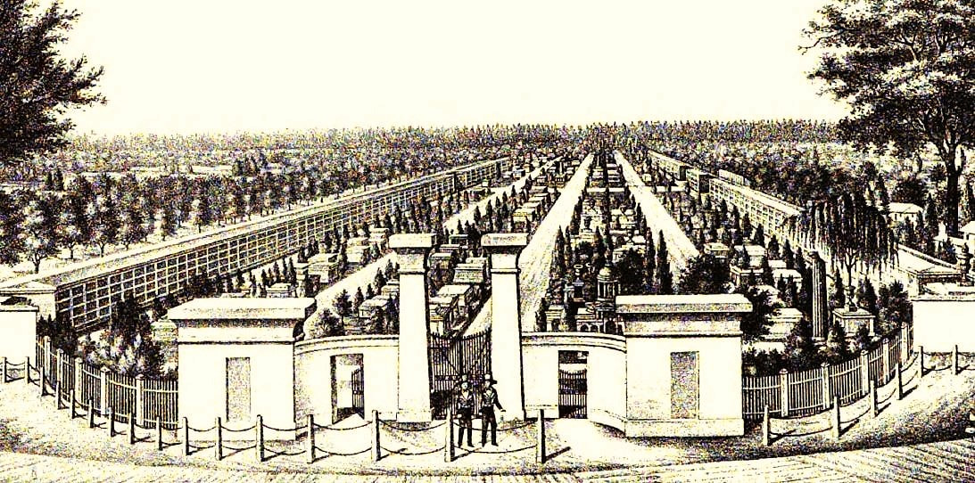 Aerial rendering of Cypress Grove Cemetery, from "History of the Fire Department of New Orleans," edited by Thomas O'Connor, 1895. This contrasted deeply with the Francophile and Creole cemeteries that had developed in New Orleans to this time – densely packed “cities of the dead” with few if any landscape features. St. Louis Cemetery No. 1 was not planned out by lots or aisles and instead haphazardly developed into the necropolis it became. After St. Louis No. 1, Girod Street Cemetery, St. Louis No. 2, and Lafayette Cemetery No. 1 (1822, 1823, and 1833, respectively) were planned into square and aisles, but remained cemeteries set in urban landscapes. The cemeteries at the end of Canal Street would be a departure from this context. On April 25, 1840, the first cemetery at the intersection of Canal Street and Metairie Road was officially opened. Cypress Grove was owned and operated by the Firemen’s Charitable Benevolent Association (FCBA) and, although the cemetery would be open to all burials, it would be dedicated to the memory of New Orleans’ volunteer firemen. The dedication ceremony of Cypress Grove included a march of nearly one thousand firemen, clergy, and prominent citizens marching through downtown New Orleans, each wearing mourning bands and a few carrying urns of the ashes of their martyred comrades. The procession boarded the Nashville railroad at the foot of Canal Street and rode to the end, where the Egyptian Revival columns of Cypress Grove’s entrance would have stood almost completely alone within the undeveloped landscape. Among the martyrs honored that day was Irad Ferry, the “first martyr,” who perished in the line of duty on New Year’s Day 1837. Originally buried in Girod Street Cemetery, Ferry’s remains were relocated to Cypress Grove as the cemetery’s first burial, beneath a marble sarcophagus topped with a broken column which was designed by J.N.B. de Pouilly and constructed by stonecutter Newton Richards. In a nearby tomb constructed for this purpose, the remains of eleven additional firemen were buried.[6]
It would seem almost superfluous to set for the advantages of this rural cemetery. The rapid growth of our city has already encroached upon the tombs of its fathers, and the sacred relics of the dead have been compelled to give way to the cold and selfish policy of speculators, and the intrusion of business; and the solemnity of the grave yard is disturbed by discordant shouts of merriment, and the baleful proximity of the dissolute.[8] (To learn more about Cypress Grove’s history, check out our blog post “Lost Landscapes of Cypress Grove,” Part 1 and Part 2) 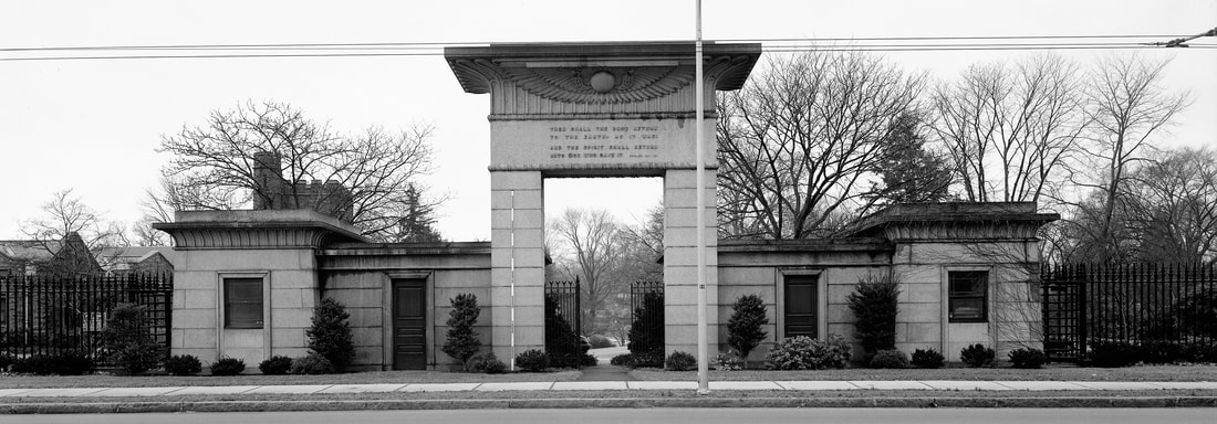 Main gate, Mount Auburn Cemetery, Cambridge, Massachusetts (Wikimedia Commons) 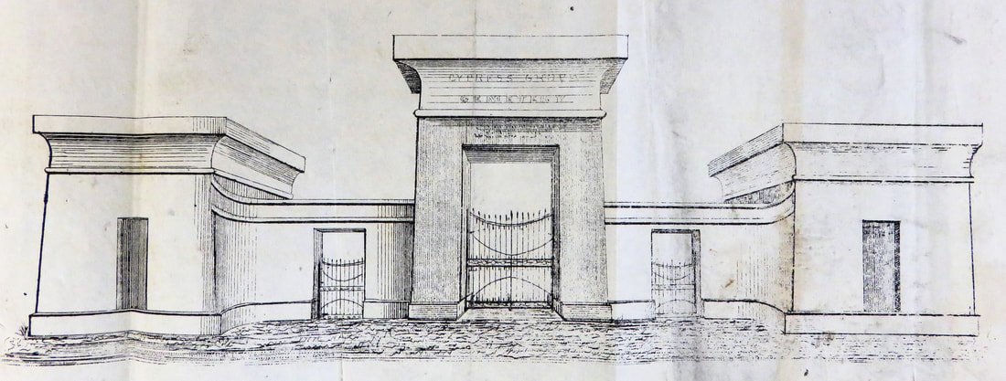 1840 sketch of Cypress Grove Cemetery entrance (Tulane University Louisiana Research Collection) 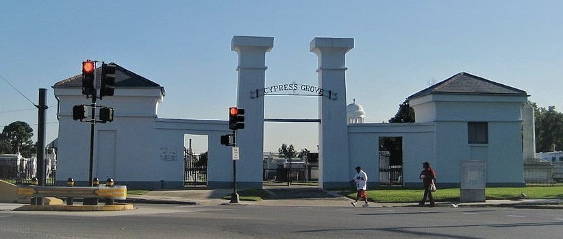 Entrance to Cypress Grove Cemetery, present day. (Wikimedia Commons) Cypress Grove Cemetery No. 2 or Charity Hospital Cemetery No. 2 Cypress Grove Cemetery may have extended across Bayou Metairie and through what is now Canal Boulevard. It is true that a cemetery was once present in this space. However, the cemetery is referred to in records as both “Cypress Grove Cemetery No. 2” and “Charity Hospital Cemetery No. 2.” This potter’s field, which records suggest was dominated only by below-ground burials of the indigent, is referred to in at least one record as belonging to the Firemen’s Benevolent Association, but leased by Charity Hospital for the burial of deceased patients.[9] Over the next century, Cypress Grove No. 2 would accept thousands of indigent burials and become an on-again, off-again bone of contention in this funerary landscape.[10] Next week, we will explore the 1840s as new cemeteries are founded, namely St. Patrick’s, Dispersed of Judah, Charity Hospital Cemetery, and Odd Fellows Rest. 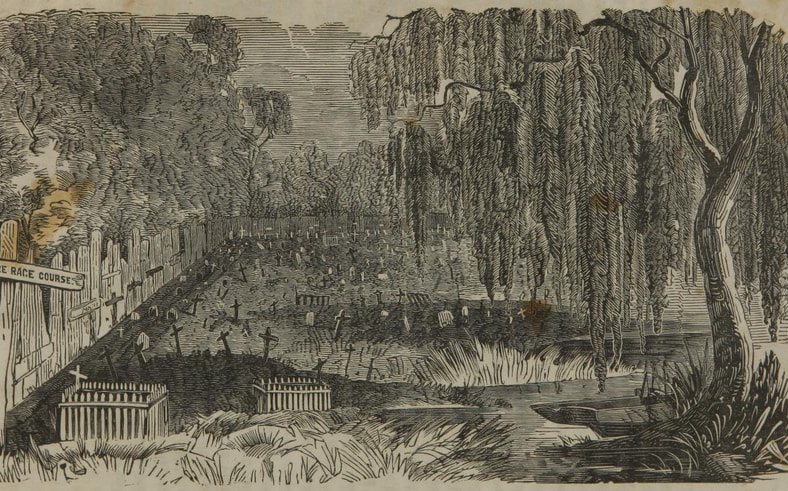 1853 sketch of Cypress Grove Cemetery No. 2, from C.W. Kenworthy, "History of Yellow Fever in New Orleans" (Tulane University Louisiana Research Collection) [1] “End to Canal ‘Dog Leg’ Urged,” Times-Picayune, August 11, 1963, 1; “Planners Revive Canal St. Cut-off,” Times-Picayune, August 12, 1963, 17; “Council Irate at Land Deal: City Officials Criticized for Failure to Buy,” Times-Picayune, July 3, 1964; “City Abandons Cemetery Suit,” Times-Picayune, December 12, 1972, 9.
[2] Richard Campanella, Bienville’s Dilemma: A Historical Geography of New Orleans (Lafayette, LA: Center for Louisiana Studies, 2008), 30, 135. [3] T.P. Thompson, “Early Financing in New Orleans: Being the Story of the Canal Bank, 1831-1915,” Publications of the Louisiana Historical Society, Vol. VII (1913-1914), 24. [4] Laura D. Kelley, The Irish in New Orleans (Lafayette: University of Louisiana at Lafayette Press, 2014), 32-36. [5] Dell Upton, “The Urban Cemetery and the Urban Community: The Origin of the New Orleans Cemetery,” in Exploring Everyday Landscapes: Perspectives in Vernacular Architecture, ed. Annmarie Adams and Sally McMurry (Knoxville: The University of Tennessee Press, 1997), 132-133, 139-140; David Charles Sloane, The Last Great Necessity: Cemeteries in American History (Baltimore and London: Johns Hopkins University Press, 1991), 44-46. [6] Thomas O’Connor, ed. History of the Fire Department of New Orleans (New Orleans: FMBA, 1890), 70-71. [7] “Firemen’s Celebration in New Orleans,” Galveston Daily News, March 6, 1869, 1. [8] Firemen’s Charitable Association, Report of the Committee of the Firemen’s Charitable Association, on the Cypress Grove Cemetery (New Orleans: McKean, 1840), 4. [9] Henry Rightor, Standard History of New Orleans, Louisiana (New Orleans: Lewis Publishing Company, 1900), 265. Rightor’s 1900 history refers to this cemetery as Charity Hospital No. 2. [10] Peter Dedek, The Cemeteries of New Orleans: A Cultural History (Baton Rouge: Louisiana State University Press, 2017), 61, 77.  The rear of St. Louis Cathedral at night, with the top of the Tonnerre obelisk and the shadow of the Sacred Heart of Jesus. Flickr User Karen Vale. New Orleans is home to dozens of cemeteries, each with its own character and history. Among these many burial and interment grounds are the influences of world cultures, human expressions of grief, and iterations of architecture that, in one way or another, are recognized as significant on small and large scales. Some are more appreciated than others. Some have been lost entirely from the landscape, such as St. Peter Street Cemetery, Girod Street Cemetery, or Gates of Prayer Cemetery on Jackson Avenue. Yet among these recognized and unrecognized burial grounds, there is one nearly always omitted, even though people walk by it and photograph it every day. Tucked behind St. Louis Cathedral and often overshadowed by the looming statue of the Sacred Heart of Jesus, is the final resting place of nineteen French navy men who died in 1857 and were re-interred at this place in 1914.
In the years following this harrowing incident, the surviving crew of the Tonnerre and their families in France, as well as French naval authorities, sought to memorialize the lost sailors. A monument was erected in the Quarantine Station cemetery in August 1859. The marble obelisk would not be seen for long, however. The Quarantine Station was soon relocated, with the former site abandoned. The monument would not be rediscovered until 1914, when Andre Lafargue endeavored to reclaim it.[3] The tale of the Tonnerre, its crew, and its monument, highlights so many historical aspects of the mid-nineteenth Caribbean and Atlantic world. It is a story of memorialization and reclamation, of the interactions between cultures and nations, and of the management of public health in this time. In this post, we seek to unpack some of these curious aspects of the monument that rises so subtly from behind St. Louis Cathedral. 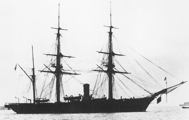 The French steam corvette Dupleix, a similar ship to the Tonnerre, active 1856-1887. Wikimedia Commons. The Ship Tonnerre The Tonnerre is referred to in historical documents as both a corvette and an aviso or “advice ship.” While there appears to be some distinction between the two (and we don’t presume to call ourselves naval historians) – for example, avisos are customarily smaller than corvettes – documents consistently refer to the Tonnerre as a ship assigned the duty of relaying messages between larger naval commands. The four-gun Tonnerre was a steam-powered vessel, propelled by a paddle, and was inducted into service by the French Navy at Indret in 1838.[4] By 1850, the French Navy had about a dozen such first class “advice boats,” including five constructed of iron (Le Mouette, Le Heron, Le Eclaireur, Le Requin, and L’Epervier), although the Tonnerre was not constructed of iron. By 1857, the Tonnerre and its crew had already completed service in the Crimean War (1853-1856) in which an alliance of European powers fought Russia for influence over the Black Sea and Middle Eastern. Lieutenant Clement Maudet, who came to command the Tonnerre, fought with the French Foreign Legion in Crimea, earning a medal for his bravery. Many of the other sailors aboard the Tonnerre served in this conflict before being dispatched to the Caribbean. The presence of the Tonnerre in the Caribbean also highlights the colonial and military interactions in the Caribbean and Atlantic world at the time. The Tonnerre was charged with relaying messages between Vera Cruz and Havana (a role the ship would serve through the late 1850s).[5] The ship’s mission likely related to French economic and political interests in Mexico, which Emperor Napoleon III viewed as critical to Latin American trade access. French intervention would escalate to full on invasion in 1861, and later the unsuccessful installation of Hapsburg emperor Maximilian I. It was in this conflict in 1863, that Lieutenant Clement Maudet would die of wounds acquired in the Battle of Camerone.[6] The Tonnerre was the fifth ship of the French navy to bear this name. The first French Naval Tonnerre was the British HMS Thunder, captured in 1696. The Tonnerre under Maudet’s command in 1857 was retired in 1878. The French Navy currently operates the eighth Tonnerre, placed into active service in 2006. 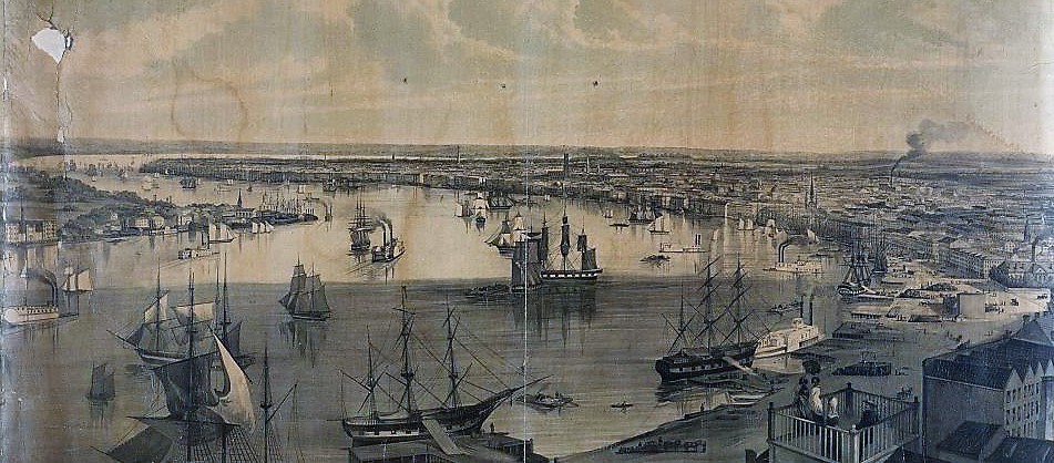 D.M. Moody, "New Orleans from the lower cotton press," 1852. Library of Congress. The Crew The Tonnerre had an original crew of eighty sailors, including a doctor (who died of yellow fever at the Quarantine Station), sailors, ensigns, stokers (steam engine operators), chefs, and mates. Eighty of whom contracted yellow fever either in Mexico, Louisiana, or Cuba. Thirty of these seamen died. Two of the chefs aboard the Tonnerre who perished in 1857 appear to have been of Italian descent: Giovanni Carletto and Jean Janotti. Ages of the men who died aboard the Tonnerre are not listed.
In 1853, for example, the fever was presumed to be caused by “miasmas” or “bad air” (a theory derived from Enlightenment thought), and thus the City burned torches of pitch and discharged cannons in order to disperse airborne maladies. By the 1850s, the Sanitarian movement had begun to marginally influence public health, focusing on cleanliness of public spaces and the removal of fetid water. Quarantine Stations were present in most eastern seaboard cities by the early 1800s. In New Orleans, the necessity of such stations was frequently debated and they were often decommissioned. In many cases, New Orleans merchants were staunch opponents of quarantine. Such systems, they said, disrupted commerce and were thus unacceptable. Their arguments appeared validated when, on occasion, epidemics broke out despite the presence of quarantine stations – likely due to the yellow fever mosquito (Aedes aegypti)’s fondness for sheltering in ship cargo holds. Incidentally, however, 1857 was not a significant epidemic year for New Orleans. As the Tonnerre had no intention of docking in the City en route to Havana, the condition of this one ship’s crew posed little danger of epidemic to the Crescent City.
The Quarantine Station would be abandoned after the 1860s, after the US Government established an additional Quarantine Station at Ship Island, Mississippi. In 1880, the Louisiana Board of Health reported on the condition of the Ostrica-area Station, the grounds “open and roamed over by cattle.[10]” It described a complex of several buildings: a fever hospital, a pox hospital, a medical residence, a boatmen’s quarters, and a warehouse. Said the board of the process of disinfection at the hospitals: The process of disinfection now employed consists of burning sulphur in iron pots. These pots are placed in tubs containing water. This method is liable to the grave objection that there is, in many cases, and especially during rough weather, danger of firing the ship.[11] In this report, the Board of Health appears to be investigating the feasibility of placing the Station back into service, although no evidence suggests this happened. However, the report documented the enduring presence of the Tonnerre monument: The graveyard of the Quarantine Station is located about 200 feet to the rear of the Fever Hospital, and is surrounded by a rude fence and covers about three-fourths of an acre. Marks of about one-hundred graves can be discerned by the inclosure [sic], which are thickly covered with tall grass, brambles, and shrubs. There is only a solitary marble monument, which bears the following inscription: "A la mémoire de Trente Marins, faisant partie de l'équipage de l'avito vaisseau de la Marine Imperiale le Tonnerre, décède à la Quarantaine de la Nouvelle Orléans en Août, 1857. Erige par l'Odre de S.E. L'amiral Hamelin, ministre de la Marine de l'Empereur Napoléon III.”[12] 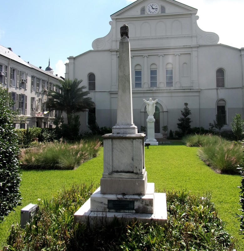 Tonnerre monument in St. Louis Cathedral garden, 2015. Photo by Emily Ford. The Monument Thanks to donations from the families of surviving Tonnerre crewmen, a marble monument was installed at the Quarantine Station in 1859. Unfortunately, the craftsperson that designed and built it is unknown. Photos from the monument’s recovery indicate that it was originally a marble-clad box tomb, with fluted corner pieces and a marble slab atop which the monument’s obelisk and urn were fixed. This style of memorial was typical of 1850s high-style cemetery architecture in both New Orleans and France. Derived from sarcophagus designs, similar monuments can be found in the cemeteries of Montparnasse (France) and St. Louis Cemetery No. 2, although less modified versions are visible in the upriver parishes. The Tonnerre monument was described intact by the Louisiana Board of Health in 1880, even though the Quarantine Station cemetery had become derelict. Andre Lafargue shares a similar recollection from his youth, seeing the monument ascending from the brush as he traveled the river. Lafargue notes that at some time between 1880 and 1914 the obelisk fell in a hurricane.[13] The Quarantine Station long abandoned, without intervention the Tonnerre monument would have sunken beneath overgrowth and debris. 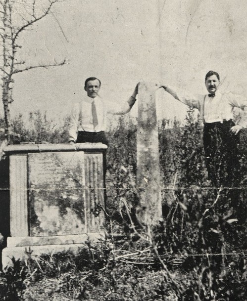 French vice-consul Andre Lacaze and Andre Lafargue after discovering the remains of the Tonnerre monument, 1914. Tulane Louisiana Research Collection. Yet in 1914, Andre Lafargue, who at that time served as the attorney for the Comité du Souvenir Francais, came across in the French Society records documentation of the Tonnerre monument. In an effort that proved fruitful if not also tremendous and risky, Lafargue chartered a boat from Buras to Ostrica, bringing with him the vice French consul general at the time, Andre Lacaze, and their wives.[14] Trudging through the brush with only a vague recollection of where the cemetery and Quarantine Station once stood, the party discovered the remains of the monument: We finally came to a spot, near a tree of greater dimensions than the others, and there found traces of former habitations, and all of a sudden our feet struck a pile of bricks and pieces of marble and we knew, after examination of the fragments, that we had finally found the spot where the cemetery stood long years before and where the monument had been built. The ladies, highly elated by the discovery, were very helpful in picking up various pieces of the pedestal and we finally located the obelisk, the main section of the most important part of the monument, and the gracefully draped urn. The urn had been wrenched from the top of the obelisk and the latter had broken into two pieces in its fall to the ground, after the pedestal and the foundation had been undermined by the elements and the rough usage of time.[15] 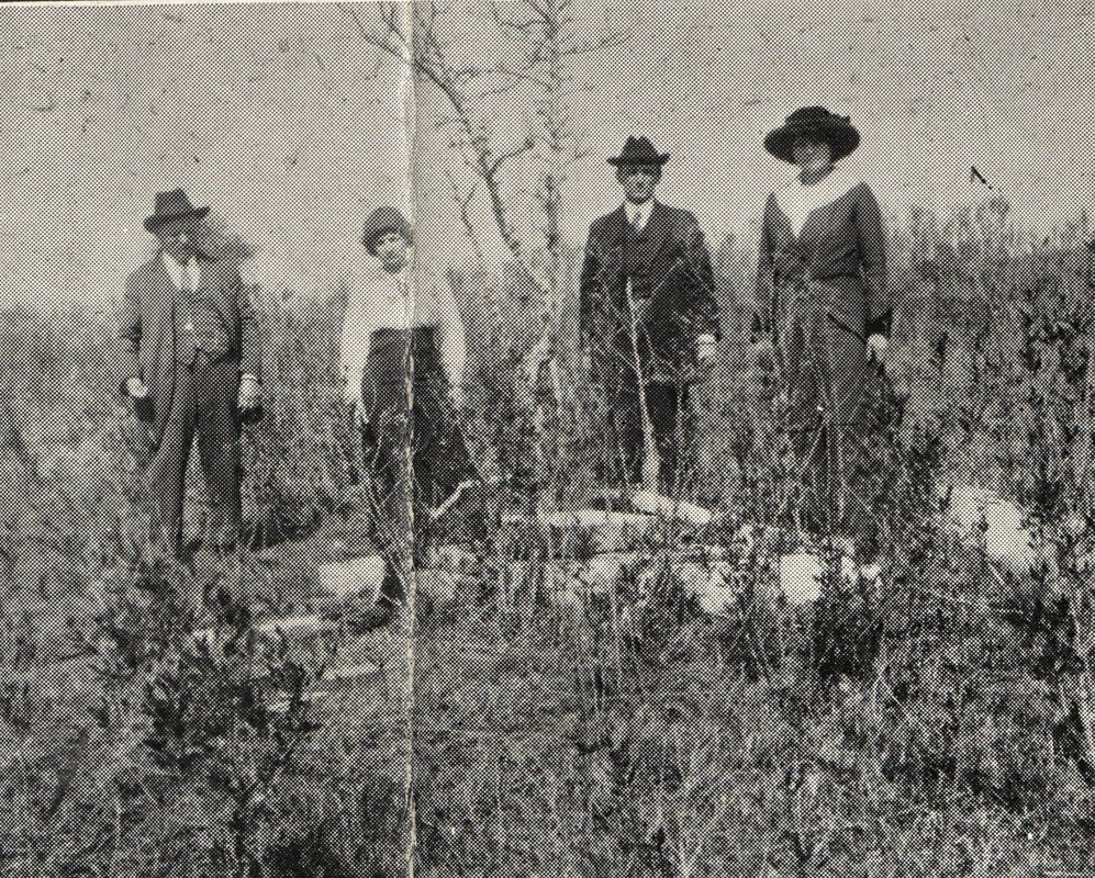 Recovery party posing with the remains of the Tonnerre monument at the ruins of the Quarantine Station, 1914. Tulane Louisiana Research Collection. Over the course of subsequent trips to the site and through partnerships with groups like the Societe de Bienfaisance et d’Assistance Mutuelle, the monument was packed away and sent upriver to New Orleans. Despite the contestations of local undertakers that recovery of the remains of the 19 seamen who died at the Quarantine Station would be impossible, Lafargue and his crew set out to disinter each one. Each body was laid beneath the flag of France during disinterment, then shrouded and placed together in a metallic casket, where a single French flag was draped across them. In an additional gesture of reverence, the party uprooted a small tree from the cemetery and placed it in the coffin with the remains, to be re-planted at the new monument site.[16] The monument was reconstructed by New Orleans stonecutter and tomb builder Albert Weiblen. Weiblen built a burial vault atop which the monument would sit and bordered with a Georgia Creole marble coping wall. This vault forms a tumulus structure and simultaneously elevates the monument. Weiblen’s skill in reconstructing the monument is remarkably evident: it is difficult to determine which elements of the monument are replacements and which are original. But some clues are visible: one inscribed tablet is of a slightly different type of marble, and is inscribed with a pneumatic tool, whereas the other inscribed faces of the pedestal have smaller, hand-carved lettering. It appears as if the monument itself may have been slightly downsized, it’s dimensions shaved away to remove damaged or unsalvageable elements. A small bronze plaque was installed at the front of the coping by De Lucas Monument Company at the cost of $13.[17] Since its rededication, the Tonnerre monument has survived a few more hurricanes, and an instance in the 1930s in which an inebriated driver crashed through the gates of the Cathedral garden and toppled the obelisk. But for the most part the monument (and the remains therein) have known peaceful repose, quietly situated between St. Louis Cathedral and Royal Street, so often escaping notice. 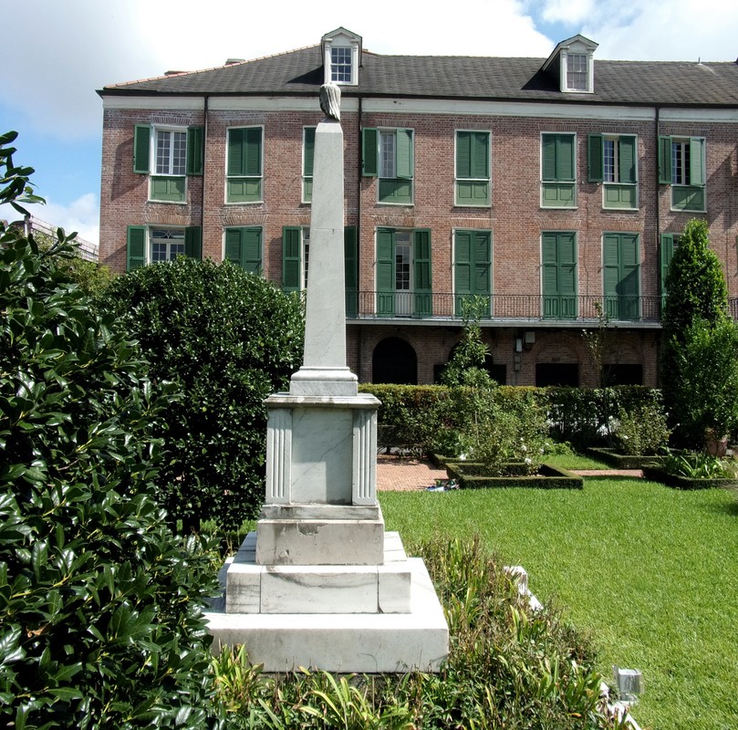 [1] Andre Lafargue, “The Little Obelisk in the Cathedral Square in New Orleans,” Louisiana Historical Quarterly, Vol. 28, No. 1 (Jan. 1945), 329.
[2] Every history of the Tonnerre’s trials at the Louisiana quarantine station omits the commander’s first name. Based on other histories of the French Navy in the Baltic and Mexico, and other statistical data, the commander of the Tonnerre was most likely Clement Maudet (1829-1863), French Legionnaire, who would die later in Mexico during the Battle of Camarone, part of the Second French Intervention. [3] Ibid., 333-336. [4] John Fincham, A History of Naval Architecture, to which is prefixed an introductory dissertation on the application of mathematical science to the art of naval construction (London: Whittaker and Co., 1851), 408. [5] French war steamer Tonnerre embarks from Havana to Mexico, Daily Picayune, October 21, 1857; French war steamer Tonnerre returns to Havana, Daily Picayune, December 14, 1857. [6] This is an extremely generalized recapitulation of colonialism in the Caribbean in the 1850s. For further reading see: The Second French Intervention in Mexico, The French Intervention in Mexico and the American Civil War, and if all of this is too complicated or frustrating, just check out this fun comic. [7] Henry Rightor, Standard History of New Orleans, Louisiana (New Orleans: Lewis Publishing Company, 1900), 211-213. [8] John Duffy, The Sanitarians: A History of American Public Health (Chicago: University of Illinois Press, 1992), 60; Joy J. Jackson, Where the River Runs Deep: The Story of a Mississippi River Pilot (Baton Rouge: LSU Press, 1993), 55; Alcee Fortier, Louisiana: Comprising Sketches of Parishes, Towns, Events, Institutions, and Persons, Arranged in Cyclopedic Form, Vol. 2 (Century Historical Association, 1914), 337. Jackson notes quarantine stations located at Cubit’s Gap (around 1910) and a post-1920 station at the lower end of Algiers. Andre Lafargue describes a quarantine station at Pilot Town, twenty miles downriver from Ostrica, by 1914. [9] John Duffy, ed. The Rudolph Matas History of Medicine in Louisiana, Vol. II (Binghamton, New York: Vail-Ballou Press, Inc., 1962), 185-186. [10] Joseph Jones, M.D. Report of the President of the Board of Health of the State of Louisiana for the Year 1880, 14. The report also notes the success of quarantine measures for that year, including the removal of the bark Excelsior, bound from Rio de Janiero, to Quarantine, which “certainly freed the city of New Orleans from the infected crew, and in the opinion of a portion of at least of the medical profession, preserved the citizens from an epidemic.” [11] Ibid., 18. [12] Ibid., 15. [13] Andre Lafargue, “The Little Obelisk in the Cathedral Square in New Orleans,” 336. [14] John Smith Kendall, A.M., History of New Orleans, Vol. III (Chicago: Lewis Publishing Company, 1922), 1149. [15] Ibid., 338. [16] Ibid., 336-342. There is no indication that this tree remains in the garden behind St. Louis Cathedral. [17] Receipt from De Lucas Monument company to Comite Francaise, Andre Lafargue papers, MSS 552, Folder 10, Tulane Louisiana Research Collection. 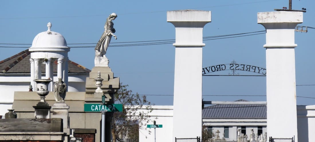 Main aisle of Cypress Grove, looking toward City Park Avenue. Photograph by Emily Ford. Part Two of Two in an examination of historic architectural landscapes at Cypress Grove Cemetery. Find Part One here. In the 1840s, Cypress Grove Cemetery developed into the landscape its founders envisioned: tree-lined and populated with tombs of the finest order. It also gained company as St. Patrick’s Cemetery, Charity Hospital Cemetery, and Odd Fellows Rest were all established between 1840 and 1850. There at the corner at what is now Canal Street and City Park Avenue, Cypress Grove was part of a pastoral scene: barges floating up Bayou Metairie and the New Basin Canal, visitors strolling the gardens at the Halfway House, and rail cars pulling up right to the cemetery gates, unloading mourners and the bodies of the mourned.[1] Between its founding in 1840 and the turn of the century, Cypress Grove would become the final resting place of many famous and infamous New Orleans characters. Northern-born transplants to the city would combine New Orleans tomb architecture with the styles and materials they were accustomed to. Firemen would memorialize their fallen brethren within the cemetery’s marble-clad walls. Much of the incremental detail of the cemetery at its height, though, has weathered away from its present-day appearance. It’s easy to miss this historic garden cemetery for its modern lack of trees. But with historic research and a keen eye, it’s possible to rediscover Cypress Grove’s historic grandeur. 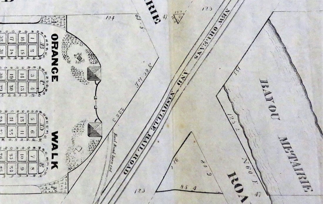 Detail of 1840 map of Cypress Grove Cemetery, showing plan view of the entrance, bayou and railroad. 1840 Firemen's Charitable Association Report (Tulane University Louisiana Research Collection) Firemen, Northerners, and Protestants Cypress Grove was the first fraternal cemetery in New Orleans. All other cemeteries founded up to 1840 belonged either to the Catholic parishes (except Protestant Girod Cemetery, belonging to Christ Church Cathedral) or to each respective municipality (i.e. Lafayette Cemetery No. 1). Many other fraternal organizations, including other firemen’s organizations, would found their own cemeteries over the course of the nineteenth century. Cypress Grove was not intended for the exclusive burial of firemen. It served all New Orleanians seeking burial, if they could purchase a plot, and many who could not. Cypress Grove Cemetery No. 2 (present-day Canal Boulevard) was contracted by the City of New Orleans for indigent burial, even after Charity Hospital Cemetery was established in 1848.[2] 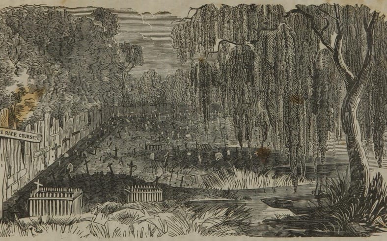 Cypress Grove Cemetery No. 2, unknown date. FindaGrave user Athanatos. While Catholics in New Orleans had many cemeteries from which to choose, Protestants had only Girod Street Cemetery and the municipal cemeteries. Perhaps it was simple economics that caused so many Northern-born Protestants to buy property in Cypress Grove. It may also have been caused by cultural interaction between the Firemen (many of whom were also non-native New Orleanians) and others who joined them as newcomers in the Crescent City. In any case, the great majority of historic burials in Cypress Grove denote birth in northern climes such as Pennsylvania, New York, Connecticut, and others. The Firemen’s Charitable Association fell into this market easily. Stonecutters whose work featured mostly in Girod Street Cemetery, such as long-time Girod Street sexton Horace Gateley, executed tombs and tablets in Cypress Grove as well. Gately himself, who drowned in at Isla del Padre, Texas in 1867, is buried in adjoining Greenwood Cemetery. The FCA even advertised in-ground burial in Cypress Grove. While in-ground burial occurred in nearly every cemetery in the city, FCA was the only cemetery owning body to advertise it – plainly appealing to newcomers with a distaste for Continental-inspired above-ground tombs.[3] 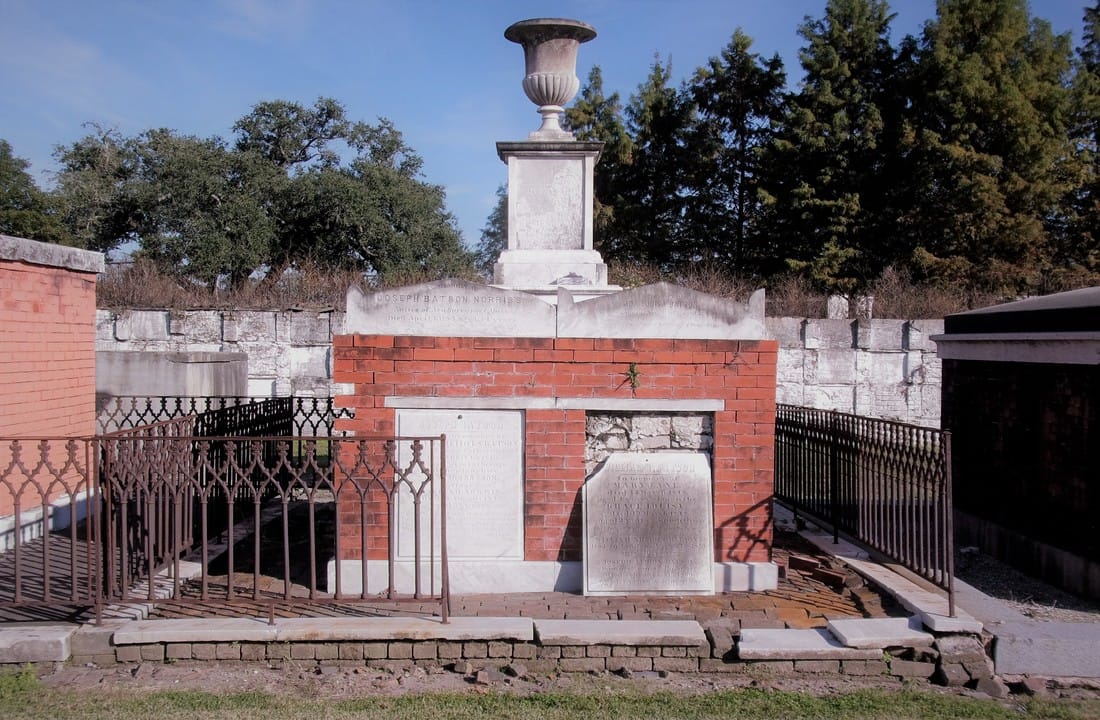 Batson family tomb, constructed of Lake Pontchartrain brick with a Philadelphia brick veneer, c. 1840s. Photograph by Emily Ford. When Girod Street Cemetery was demolished in 1957, Cypress Grove became a de facto artifact of what the Protestant cemetery may have looked like. Simpler, sarcophagus-style tombs with accents placed more on great obelisks and sculpture than on Greek acroteria or Baroque scrollwork dotted the aisles of both Girod and Cypress Grove. What few photos of Girod Street Cemetery remain even suggest a few duplicate tombs between both cemeteries: including the now headless and armless tomb statue and tomb of Henrietta Sidle Davidson (died 1881) and another tomb in Girod Street. Philadelphia brick, New Hampshire granite, and other Anglo-inspired tastes contributed to the budding landscape of Cypress Grove.
Mr. [S.T.] Jones placed a closely sealed bottle in the box, containing the constitution and list of members of this efflisient [sic] company, the daily newspapers of the city, and the various coins of the country. This was also embedded in mortar, the cover put on, and the whole covered with solid masonry, upon which the corner stone was laid. The beauty of the day, the solemnity of the occasion, and the mournful memories engendered by the scenes around, all contributed to give the ceremony a peculiar interest.[5] The tomb of Perseverance Lodge No. 13 dominated the entrance of Cypress Grove Cemetery then as it does now – a large terra cotta cupola with ionic columns and a cast-iron finial at its dome was constructed atop the tomb roof. At the center of its primary façade, an entrance was likely constructed which was enclosed by cast-iron doors. Above this door were marble brackets and a Classical pediment.
The tombs of Philadelphia Fire Engine and Eagle Fire Company were tucked into the front corners of the cemetery. Each built identically, with marble-clad masonry and large urns and finials, they were each enclosed with iron gates, each within the line-of-sight of the Irad Ferry monument. 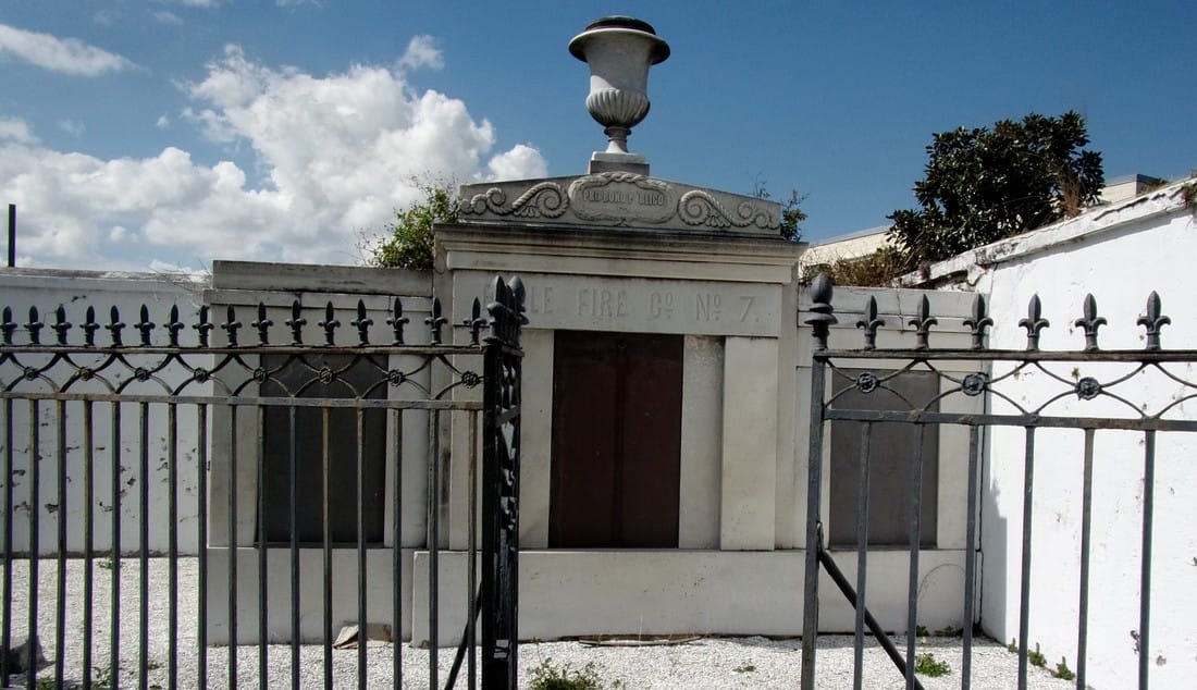 Tomb of Eagle Fire Company No. 7. Photograph by Emily Ford. Masterpieces in Marble and Granite Other societies in addition to fire companies would build their tombs in Cypress Grove, most notably the Chinese tomb and Baker’s Benevolent Association tomb. But Cypress Grove would make its mark in the number of great family tombs that populated its aisles. The sarcophagus tomb is one of the most notable artifacts of funerary architecture in New Orleans cemeteries, and in Cypress Grove this was no different. Built of brick and clad in marble pilasters, cornicework, and sculptural elements, the sarcophagus tombs of the McIlhenny, Davidson, Johnston and Walker tombs are examples of the dozens of this burial type found in Cypress Grove. Built by stonecutters like Anthony Barret, James Reynolds, and Newton Richards, they represented the English-speaking stonecutter’s take on a burial style often associated with Creole artisans. 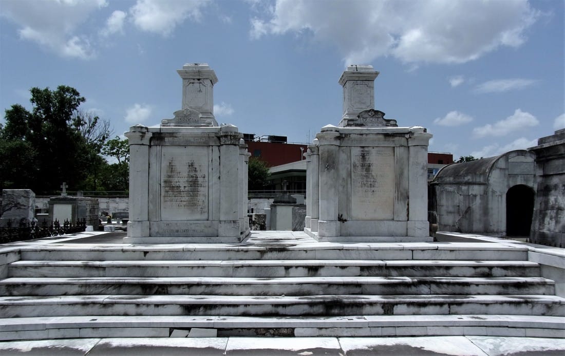 Johnston and Walker marble-clad sarcophagus tombs. The pedestals on each structure likely once had sculpture. Constructed by James Reynolds, 1871. Photograph by Emily Ford. The French-speakers were present in Cypress Grove, as well. Sarcophagus tombs by signed by Florville Foy are present beside the work of New Orleans-born Jewish stonecutter Edwin I. Kursheedt. Renowned French-born cemetery architect J.N.B. de Pouilly designed two of the best-known tombs in Cypress Grove: those of Maunsel White and Irad Ferry (constructed by Monsseaux and Richards, respectively).
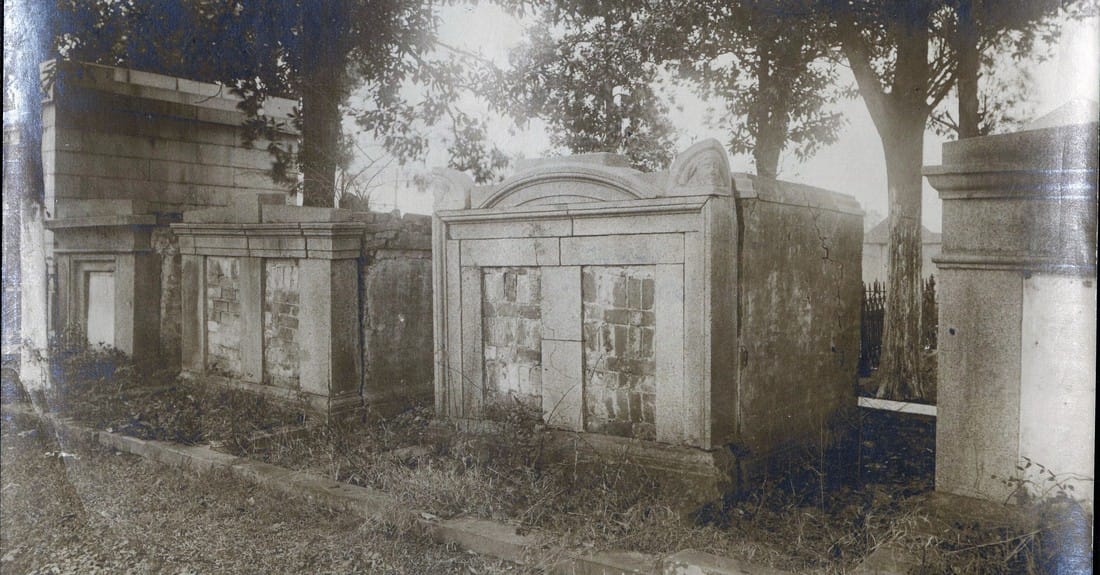 Undated photograph of granite tombs on main aisle (possibly 1950s). Cypress Grove, Huber “Cemeteries” folder, Louisiana Image Collection, Louisiana Research Collection, Tulane University. 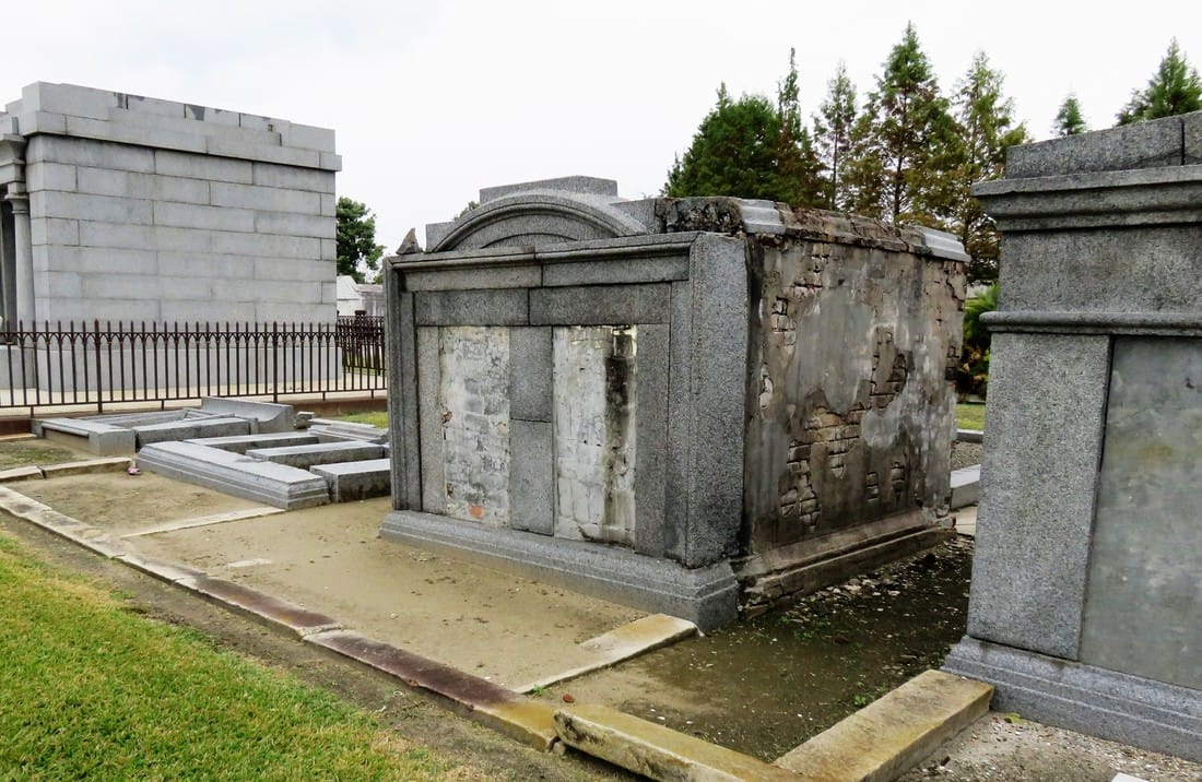 Same view, December 2016. Photograph by Emily Ford. The only remaining example of this style of historic tomb construction lies not in Cypress Grove but in Metairie Cemetery – the Duverje family tomb, constructed between 1808 and 1820 and moved from the family cemetery in Algiers in 1916, retains such acroteria. They are the last of their kind in New Orleans cemeteries.
Then and Now After 1945, New Orleans cemeteries underwent a seismic shift in management, industry, and trade. The monument industry had been slowly becoming a national affair managed by large companies – a shift that reached New Orleans after World War II. Over the years, most cemeteries abandoned the employ of the cemetery sexton who traditionally cared for the grounds on a daily basis. Stonecutters, who had often served as sextons, adapted and became cemetery owners and dealers of nationalized products. Technology changed the way tombs were built, repaired, and maintained. This shift affected every cemetery in New Orleans. In the Catholic cemeteries, it led to the consolidation of parish burial grounds into the incorporated New Orleans Archdiocesan Cemeteries. In municipal cemeteries, it meant a transfer of management to overstretched city departments that cared for publicly-owned buildings and parks.[7] In the fraternal cemeteries, it meant a consolidation of duties and a new focus on sellable space to accommodate budget shortfalls.[8] With population movement to the suburbs and elsewhere, tombs were less likely to be cared for by their owners. With no sexton to manage the landscape, small issues with tombs became larger problems, often solved in the quickest and cheapest way possible. Storms like Camille, Betsy, and Katrina flooded Cypress Grove Cemetery, killing many of the surviving trees. 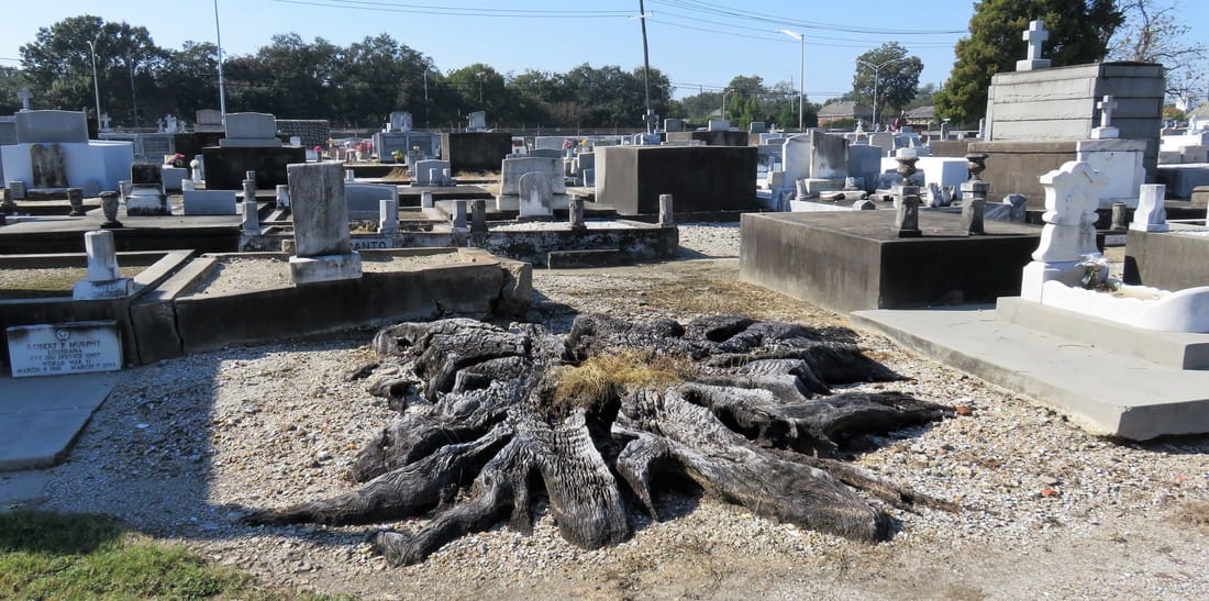 Remnants of removed tree, rear sections of Cypress Grove cemetery. Photo by Emily Ford. Those who entered the monument trade after 1950 were much more familiar with new technologies than old materials. Old problems, then, were solved in new ways. In the 1960s, when the marble facing of the extensive wall vaults at Cypress Grove began to sag away from their brick substrate, the decision was made to remove the marble instead of repair it. 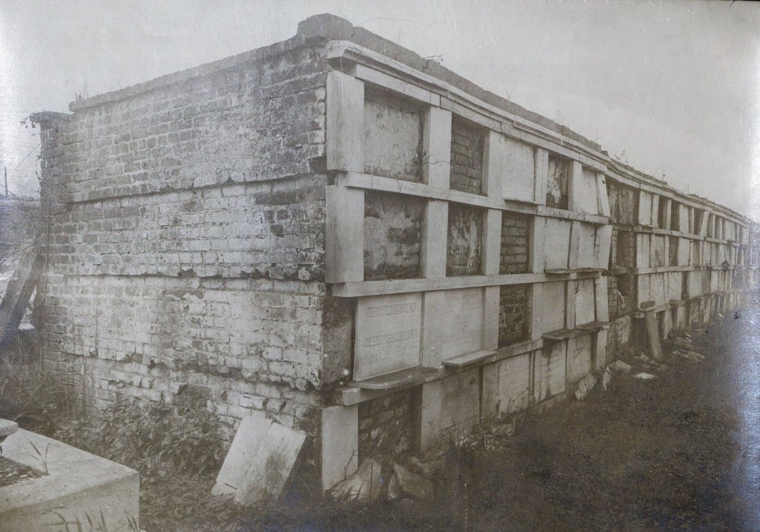 No date, but possibly 1950s, Cypress Grove wall vaults, “Cemeteries” folder, Louisiana Image Collection, Louisiana Research Collection, Tulane University. 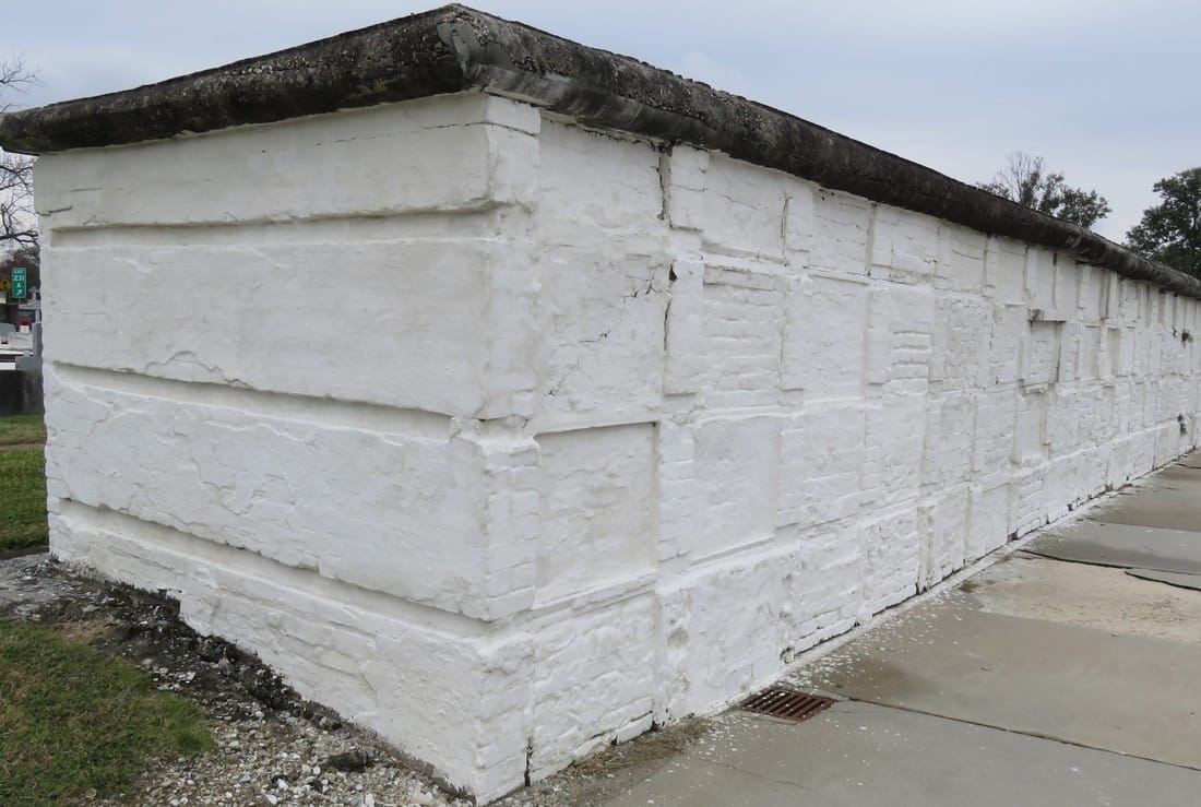 Same section of wall vaults, December 2016. Photo by Emily Ford. When landscaping tumuli was too labor intensive, the sod was stripped from their structures, leaving cement-patched, igloo-like bodies behind. Herbicides like RoundUp were selected to replace arduous mowing, damaging masonry and causing grassy root structures to erode, leaving deep ruts which can destabilize walls and tombs. Alternately, trees which lent such a rural feel to Cypress Grove eventually overgrew their root structures, tipping walls and capsizing tombs. 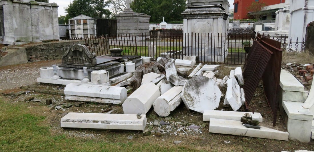 Deconstructed tomb of Joshua James, built by Anthony Barret, 1870. Photo by Emily Ford. All the while, the responsibility of families to care for and repair their own cemetery property became anachronistic in an era of new innovations and perpetual care. The cultural forces that created Cypress Grove had transformed, with the role of the fraternal society somewhat supplanted by the rise of Social Security and insurance companies; the rural cemetery now firmly at the edges of the metropolis. New Orleans cemeteries in general are prized for their historic value, but the value of their maintenance and preservation may exceed that interest from many sides. Yet Cypress Grove remains, its Egyptian columns rising above Canal Street and City Park, where once the bayou and the railroad met. It may be difficult to see it, but with a conscientious eye and a little history, its lost landscapes can be found. 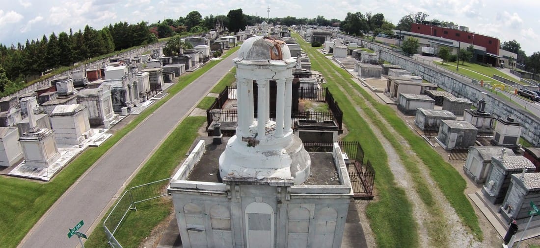 Aerial image of Perseverance Lodge No. 13 and main aisles of Cypress Grove, August 2016. Photograph by Alahna Moore. [1] “Passenger and Freight Barges on the New Canal,” Daily Picayune, January 1, 1846, 4; Leonard V. Huber, Peggy McDowell, Mary Louis Christovich, New Orleans Architecture, Vol. III: The Cemeteries (Gretna: Pelican Press, 2004), 30-35; At least one duel also took place in front of Cypress Grove’s gates, between former state senator Waggaman and a former New Orleans mayor Prieur, Daily Picayune, March 11, 1843, 2.
[2] Daily Picayune, April 21, 1846, 2. [3] “Cypress Grove Cemetery,” Daily Picayune, September 15, 1842, 2. Full text: “CYPRESS GROVE CEMETERY. A portion of this rural cemetery having been appropriated for interments in GRAVES, application can be made at the Firemen’s Insurance Office; to M.C. Quirk & Sons, or Mr. Monroe, Undertakers. The Superintendent will also receive at the ground any corpse for interment, on payment of $5 for grown persons and $3 for children. GEORGE BEDFORD, President F.C.A.” [4] “Grand Fancy Dress Ball,” Daily Picayune, February 26, 1852, 3; “Fireman’s Funeral,” Daily Picayune, August 14, 1847, 2. [5] “The City: An Interesting Ceremony,” Daily Picayune, January 3, 1854, 1. [6] Cohen’s New Orleans Directory for 1855 (New Orleans: Printed at the office of the Picayune, 66 Camp Street, 1855), xiv. [7] Pie Dufour, “Old Cemetery Getting New Look,” Times-Picayune, November 10, 1968. [8] In Cypress Grove, sexton and stonecutter Leonard Gately was instrumental in developing sections into sellable space. Daily Picayune, April 12, 1959, 154.  Cypress Grove Cemetery c. 1890. From "History of the Fire Department of New Orleans," 1890. Part One of Two in an examination of historic architectural landscapes at Cypress Grove Cemetery. The foot of Canal Street at City Park Avenue is surrounded by cemeteries. At one end, the bronze statue of the Elks Lodge tumulus presides over ever-bustling traffic - right now, in December, the Elk has been decorated with a festive red nose. Facing the intersection from another side is the tall edifice of Odd Fellows Rest. The entrance gate of Cypress Grove stands out even in the grandiose company of these monuments. Comprised of two gatehouses and towering Egyptian Revival pillars, the gate has stood longer than the Elk, the Odd Fellows, or any other cemetery in the area. Within these gates is the oldest rural cemetery in New Orleans. Cypress Grove’s significance is self-evident – its wide avenues showcase example after example of high funeral architecture, of stories that strike the heart of the New Orleans history. But there’s another story among the thousands of tombs in the cemetery. It’s the story of a landscape now obscured by time, of what it used to mean to walk through these aisles. Beyond the mowed grass and paved paths is evidence of what once was a lush, tree-lined landscape on par with the garden cemeteries of the northeast. If you look hard, you can still find it there. 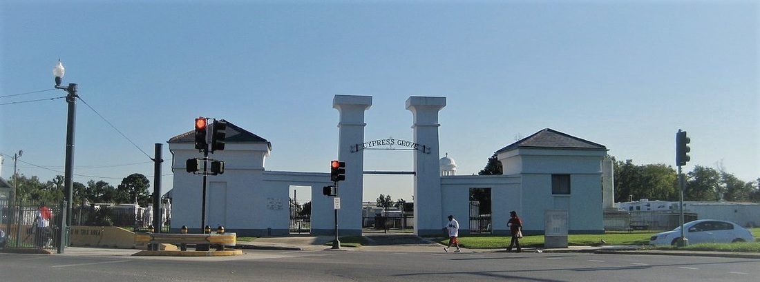 Cypress Grove Cemetery entrance, 2009. Photo by Wikimedia Commons user Infrogmation. The Firemen’s Cemetery Cypress Grove was founded in 1840 by the Firemen’s Charitable Association (FCA), now known as the Firemen’s Charitable Benevolent Association (FCBA). The Association was organized in 1834, about five years after the first New Orleans volunteer fire companies formed. Originally, the Association served in a manner similar to other mutual aid societies: providing social and financial support to the city’s volunteer firemen. Within its first decades, however, the Association became the fire department itself. Until the city switched to a paid fire department in 1892, the Association was responsible for all firefighters in New Orleans – and all firefighters were volunteers.[1] The tale of the founding of Cypress Grove is one well-known to cemetery lovers in New Orleans. On New Year’s Day 1837 while carrying out his duty with Mississippi Fire Company No. 2, thirty-five year-old Irad Ferry perished in a fire on Camp Street. Dubbed the “the first martyr” of the newly-formed fire department, Ferry was venerated with a public funeral and a large memorial march. He was originally laid to rest in Girod Street Cemetery. Along with relief services for their members, benevolent societies of this time provided burial benefits to their members. The Firemen’s Charitable Association was no different, and considered purchasing a section of Girod Street Cemetery for that purpose with plans for Ferry’s monument to be built at its center. But in 1838 the death of Destrehan plantation owner Stephen Henderson widened the Association's prospects. In addition to multiple provisions regarding people enslaved by Henderson, the will specified large bequeaths to religious and social charities, and $500 per annum to the Firemen’s Charitable Association.[2] On Sunday, April 25, 1840, a nearly one thousand firemen, clergy, and prominent citizens marched through downtown New Orleans, each wearing mourning bands and a few carrying urns representing the ashes of their martyred comrades. At Canal Street, they boarded train cars and traveled to Cypress Grove Cemetery, where they re-interred the remains of Irad Ferry beneath a great monument designed by J.N.B. de Pouilly and constructed by stonecutter Newton Richards. In a nearby tomb constructed for this purpose, the remains of eleven additional firemen were buried.[3]
The Rural Cemetery At its founding in 1840, Cypress Grove became the sixth active cemetery in New Orleans, and the only cemetery at the lake-side foot of Canal Street.[4] Its predecessors were decidedly urban in design: dense, utilitarian though beautiful, and without significant landscaping. A possible exception to this rule was Lafayette Cemetery No. 1, located in what would become the Garden District. Lafayette No. 1 has been referred to as a “transition” cemetery between urban and rural model cemeteries. But even this cemetery was squeezed into a single city block, with no room for the rolling greenery that had become popular in American cemetery design by 1840.[5] Cypress Grove was destined to become something different. Enormous in land area by contemporary New Orleans standards, it was conceived by relative newcomers to the New Orleans Francophile aesthetic. Members of the FCA were often northern-born – for example, Irad Ferry was from Connecticut – and thus influenced by English sensibilities. The Americans brought with them new ideas for cemeteries. They were inspired by what they saw at Mount Auburn Cemetery in Massachusetts, Laurel Hill Cemetery in Philadelphia, Green-Wood Cemetery in Brooklyn, and many more. These were cemeteries that were designed instead of planned, with undulating pathways that strolled past weeping willows and reflecting pools. This was the rural cemetery movement, a great shift in the history of cemeteries that would change the American perception of death forever.  Thomas Chambers, "Mount Auburn Cemetery," mid-nineteenth century. National Gallery of Art. The rural cemetery movement arose in the northeastern United States as a result of the expansion of cities. Advances in industrialization within the urban landscape created in city-dwellers a longing for the countryside. Furthermore, this same industrialization advanced the American middle class in such a way that recreation was newly defined. Inspired by English landscape design, the rural cemetery was the predecessor to the public park – in fact, Central Park landscape architect Frederick Law Olmstead designed one such cemetery in California. This shift in the appearance and purpose of cemeteries coincided with many American cultural movements like Romanticism and the “beautification of death period.” The Firemen’s Charitable Association was certainly aware of this trend. In addition to the explicit use of the term “rural cemetery” in FCA planning documents, the Association expressed a disdain for contrasting urban cemeteries: It would seem almost superfluous to set for the advantages of this rural cemetery. The rapid growth of our city has already encroached upon the tombs of its fathers, and the sacred relics of the dead have been compelled to give way to the cold and selfish policy of speculators, and the intrusion of business; and the solemnity of the grave yard is disturbed by discordant shouts of merriment, and the baleful proximity of the dissolute.[6] If there was any question as to whether the FCA was directly influenced by the rural cemetery movement, one must note that the iconic Cypress Grove entrance gate is a near-exact facsimile of the gate at Mount Auburn.  Main gate, Mount Auburn Cemetery, Cambridge, Massachussetts, 1967. Library of Congress Historic American Building Survey (HABS) 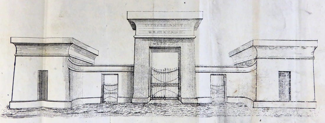 1840 sketch of Cypress Grove entrance gate, from a report of the FCA. It is unclear if the original gate was constructed with the closed lintel design. (Tulane University Louisiana Research Collection) The Cemetery at the Half-Way House For those in FCA who wished Cypress Grove to be a truly rural cemetery, a better location could not have been chosen. The new cemetery was situated at the confluence of vital infrastructure lines: the New Basin Canal and Shell Road, Bayou Metairie, and rail lines at Canal Street. Although the area was an important checkpoint in travel through the area, it was largely undeveloped. One map from 1849 describes the area as a “ridge covered with live oak, persimmon, liriodendron, pecan, wild cherry, interspersed with acacia trees.” 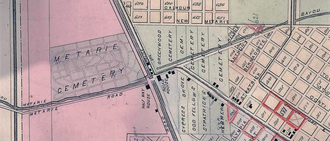 Detail of 1883 Robinson Atlas of New Orleans, showing bayous, roads, railroads and cemeteries. Cypress Grove is labeled correctly, although the boundaries of Odd Fellows Cemetery are incorrect. (Wikimedia Commons) The cemetery itself would have, in its own way, water features much like the rural cemeteries it emulated. Early descriptions of the cemetery plan boast “frontage” on both the New Basin Canal and Bayou Metairie. In fact, Cypress Grove Cemetery once straddled Bayou Metairie (today City Park Avenue). The bayou divided Cypress Grove Cemetery No. 1 (present-day Cypress Grove) and Cypress Grove Cemetery No. 2, a potter’s field now covered by Canal Boulevard. The location of the cemetery not only suited the rural aesthetic but also the new role of the cemetery as a venue for picnics and outings. The Shell Road, which ran alongside the New Basin Canal toward Lake Pontchartrain, was a popular day trip for visitors and locals alike.[7] The Half-Way House and Road House were located at the meeting of the Shell Road and Bayou Metairie – both places of rest, refreshment, and entertainment located at the midway point between the Mississippi River and Lake Pontchartrain, further cementing Cypress Grove’s destiny as a park-like destination. 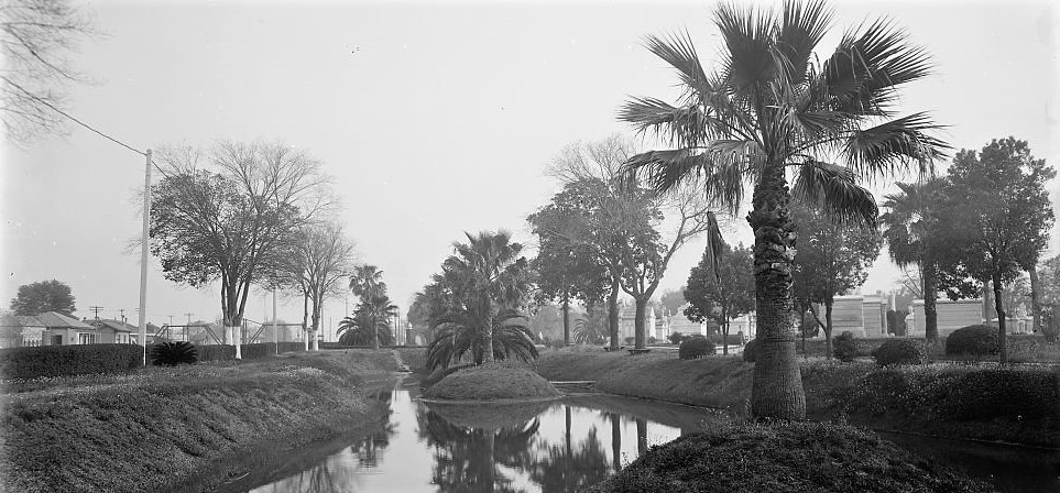 Lagoon in Metairie Cemetery along the New Basin Canal, 1910. (Library of Congress) Growth and Change Those who were drawn to own tombs and lots after 1840 chose Cypress Grove for its bucolic location, wide aisles, and landscaping. In its first twenty years, the cemetery would be filled with some of the grandest architecture New Orleans craftsmen could offer. Its aisles, all named after trees and plants, would bristle with their namesakes shading each pathway. The finest cast iron fences would encircle family tombs clad in marble and Pennsylvania brick. Cypress Grove became, in some ways, an extension of Girod Street Cemetery. Protestants and other non-Catholics sought property within its walls, bringing their taste in obelisks and urns with them. Cypress Grove became home to the second tomb for traditional Chinese burials in New Orleans. The Slark and Letchford families built two tombs inspired by stately Gothic spires along the cemetery’s marble-clad side wall vaults. 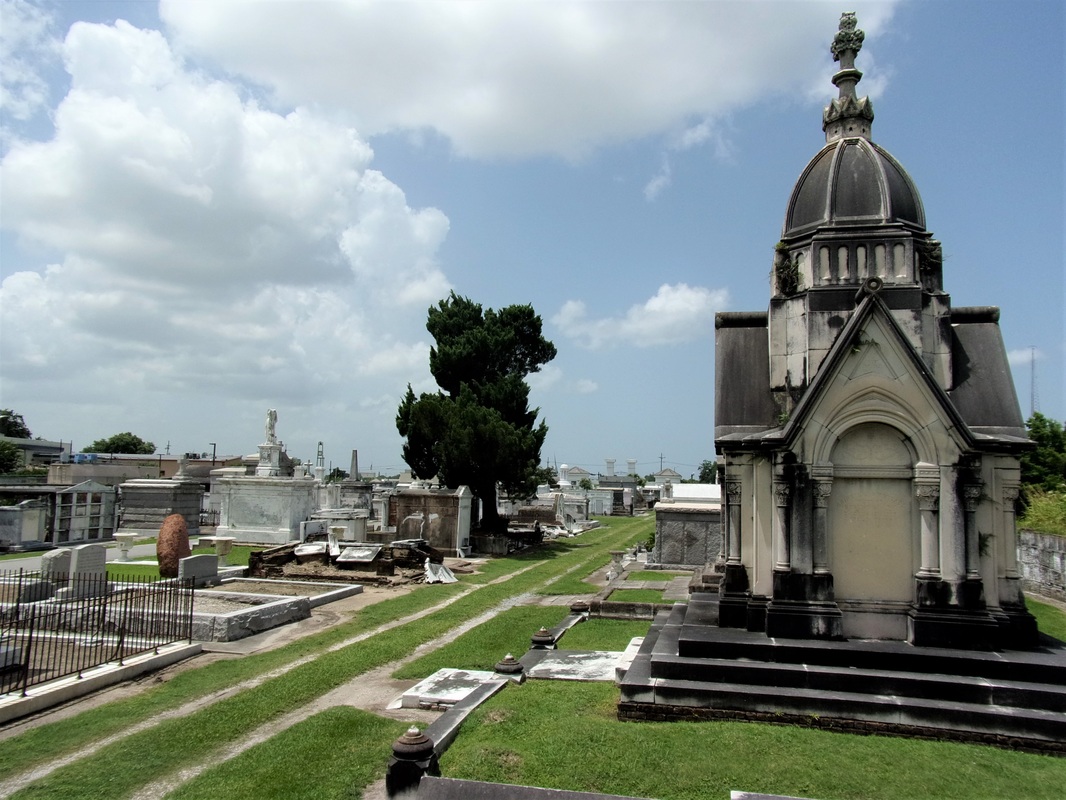 Slark mausoleum and side aisles, 2015. Photo by Emily Ford. Cypress Grove would not be alone at the confluence of bayou, canal, and railroad for long. In the same year Cypress Grove was founded, St. Patrick’s Cemetery No. 1 was established. Cypress Grove would be joined by Greenwood Cemetery, Odd Fellows Rest, Dispersed of Judah and other Jewish cemeteries, Charity Hospital Cemetery (now Katrina Memorial), and Masonic Cemetery No. 1. In 1872, Metairie Racetrack would be converted to Metairie Cemetery, and Cypress Grove would be supplanted as the great rural cemetery of New Orleans. One hundred seventy-five years after Cypress Grove’s dedication, there are twelve cemeteries clustered near the intersection of Canal Street and City Park Avenue. The New Basin Canal was filled in the 1960s and replaced by the Pontchartrain Expressway. Metairie Bayou has been filled and City Park Avenue widened atop it. The Half-Way House and other former New Basin Canal structures were demolished in recent decades. Today, the New Orleans Emergency Communication District buildings are located at the site. Cypress Grove may not be so easily recognized for what it once was. Its trees are mostly missing, replaced by deep ruts in sod where herbicide has taken hold. Many of its great structures have changed or completely disappeared – tumuli stripped of their grassy knolls, wall vaults stripped of their marble facing. Next blog post, we dive deeper into the architectural history of specific tombs and structures in Cypress Grove Cemetery and how they have changed over time. 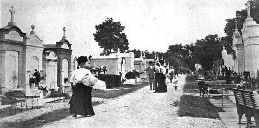 Cypress Grove Cemetery, 1909. From the Florists Review, Vol. 24, Oct. 1909. [1] Thomas O’Connor, ed. History of the Fire Department of New Orleans (New Orleans: FMBA, 1890), 54-57.
[2] Ibid., 65-70; “Mr. Henderson’s Will,” Daily Picayune, March 17, 1838, 1; Although unrelated to Cypress Grove, the will of Stephen Henderson and how it was executed bears some interest. Among other provisions, Henderson attempted to arrange for the gradual emancipation of his many slaves, with the option for some to be sent to Liberia. Find more here, and here. [3] O’Connor, 70-71. [4] St. Louis Cemetery No. 1 and 2, Girod Street Cemetery, and Lafayette Cemetery No. 1. At least two Potter’s Fields or indigent burial grounds and unknown family cemeteries were also in the City. [5] Dell Upton, “The Urban Cemetery and the Urban Community: The Origin of the New Orleans Cemetery,” in Exploring Everyday Landscapes: Perspectives in Vernacular Architecture, ed. Annmarie Adams and Sally McMurry (Knoxville: The University of Tennessee Press, 1997), 131-145. [6] Firemen’s Charitable Association, Report of the Committee of the Firemen’s Charitable Association, on the Cypress Grove Cemetery (New Orleans: McKean, 1840), 4. [7] Visitor’s Guide to New Orleans (New Orleans: J. Curtis Waldo Southern Publishing & Advertising House, Nov. 1875), 30-33. 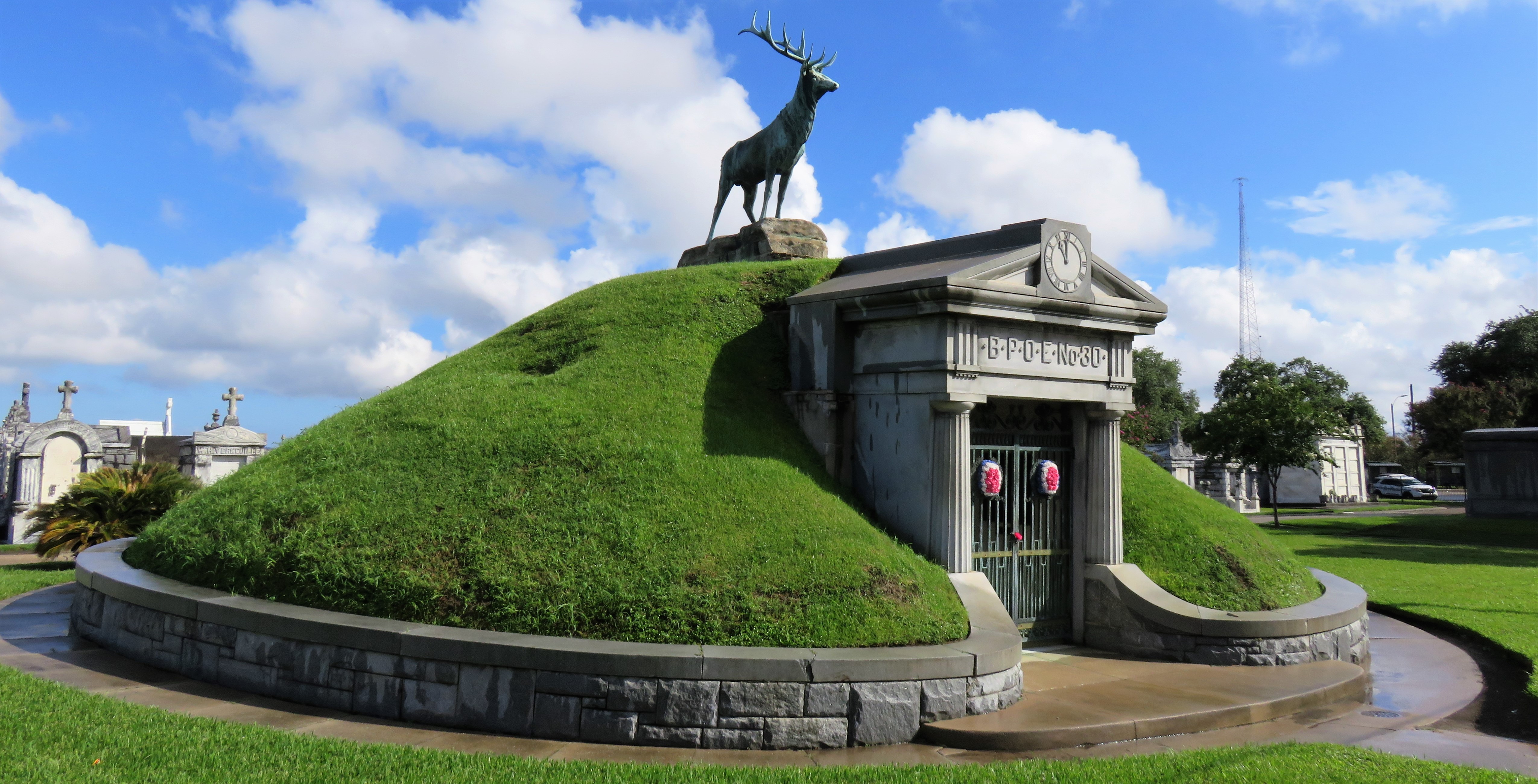 Elks Lodge No. 30 tumulus, Greenwood Cemetery. Photo by Emily Ford. To call any cemetery landscape “eclectic” is usually an understatement. Within cemetery landscapes are the architectural whims of uncountable individuals, families, and craftsmen. And so it goes that in New Orleans cemeteries we pass a Gothic chapel and find a Celtic cross. Our landscapes are amalgams of recollection – Classical Greek, Roman, and Egyptian are at home with the Italianate, the Moorish Revival, and the Art Nouveau. This rich tradition has inspired architects to look backward for inspiration, but there is no farther backward one can reach than the tumulus. Known also as a barrow, the tumulus is a burial structure that rises from the ground as a hill or mound. Often, the tumulus bears a means of access from the side or top of the hill. Its origins span across the ancient world, both Old and New, representing a common type of burial shared between the ancient Norse, Etruscans, Chinese, Native Americans, and many, many more.[1] This type of burial also has its home in New Orleans cemeteries. The Elks Lodge tumulus in Greenwood Cemetery, and the Armies of Tennessee and Northern Virginia in Metairie Cemetery are often used as examples for the tumulus in modern cemeteries. Yet they are not alone in their unique appearance. The tumulus once graced many more New Orleans cemetery landscapes than it does today. In this blog post, we explore the origins, proliferation, and eventual disappearance of the tumulus in New Orleans cemeteries. Mounds, Barrows, and Antiquarians In Europe, mound, barrow, or tumulus burial was practiced by pre-Roman and Roman cultures. Tumuli can be found in nearly every European country – today as protected archaeological sites and heritage attractions.[2] The practice of mound burial was abandoned after the rise of Christianity and the development of churchyards in Europe. Until the cemetery landscape was reinvented by the rural cemetery movement in the early 19th century, the tumulus was a thing of ancient history.  Tumulus of Dissignac, Saint-Nazaire, France. Between 4,500 and 4,700 years old. From Wikimeda Commons user Dmitri Lytov) A number of factors contributed to the reintroduction of the tumulus to cemetery landscapes in Europe and the New World. With the establishment of cemeteries like Pere Lachaise in Paris, the understanding of cemetery landscapes shifted into one of green space and architectural eclecticism. From this cultural development sprang the Greek Revival architecture that proliferated New Orleans thanks in part to J.N.B. de Pouilly. But the gaze of nineteenth century Europeans and Americans did not exclusively look back to Greece. It turned to Egypt and the Middle East. It incorporated Gothic spires into new designs. And it looked even farther back to the mysterious mounds found in the European countryside. By the 1870s, the antiquaries of Europe excavated numerous tumuli in England, Italy, France, and Norway. Such discoveries were commonly featured in New Orleans newspapers.[3] An awareness of the burial mounds of great ancient cultures joined Greek temples and Gothic cathedrals in the consciousness of New Orleaneans. Furthermore, the people of the American South were familiar with mound burial in their own backyards. The presence of seemingly abandoned mounds in the southern and mid-western United States had captured the interest of Europeans since Hernando de Soto reported their existence in 1541. After colonization and into the nineteenth century, some of these mounds in Louisiana were repurposed by Americans for use as their own cemeteries. This was the case in Monroe’s Filhiol-Watkins Cemetery. Fleming Plantation Cemetery is also located on a Native American mound. By the mid-nineteenth century, mound burial was firmly rooted in the imagination of New Orleaneans. From these inspirations, the tumulus made its debut in cemetery landscapes. 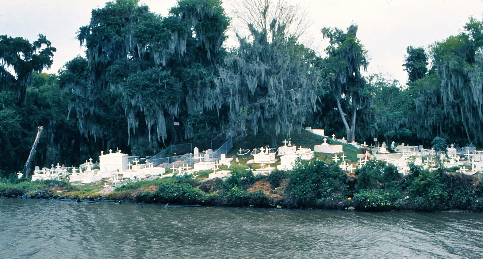 Fleming Cemetery, along Bayou Barataria in Lafitte, Louisiana, 1972. Photo via Wikimedia Commons. The Tumulus in New Orleans Like the city itself, New Orleans cemeteries are the product of many layers of community and identity. Each cemetery is a reflection of the people who made it their own. Cemeteries that were built and utilized by Irish, German, or American New Orleaneans developed with a different aesthetic than those shaped by French speakers. Each community drew upon their own culture and style to create their cemetery. The tumulus entered the popular consciousness in part via a new interest in archaeology and ancient architecture.[4] Though tumuli in New Orleans often had Greek Revival motifs, they were utilized by Americans elsewhere in the United States. Great northern cemeteries like Mount Auburn featured tumuli as part of their cultivated agrarian landscapes, as did closer cemeteries in Charleston and Savannah.[5] Thus, it is no surprise that tumuli in New Orleans appeared first in American and not Francophone cemeteries – decades before the Elks, the Army of Tennessee, or the Army of Northern Virginia. Tumuli are found primarily in the Canal Street cemeteries, including Cypress Grove, Masonic, Odd Fellows Rest, and Greenwood. They are also found in American-oriented cemeteries like Lafayette Cemeteries No. 1 and 2. There are dozens of tumuli to be found in our cemeteries, yet the untrained eye will not find one. Hidden Tumuli, or How the Lawnmower Changed Everything Most tumuli in New Orleans cemeteries no longer look like tumuli. Stripped of their grassy hill features, they appear instead simply as unusual tombs with rounded bodies. The Hornor and Holdsworth tumuli in Cypress Grove and Masonic Cemeteries (respectively) are good examples. Both constructed with a marble primary façade featuring relief carvings of cut flowers, they were likely carved by the same craftsperson, although neither structure is signed. 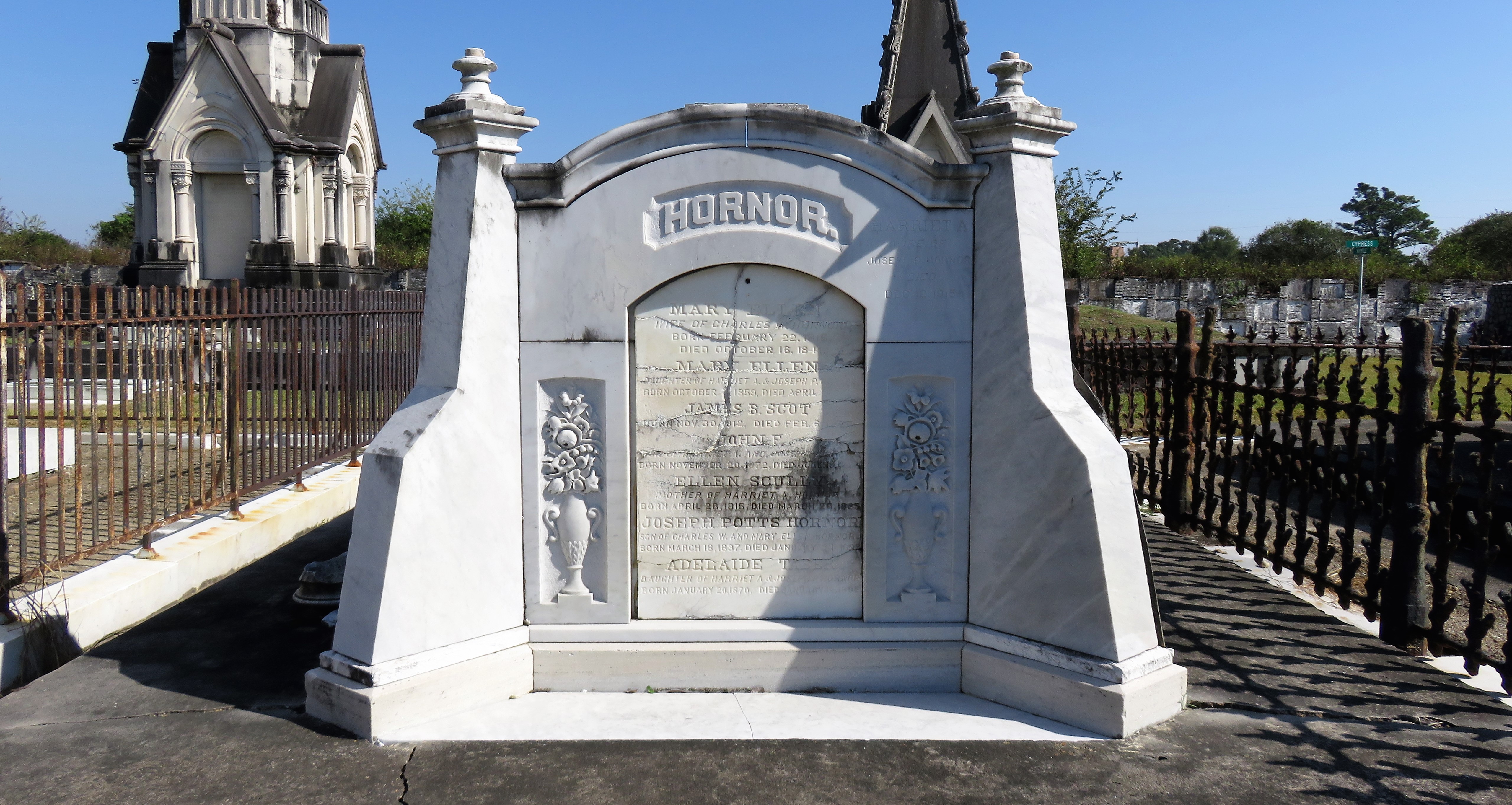  Above: The Hornor tumulus in Cypress Grove, constructed c. 1855. Below: The Schilling-Holdsworth-Brennan former tumulus, Masonic Cemetery No. 1, c. 1860s. Photos by Emily Ford.   Both tumuli have conspicuously rounded structures that seem to contrast with the grandiose style of their primary face. Yet when imagined as they originally appeared, as green hills from which their marble faces projected, their aesthetic comes together. There are many former tumuli in New Orleans cemeteries that have been stripped of their signature mounds. The John P. Richardson tomb, located in Lafayette Cemetery No. 1, was described in 1885 as “enclosed in a tall oval mound of turf, with marble doors set in a stone frame.”[6] The tumulus memorialized Richardson’s young daughters – Ella and Marguerite Callaway or “Calla,” ages six months and four years old. This original appearance could certainly not be deduced from examining the Richardson tomb today: its sweeping marble doors and arched primary face are attached to what appears to simply be a brick-and-mortar tomb. 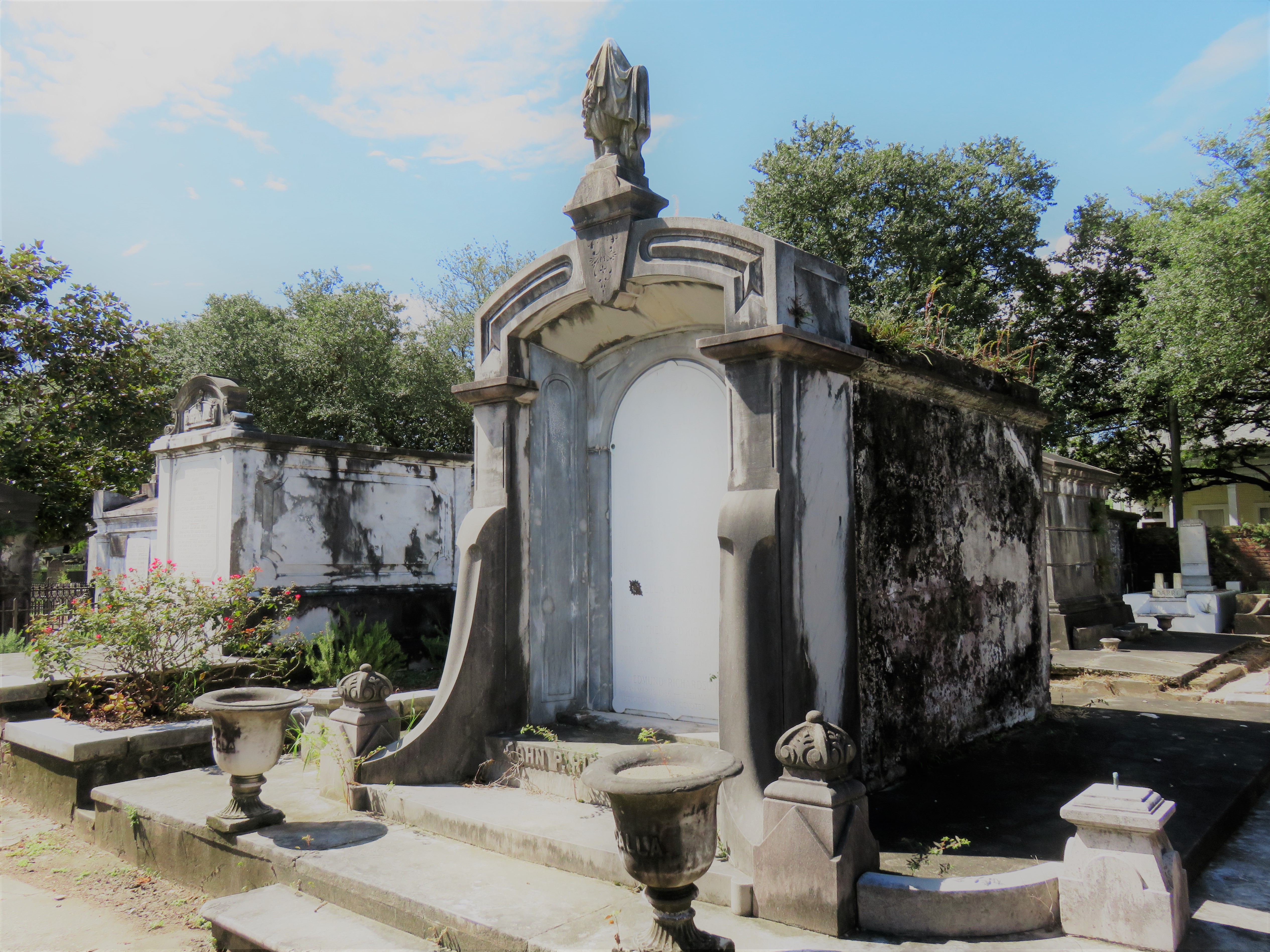 John P. Richardson tomb, Lafayette Cemetery No. 1. Photo by Emily Ford. Dozens of former tumuli can be found in New Orleans cemeteries; most are identified by the slightly unusual appearance of the tomb body when compared to its front. Nineteenth century tumuli were designed to appear monumental in both mass and detail, with their entrances featuring sweeping side elements or rounded tops. The massive hill that comprised the tumulus body framed these features. Other examples of former tumuli include: 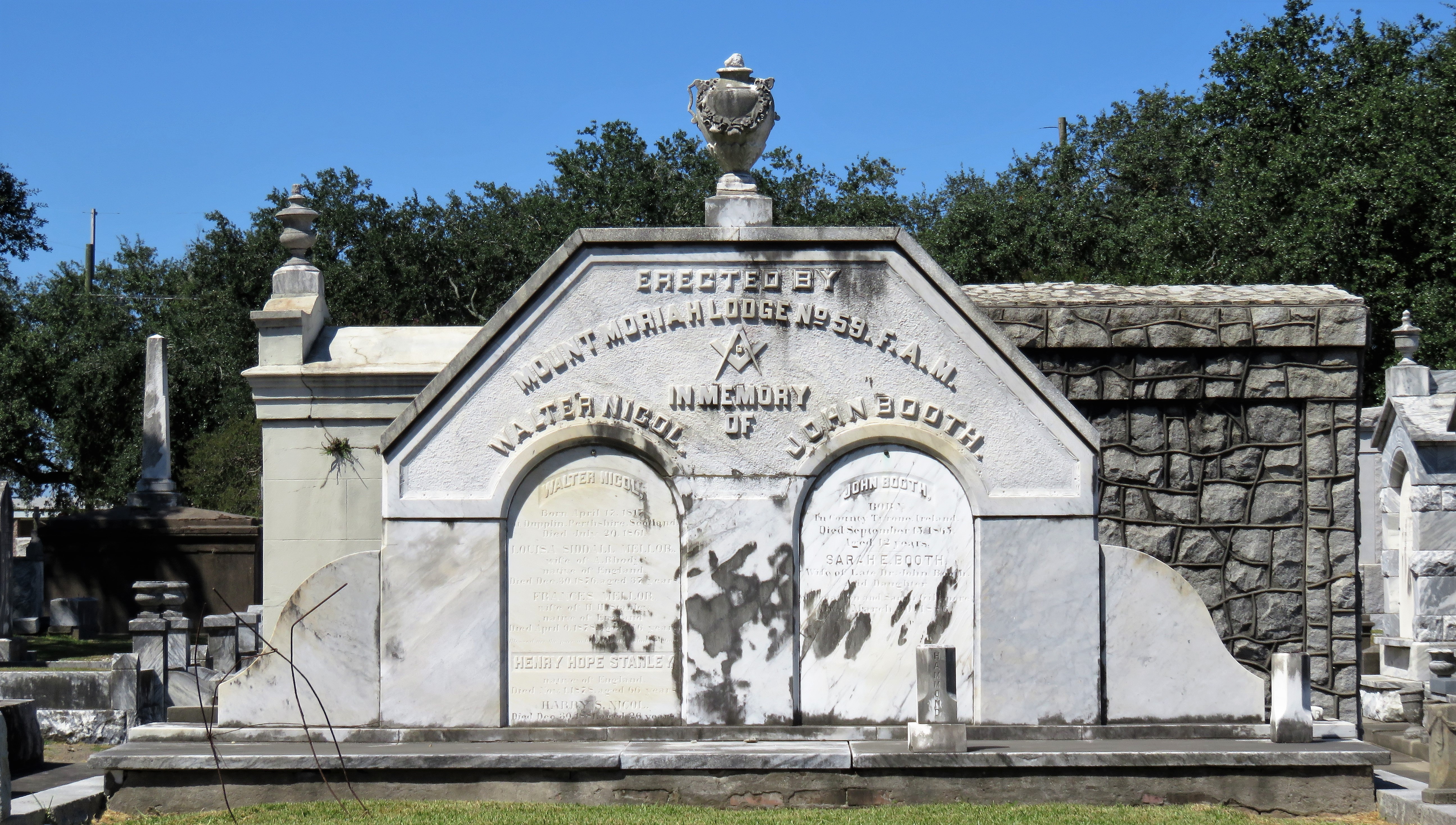 Mount Moriah Lodge, Masonic Cemetery, c. 1861. 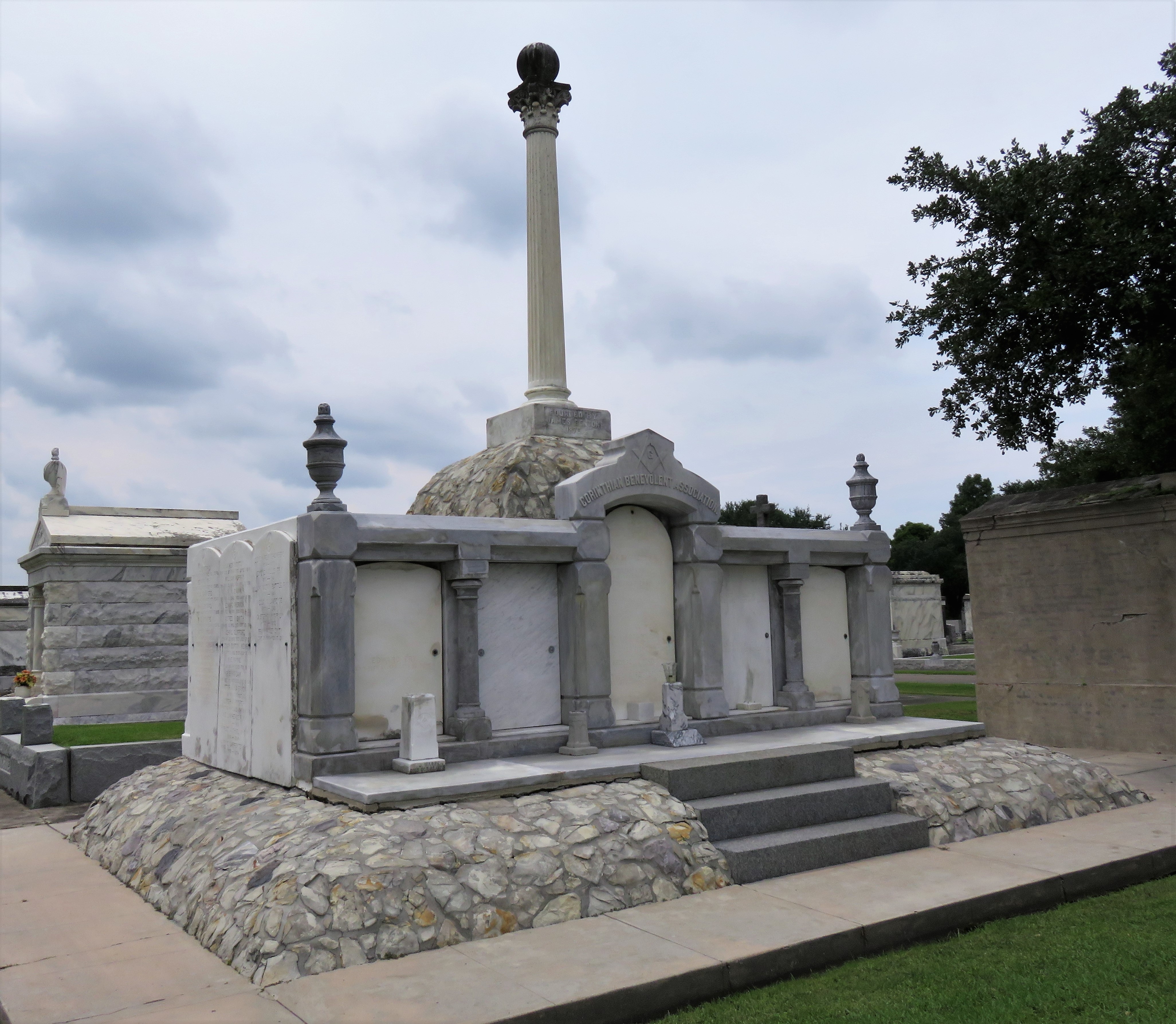 Corinthian Lodge Benevolent Association, Metairie Cemetery, c. 1875. 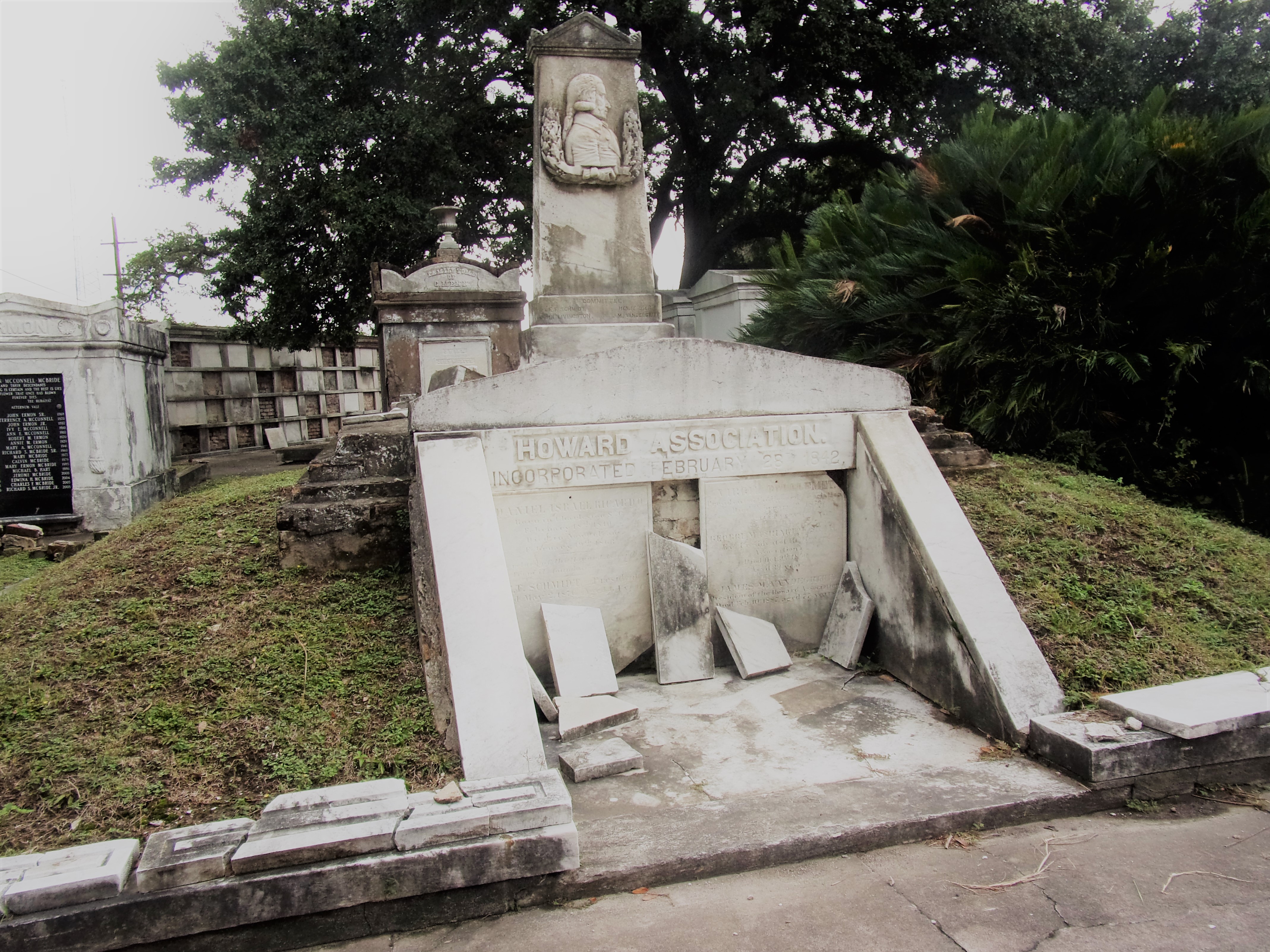 Howard Association, Odd Fellows Rest, c. 1850s. 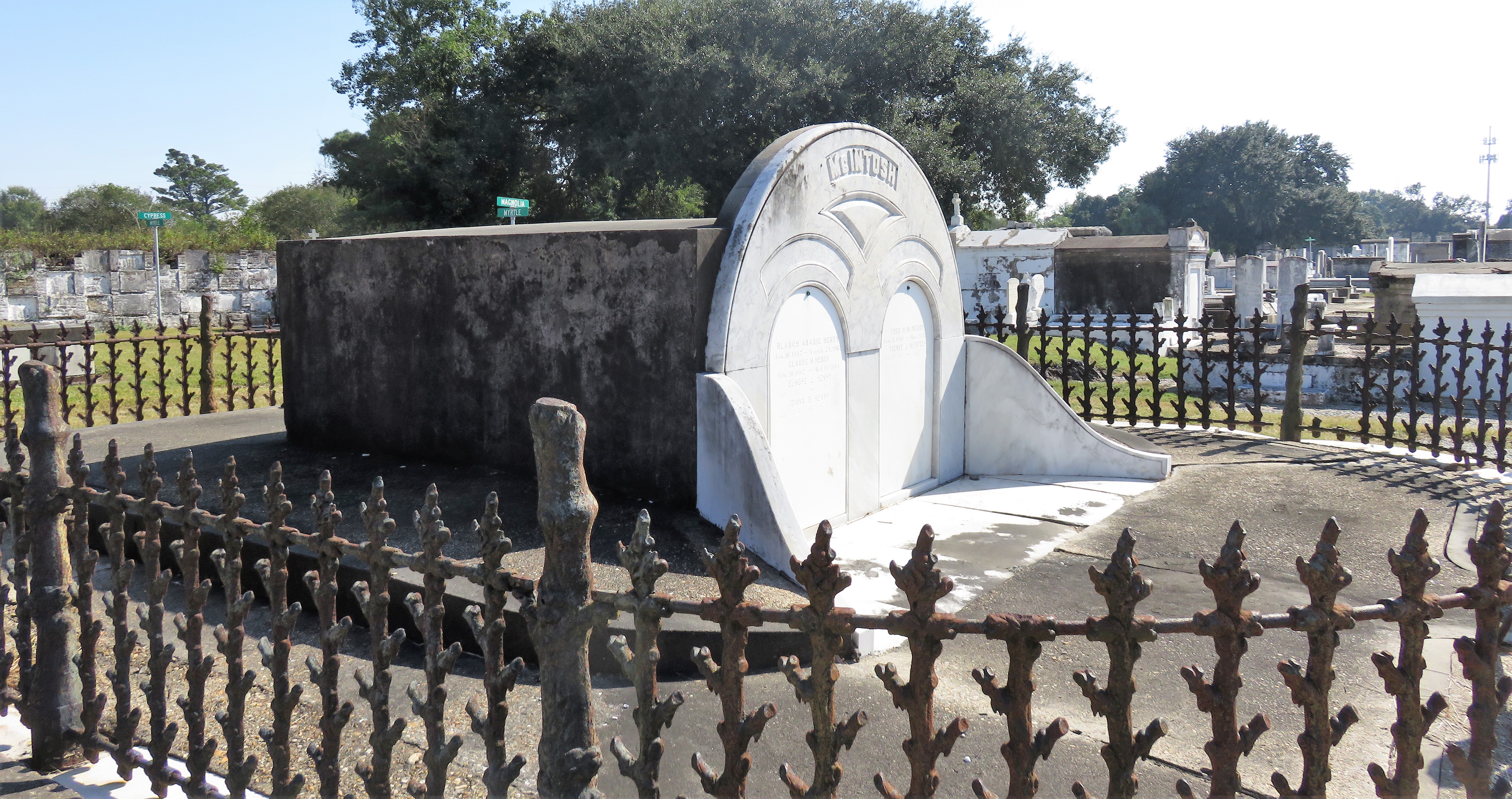 McIntosh tumulus, Cypress Grove Cemetery. In November 1873, the Nixon (now McIntosh) tomb was described as: "in the form of a mound overgrown with grass, with a large marble front. Along the top of the slab creeps an ivy, which will eventually cover the whole mound. The frontispiece was garnished on each side by a vase of white flowers." (New Orleans Republican) 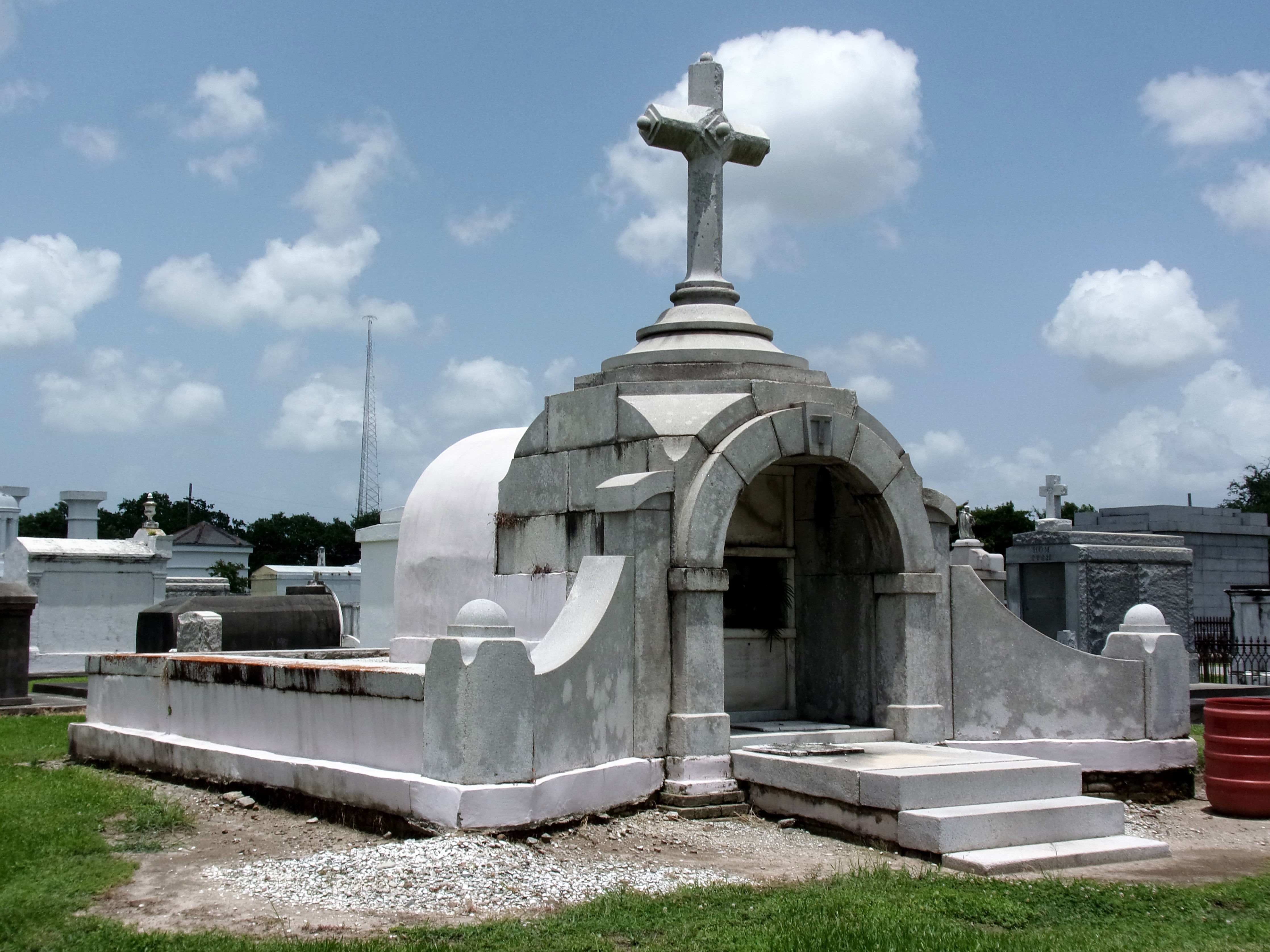 Cypress Grove Cemetery. 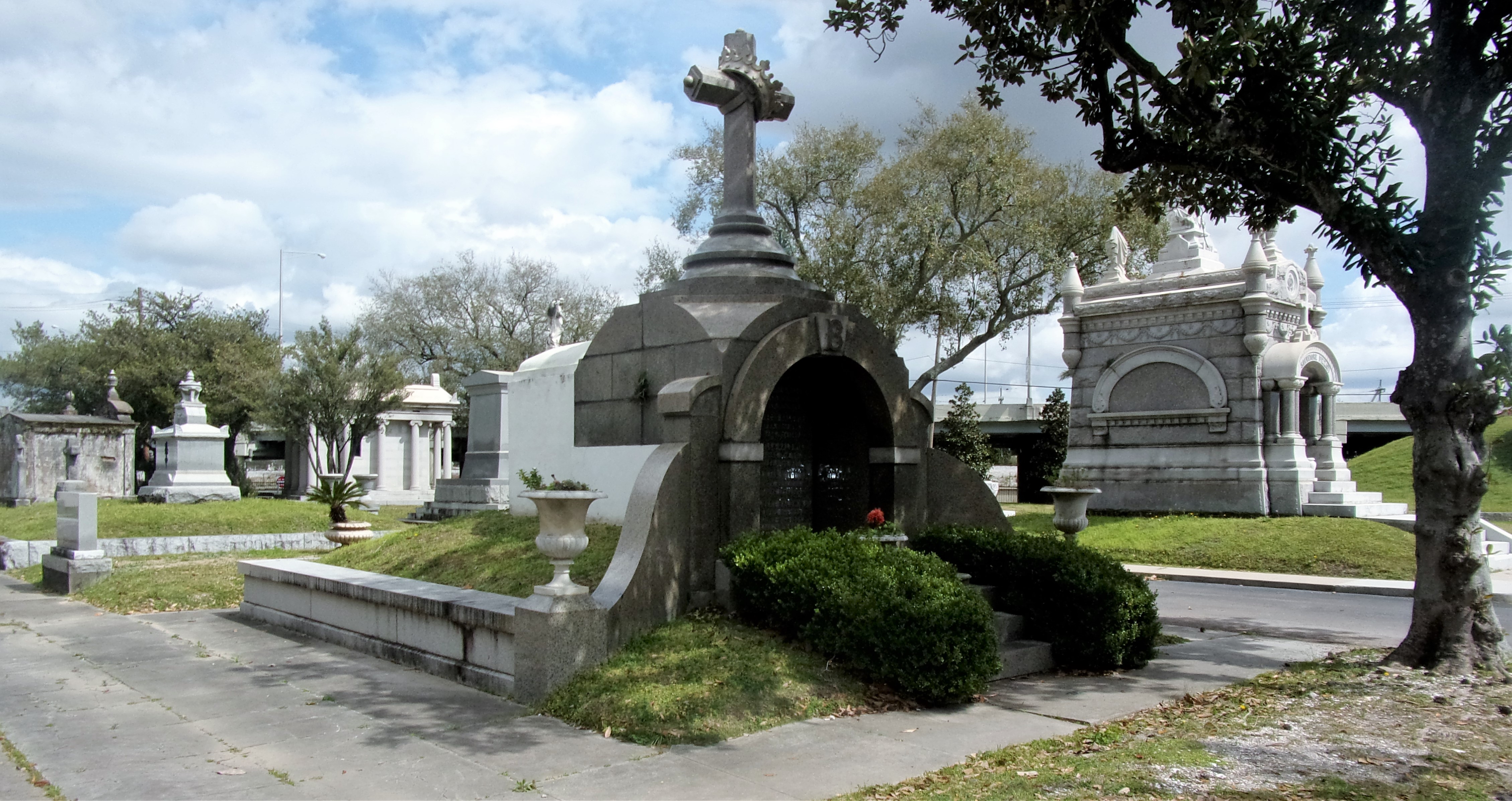 Metairie Cemetery. 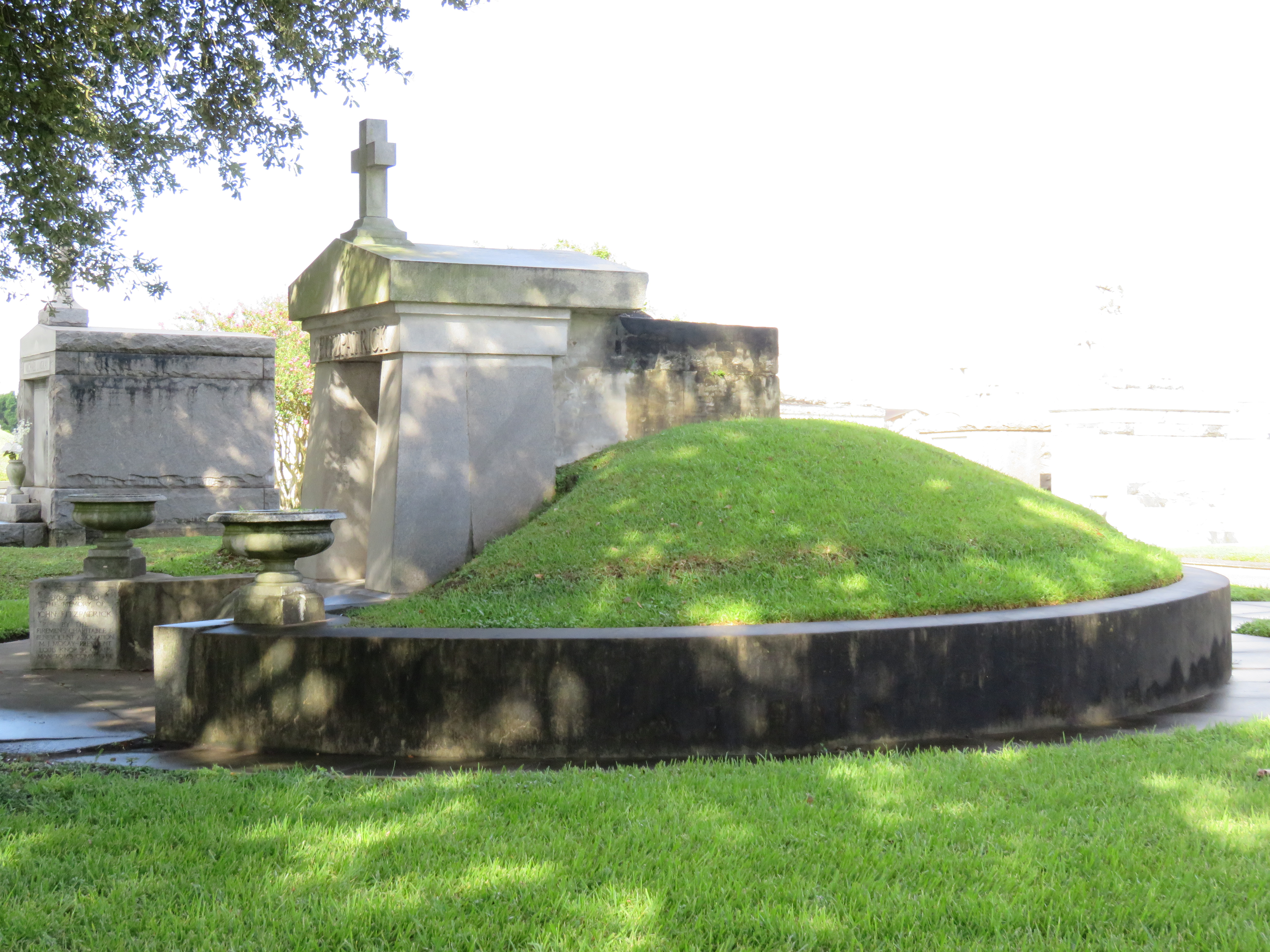 Fitzpatrick tumulus, Greenwood Cemetery, c. 1940. The Fitzpatrick tumulus is undergoing the soil and sod loss that many tumuli have experienced. 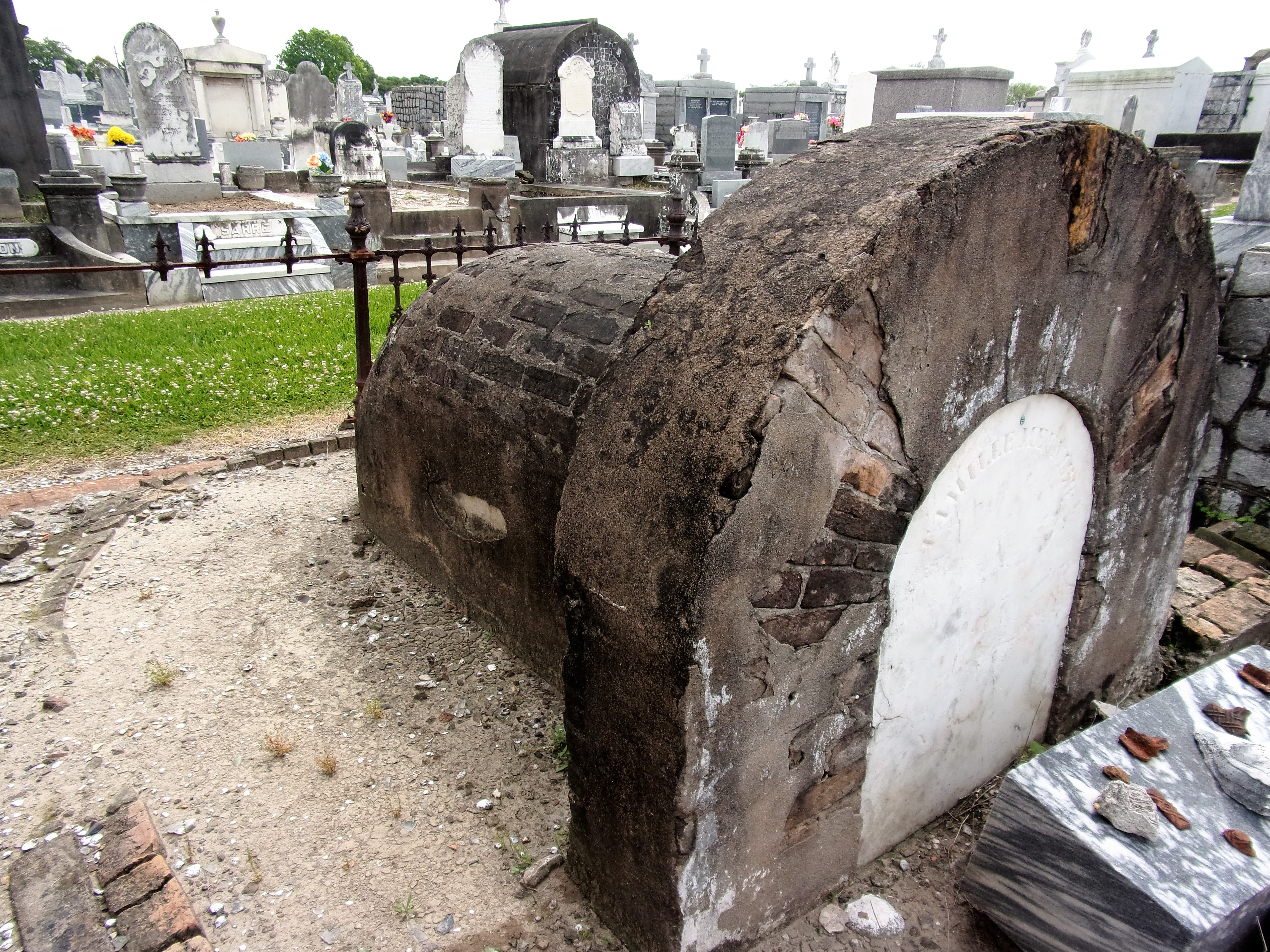 Meunier tumulus, Greenwood Cemetery, 19th century. The disappearance of historic tumuli can be explained in the same way many other landscape features have been altered. As cemetery design, economics, and management changed, the tumulus was viewed as far too costly to maintain. Before the 1920s, cemeteries featured cultivated grounds with aisles paved in crushed shells – and they were manicured using manual, spiral-bladed lawn-cutters. Between 1920 and 1945, new lawnmowing equipment was patented with small gas-powered motors, cutting down on the labor required for landscape maintenance. This innovation was later supplemented by the availability of ready-mix concrete with which to pave once shell-strewn aisles. Finally, in the 1940s, industrialization of the monument and funerary industries led to most cemeteries eliminating the position of sexton (caretaker) from their ranks.
Each tumulus memorializes the fallen Confederate soldiers and deceased veterans associated with each division. After the Civil War, veterans of both Confederate and Union armies formed such benevolent associations for the support of their members. In the case of the Armies of Northern Virginia and Tennessee, perhaps the tumulus design was a nod to the military and fraternal connotations many ancient tumuli bear. Each tumulus features a remarkable sculpture at its hillside apex. The Army of Northern Virginia tumulus supports a 38-foot column atop which a sculpture of General Thomas Jonathan “Stonewall” Jackson stands. The Army of Tennessee features an equestrian bronze, sculpted by Alexander Doyle, depicting General Albert Sidney Johnston atop his horse, Fire Eater. Both tumuli are notable features of Metairie Cemetery, included in most histories of the cemetery.[7] 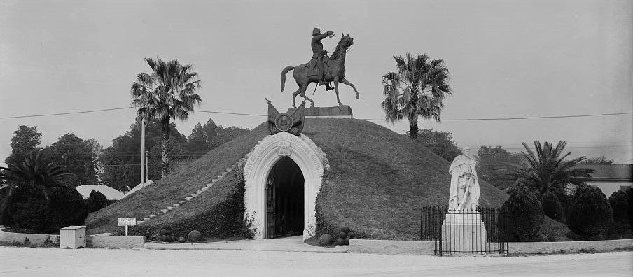 Army of Tennessee tumulus, Metairie Cemetery, in 1910. Image via Library of Congress. 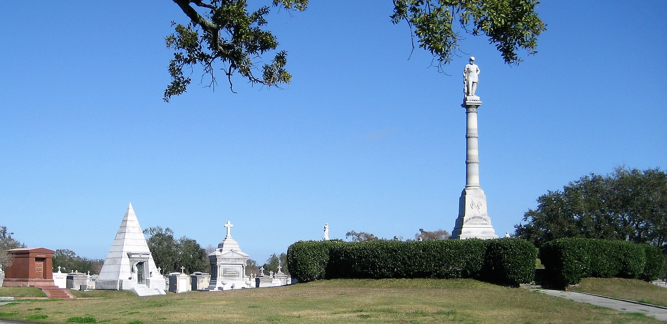 Army of Northern Virginia tumulus, Metairie Cemetery. Photo by Wikimedia Commons user Infrogmation. The third notable tumulus in New Orleans is viewed daily by many city commuters. The tomb of the Benevolent Protective Order of Elks, Lodge 30, features a bronze elk standing atop its grassy summit. The tumulus is located in Greenwood Cemetery at the intersection of Canal Street and City Park Avenue, where the elk looks out above the traffic. The Elks lodge tumulus was first conceived of in 1911 by the local Elks, who held a great circus in downtown New Orleans to raise funds for the cause. In subsequent years, the Elks would commission monument man Albert Weiblen to construct the tomb at the cost of $10,000 (approximately $250,000 in 2016 currency). The structure was assembled of Alabama granite, shaped with a classical pediment, the center of which features a clock forever frozen at the eleventh hour, a reference to the “Eleventh Hour Toast” held by Elks when gathered together. 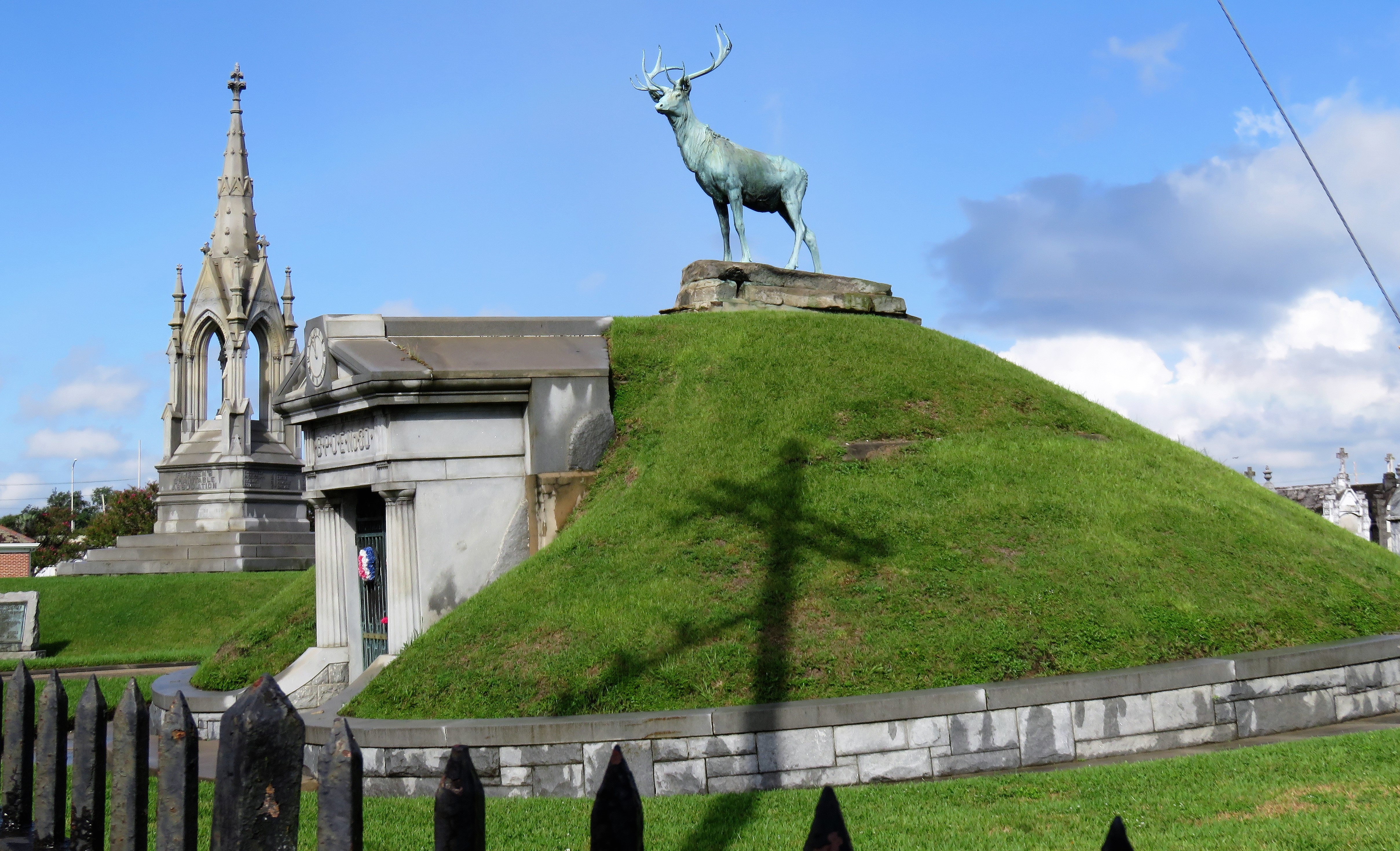 Elks Lodge tumulus, Greenwood Cemetery, c. 1913. Photo by Emily Ford. Local legend has suggested that Albert Weiblen warned the Elks that the lot on which they wished the tumulus be constructed was not suitable for a structure of that size. It is true that, historically, City Park Avenue was once part of a navigation canal, an infill had only partially stabilized the soft earth. The story goes that the Elks decried Weiblen’s warning and enjoined he move ahead with construction. While primary sources for this story are nonexistent, the Elks Lodge tumulus does have a noticeable tilt toward Canal Street. Lessons in Preservation While the tumulus holds its place of honor in cemetery landscapes with the Elks and the Armies of Tennessee and Northern Virginia, it has faded from the everyday view of most cemeteries. Such a loss is difficult to quantify. Historic New Orleans cemeteries are dynamic places where features are constantly altered, modified, destroyed, or restored. Yet as we approach the task of preserving these cemeteries as functional landscapes, the tumulus offer some distinct lessons. Stripped-down tumuli confuse the historic appearance of cemeteries like Cypress Grove and Lafayette Cemetery No. 1. Had these structures been preserved, their green mounds would carry on the tradition of the cemetery as garden space; and they would properly communicate the historic landscape for both grieving family and heritage tourist alike. Stripped-down tumuli are an example of one cardinal rule of cemetery preservation: that once improper treatment has taken place, it’s nearly impossible to reverse. Each blow to responsible and considerate preservation is most likely permanent. Thus, while restoration is important, maintenance, documentation, and planned preservation are much more crucial. When the cemetery landscape is understood and preserved, large-scale restorations are less necessary. Finally, stripped-down tumuli teach us to deeply consider each structure as part of a whole, to read the structure for what isn’t there as much as for what is. Through this consideration, cemetery stewards can preserve these resources of history and heritage in a responsible manner that benefits generations to come.  [1] Dan Hicks, et. al. Envisioning Landscape: Situations and Standpoints in Archaeology and Heritage (Routledge, 2016), 167.
[2] James C. Southall, The Recent Origin of Man (Philadelphia: J.B. Lippincott & Co., 1875), 87-97. [3] “Jackson Mounds,” Daily Crescent, January 16, 1851; “Norwegian tumulus,” New Orleans Bulletin, April 8, 1874, 2; “Norwegian Tumulus,” Opelousas Journal, August 4, 1876, 1. [4] George F. Beyer, “The Mounds of Louisiana,” in Publications of the Louisiana Historical Society (New Orleans: 1895), 12-30. (Link) [5] Gibbes tumulus, Magnolia Cemetery, Charleston, SC, and HABS documentation (Library of Congress). [6] “All Saints Day,” Daily Picayune, November 2, 1885, p. 2. [7] Henri Gandolfo, Metairie Cemetery, An Historical Memoir: Tales of its statesmen, soldiers, and great families (New Orleans: Stewart Enterprises, 1981). |

About the Author:Emily Ford owns and operates Oak and Laurel Cemetery Preservation, LLC. Archives
November 2019
Categories
All
|
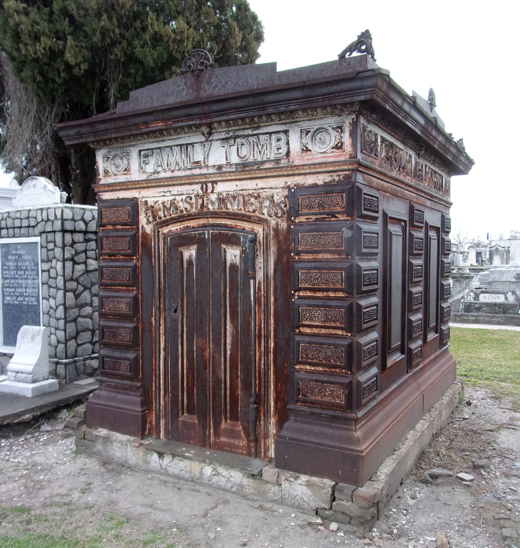
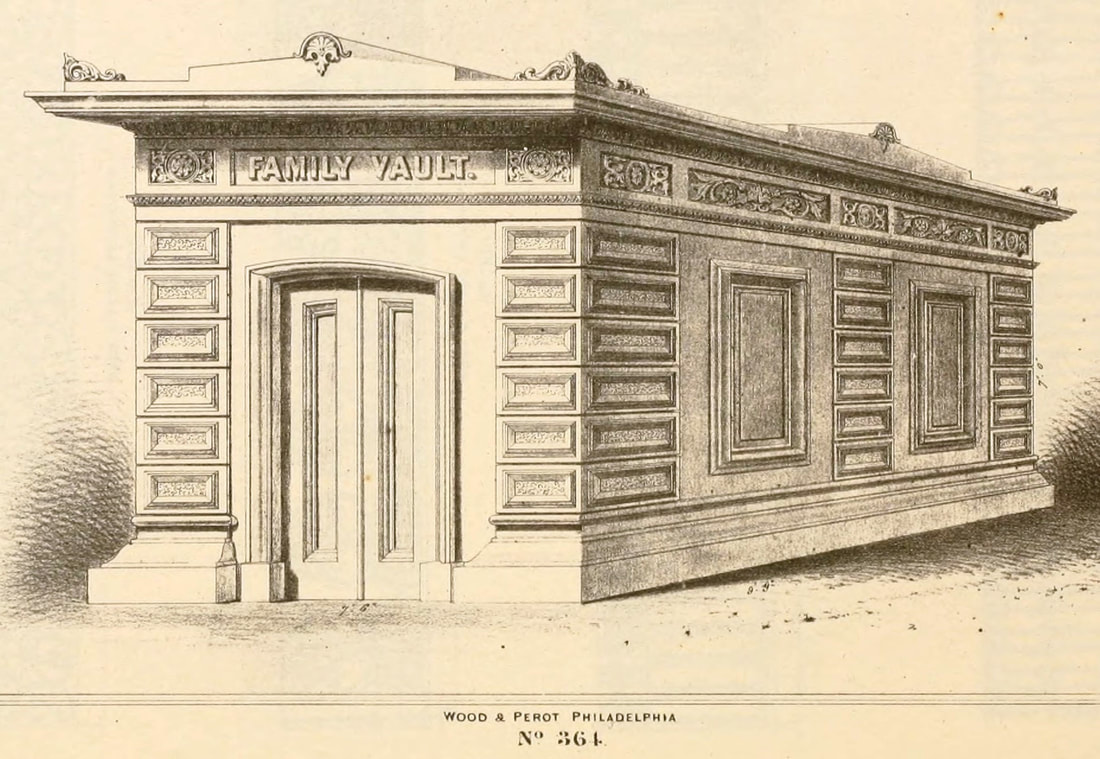
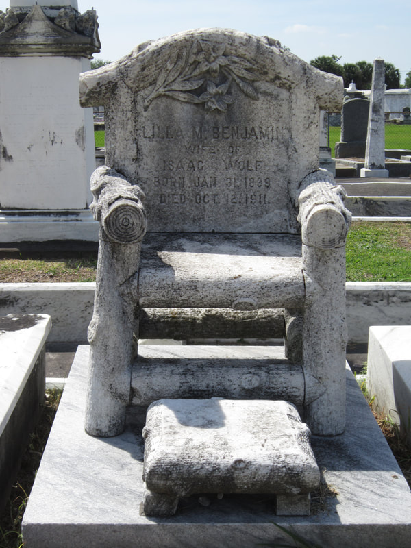
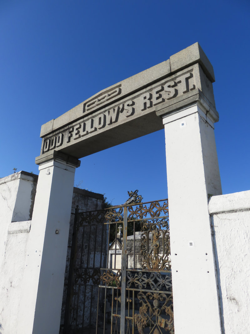
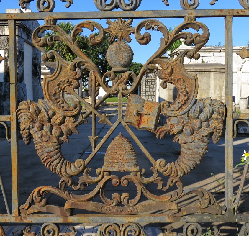
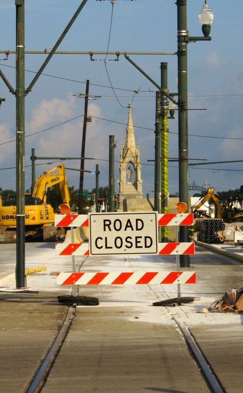
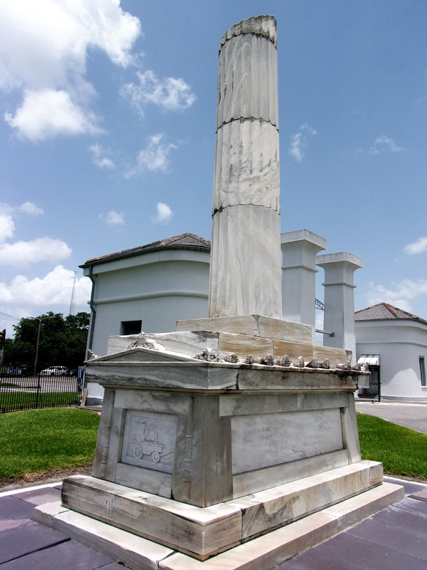
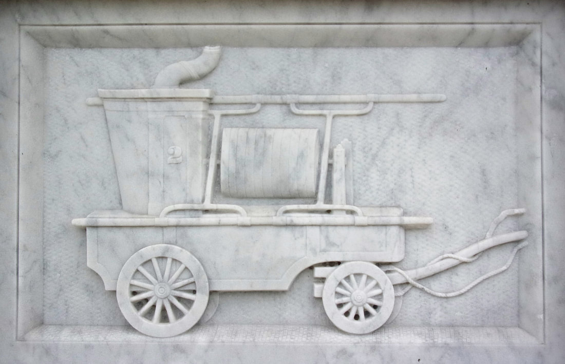
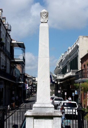
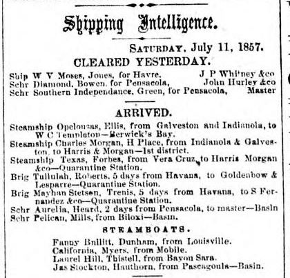
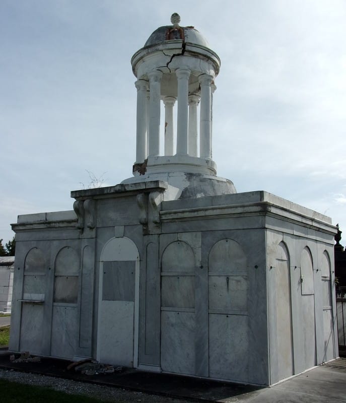
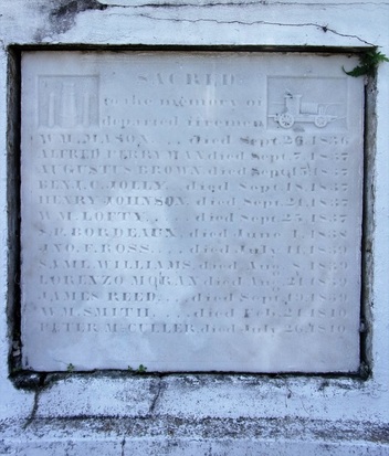
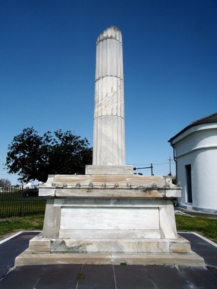
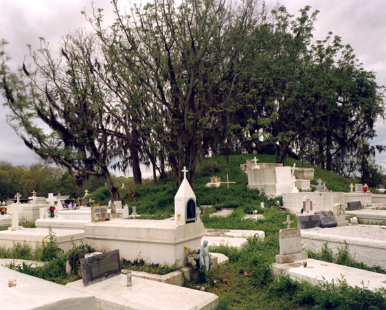
|
Oak and Laurel Cemetery Preservation, LLC is a preservation contractor in New Orleans, Louisiana, specializing in historic cemeteries, stone conservation, educational workshops and lectures. Oak and Laurel serves the region of the Southeastern US.
|
QUICK LINKS |
CONNECTNew Orleans, Louisiana
restoration@oakandlaurel.com (504) 602-9718 |